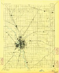
1894 Map of Wichita
USGS Topo · Published 1905About this map
Wichita serves as the central hub of this late 19th-century landscape, where a dense grid of streets radiates from the confluence of the Little Arkansas River and the Arkansas River. The map documents a pivotal era of railroad expansion across South Central Kansas, showing five major lines converging on the city. These steel corridors fostered a network of satellite towns and shipping points such as Maize, Oatville, and Valley Center.
Find a feature on this map
77 named features on this map. Tap any name to fly to it.
Don’t see what you’re looking for? This feature index may not catch every label — zoom into the map to look around manually.
Map Details
Editions of this 1894 Wichita Map
5 editions found

Other maps of this area

1888 · Eldorado
USGS Topo · 1:125,000

1889 · Newton
USGS Topo · 1:125,000

1889 · Burden
USGS Topo · 1:125,000

1889 · Cheney
USGS Topo · 1:125,000

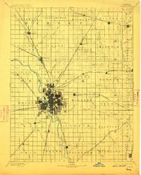
1889 · Wichita
USGS Topo · 1:125,000

1889 · Caldwell
USGS Topo · 1:125,000

1890 · Wellington
USGS Topo · 1:125,000

1891 · Hutchinson
USGS Topo · 1:125,000

1891 · Cheney
USGS Topo · 1:125,000

1893 · Caldwell
USGS Topo · 1:125,000