Old Maps of Weskan Township, Kansas for Genealogy
Trace your family roots with 96 historic maps of Weskan Township. These high-res maps reveal old neighborhoods, homesites, landmarks, and streets — helping you uncover where your ancestors lived and how the area evolved over time.
- Explore historic neighborhoods: Identify where your relatives may have lived in the 1800s or 1900s.
- Compare maps over time: Trace the changes in streets, buildings, and landmarks for multi-generational research.
- Perfect for genealogy & ancestry research: Used by family historians and researchers to map out lineage and migration.
These maps are an incredible resource for exploring your personal connection to Weskan Township's past.
Weskan Township, KS maps
(96)- 1892 Map of Cheyenne Wells
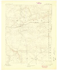
 1892 Cheyenne Wells1892 Print · USGSEastern Colorado during the early frontier era is documented here as the railroad transformed the High Plains. Genealogists and historians can trace the vital iron link of the Union Pacific Railroad through settlements like Cheyenne Wells and Arapahoe.
 - 1894 Map of Cheyenne Wells
 1894 Cheyenne Wells1894 Print · USGSEastern Colorado in the late nineteenth century is a landscape of expansive ranchland defined by the Union Pacific Railroad. Researchers can trace early railroad settlements like Cheyenne Wells and Arapahoe or follow the courses of Ladder Creek and White Woman Creek.6 unique versions available
 - 1954 Map of Limon
 1954 Limon1954 Print · USGSThe Eastern Colorado plains and the Kansas borderlands come alive in the mid-fifties, showing the vital rail-and-road corridor through Limon. Genealogists and historians can trace the Chicago Rock Island & Pacific line through Burlington and find remote outposts like Arickaree and Anton.4 unique versions available
 - 1954 Map of Lamar, 1964 Print
 1954 Lamar1964 Print · USGSSoutheastern Colorado and the Kansas borderlands appear here in the mid-fifties, dominated by the vital Arkansas River irrigation network. Researchers can trace the development of river towns like Lamar and La Junta alongside the Amity Cemetery and several major reservoirs.3 unique versions available
 - 1954 Map of Goodland, 1976 Print
 1954 Goodland1976 Print · USGSNorthwest Kansas comes into focus during the mid-1950s, showing a landscape defined by its vital river forks and thriving rail towns. Researchers can trace the path of the Union Pacific through Colby or locate historic parks like Sheridan Co State Park.
 - 1955 Map of Scott City, 1969 Print
 1955 Scott City1969 Print · USGSWestern Kansas in the mid-fifties is captured here as a landscape of rural schoolhouses and significant rail corridors. Family historians can trace the locations of Skyline and Beaver Creek Schools or follow the Union Pacific line through Oakley and Sharon Springs.4 unique versions available
 - 1956 Map of Goodland
 1956 Goodland1956 Print · USGSThe high plains of Northwest Kansas in the mid-fifties reveal a landscape of river-fed agriculture and expanding rail networks. Genealogists and historians can trace the development of county seats like Goodland and Atwood or locate landmarks such as the Arikaree Breaks.
 - 1957 Map of Limon
 1957 Limon1957 Print · USGSThe High Plains of Eastern Colorado and Western Kansas come alive in the mid-1950s, showing the vital rail-and-road connections of the era. You can trace the path of the Chicago Rock Island and Pacific through towns like Limon, Stratton, and Burlington or find the early footprint of Bonny Reservoir.
 - 1957 Map of Goodland
 1957 Goodland1957 Print · USGSNorthwest Kansas in the mid-1950s shows a landscape of high plains agriculture and vital rail junctions. Researchers can trace the river-valley settlements from Goodland to Oberlin and follow the paths of the Union Pacific and Sappa Creek.2 unique versions available
 - 1958 Map of Limon
 1958 Limon1958 Print · USGSEastern Colorado and the Kansas border meet in this late-fifties study of High Plains rail and river systems. Researchers can trace the path of the Chicago Rock Island and Pacific through Limon and Burlington, or locate the Bonny Dam and Bonny Reservoir.
 - 1958 Map of Lamar
 1958 Lamar1958 Print · USGSThe High Plains of Eastern Colorado and Western Kansas in the late fifties reveal a landscape tied to the Arkansas River and the rails. Trace the heritage of the river valley through Fort Lyon, the Atchison Topeka and Santa Fe RR, and rural landmarks like Kendrick Church.2 unique versions available
 - 1958 Map of Scott City
 1958 Scott City1958 Print · USGSWestern Kansas at the peak of the post-war era reveals a landscape of high-plains agriculture and vital rail junctions. Genealogists and historians can trace old country school sites like Prairie Bell School, the landmark Chalk Pyramids, and small stops along the Union Pacific and Missouri Pacific.
 - 1959 Map of Weskan, 1960 Print
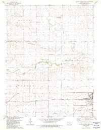
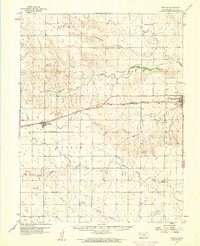 1959 Weskan1960 Print · USGSWallace County in the late 1950s was a land of railroad sidings and river breaks, centered on the Union Pacific line. Genealogists and historians can trace local landmarks like Weskan Cem, the water at Old Maid Pool, and the siding of Sunland.
 - 1959 Map of Horsethief Draw, 1960 Print
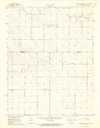
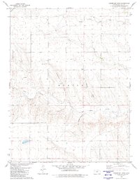
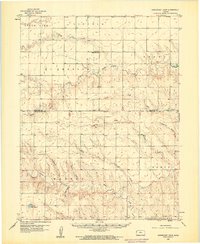 1959 Horsethief Draw1960 Print · USGSThe high plains of Wallace County are captured in the late 1950s as a landscape of deep draws and seasonal rivers. Genealogists and local historians can locate rural landmarks such as Sandy Hill Sch, Fairview Cem, and the notable Horsethief Cave.2 unique versions available
 - 1968 Map of Sharon Springs 3 NE, 1969 Print
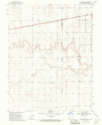
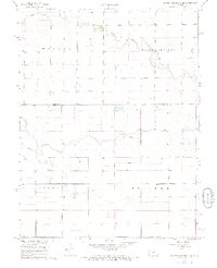 1968 Sharon Springs 3 NE1969 Print · USGSWestern Kansas ranching and farm lands are captured here in the late sixties, where the high plains meet the Colorado border. Researchers can trace land use through a network of water sources including South Ladder Creek and numerous Well sites across Colony and Weskan.2 unique versions available
 - 1968 Map of Sharon Springs 3 NW, 1969 Print
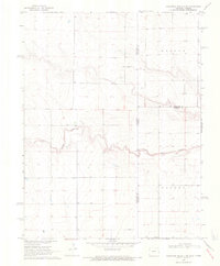
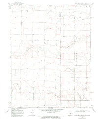
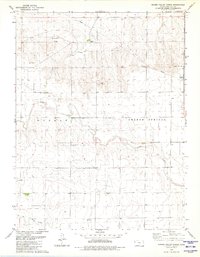
 1968 Sharon Springs 3 NW1969 Print · USGSThe High Plains of western Kansas in the late sixties reveal a landscape of vast townships and scattered prairie homesteads. Genealogists can locate Stockholm Cem and trace the meandering paths of South Fork Middle Ladder Creek through the townships of Weskan and Colony.2 unique versions available
 - 1969 Map of Arapahoe SE, 1971 Print
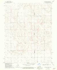
 1969 Arapahoe SE1971 Print · USGSThe high plains of the Colorado-Kansas border come into focus in the late sixties, highlighting the vital rail corridor of the Union Pacific. Researchers can trace the path of Ladder Creek and locate numerous family ranch assets including scattered Well sites and surveyed fence lines.
 - 1969 Map of Cheyenne Wells 4 NE, 1971 Print
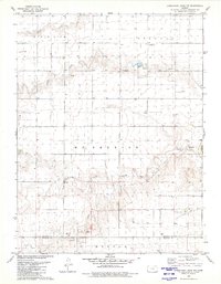
 1969 Cheyenne Wells 4 NE1971 Print · USGSThe Colorado and Kansas borderlands meet in the late sixties along the winding path of South Ladder Creek. Genealogists and researchers can trace township boundaries and find family-named landmarks like Wells or the remote Colony and Weskan districts.3 unique versions available
 - 1969 Map of Arapahoe NE, 1971 Print
 1969 Arapahoe NE1971 Print · USGSThe High Plains of the Colorado-Kansas border come into focus in the late sixties, where the Smoky Hill River defines the landscape. Genealogists and researchers can trace early water sources like Wells and the terrain of Morton and Weskan.
 - 1969 Map of Mount Sunflower, 1972 Print
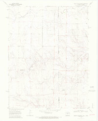 1969 Mount Sunflower1972 Print · USGSThe High Plains border of Colorado and Kansas comes into focus in this late 1960s survey. Genealogists and historians can locate the highest point in Kansas at Mount Sunflower and trace the sparse prairie settlements like Hitchcock and the drainages of Goose Creek.2 unique versions available
 - 1969 Map of Mount Sunflower NE, 1972 Print
 1969 Mount Sunflower NE1972 Print · USGSThe Colorado-Kansas state line at the edge of Kit Carson and Sherman Counties comes into focus in the late 1960s. Genealogists and local historians can trace rural development near the Green Valley Sch or follow the waters of the North Fork Smoky Hill River and Sappa Creek.
 - 1979 Map of Horsethief Draw NW, 1980 Print
 1979 Horsethief Draw NW1980 Print · USGSSherman and Wallace counties are captured in the late seventies, showing a landscape defined by the High Plains river system. Genealogists and land researchers can locate specific sites like Turtle Creek Lake, Sappa Creek, and various Gravel Pits along the county line.
 - 1979 Map of Sharon Springs West, 1980 Print
 1979 Sharon Springs West1980 Print · USGSWestern Kansas at the close of the 1970s shows a prairie landscape deeply tied to the Smoky Hill River and the railroad. Genealogists and local historians can trace the development of Sharon Springs through its original Union Pacific tracks, Lakeview Park, and Sharon Springs Cem.
 - 1979 Map of Horsethief Draw, 1980 Print
 1979 Horsethief Draw1980 Print · USGSWallace County high plains are captured here in the late seventies, showing a landscape defined by deep draws and canyons. Researchers can trace land use through features like Horsethief Cave, a lone Grave, and the winding Salt Grass Canyon.
 - 1979 Map of Spring Valley Ranch, 1980 Print
 1979 Spring Valley Ranch1980 Print · USGSWallace County ranching and water management are front and center in this late-seventies survey of the High Plains. Genealogists and local historians can locate Spring Valley Ranch and the Dover Grange Hall or trace the winding paths of Ladder Creek.
Showing maps 1-25 of 96
Top cities near Weskan Township
Top neighborhoods of Weskan Township
Frequently asked questions
- What are the different types of historical maps available for Weskan Township?
- What is the oldest map of Weskan Township?
- Where can I purchase historical maps of Weskan Township for my home or office?
- Where can I download high-res historical maps of Weskan Township?
- Are there historical topographic maps available for Weskan Township?
- Is there historical aerial imagery available for Weskan Township?
- Where are historical maps of Weskan Township sourced from?