1970s Maps of Ballard County, Kentucky
Explore 6 historic maps of Ballard County from the 1970s. These maps offer a rare glimpse into what life looked like during the 1970s — showing old roads, neighborhoods, homes, and landmarks that have changed or disappeared over time.
Whether you're researching your family's past, planning a metal detecting trip, or studying how Ballard County's landscape evolved across the 1970s, these high-resolution maps are a powerful tool for exploring the history of this region.
- Focus on a specific era: All maps on this page are from the 1970s, giving you a focused view of this time period.
- See what’s changed: Compare century-old streets, trails, and buildings to today's modern landscape using overlays and satellite layers.
- Research with precision: Use these maps for genealogy, historical research, land use analysis, or educational projects.
- View, download, or print: Maps are fully viewable online in high resolution, and can be downloaded or printed for your own records.
Start exploring Ballard County's history through authentic maps from the 1970s. This is your window into the past.
Ballard County, KY maps
(6)- 1970 Map of Wickliffe, 1972 Print
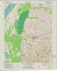
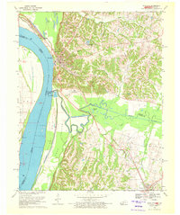 1970 Wickliffe1972 Print · USGSThe river bluffs of western Kentucky met the great confluence in the 1970s, where the Missouri and Illinois borders converge. Genealogists and historians can trace significant landmarks like the Ancient Buried City, the Site of Fort Jefferson, and the Wickliffe Cem.2 unique versions available
 - 1972 Map of Wickliffe
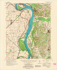 1972 Wickliffe1972 Print · USGSThe confluence of the Ohio and Mississippi Rivers is captured here in the early seventies, showing a landscape defined by major levees and river commerce. Genealogists can trace family landmarks like Bird Cem and Birds Point Sch or the riverside town of Wickliffe.
 - 1975 Map of La Center, 1977 Print
 1975 La Center1977 Print · USGSBallard County's agricultural and rail landscape is captured here in the mid-seventies as it transitions through La Center and Kevil. Genealogists and local historians can trace family plots like Terrell Cem and early landmarks such as Antioch Ch or the Fairground.
 - 1977 Map of Blandville
 1977 Blandville1977 Print · USGSWestern Kentucky life in the late seventies centered around the rural crossroads of Ballard and Carlisle counties. Genealogists and local historians can locate several family burial sites like Martin Cem and settlements such as Blandville and New York.
 - 1977 Map of Barlow
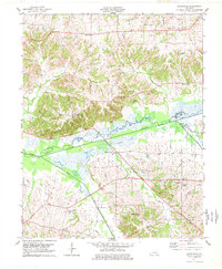
 1977 Barlow1977 Print · USGSWestern Kentucky’s river lowlands come to life in this mid-seventies survey of the wetlands and settlements near the Ohio River. Genealogists and local historians can trace the Illinois Central Gulf rail lines and find family landmarks like Watwood Cem and Northington Cem.
 - 1978 Map of Heath
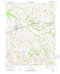
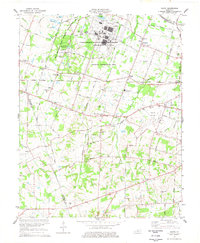 1978 Heath1978 Print · USGSMcCracken and Ballard counties in the late 1970s reveal a landscape defined by massive industrial energy plants and rural crossroad communities. Researchers can locate family landmarks like Bethel Church and Kelley Cemetery or trace the Illinois Central Gulf rail line.
End of results
Showing maps 1-6 of 6
Top cities of Ballard County
Frequently asked questions
- What are the different types of historical maps available for Ballard County?
- What is the oldest map of Ballard County?
- Where can I purchase historical maps of Ballard County for my home or office?
- Where can I download high-res historical maps of Ballard County?
- Are there historical topographic maps available for Ballard County?
- Is there historical aerial imagery available for Ballard County?
- Where are historical maps of Ballard County sourced from?