2020s Maps of Ballard County, Kentucky
Explore 12 historic maps of Ballard County from the 2020s. These maps offer a rare glimpse into what life looked like during the 2020s — showing old roads, neighborhoods, homes, and landmarks that have changed or disappeared over time.
Whether you're researching your family's past, planning a metal detecting trip, or studying how Ballard County's landscape evolved across the 2020s, these high-resolution maps are a powerful tool for exploring the history of this region.
- Focus on a specific era: All maps on this page are from the 2020s, giving you a focused view of this time period.
- See what’s changed: Compare century-old streets, trails, and buildings to today's modern landscape using overlays and satellite layers.
- Research with precision: Use these maps for genealogy, historical research, land use analysis, or educational projects.
- View, download, or print: Maps are fully viewable online in high resolution, and can be downloaded or printed for your own records.
Start exploring Ballard County's history through authentic maps from the 2020s. This is your window into the past.
Ballard County, KY maps
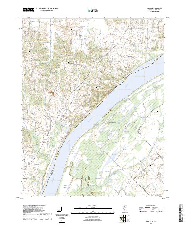
(12)- 2021 Map of Olmsted, 2021 Print
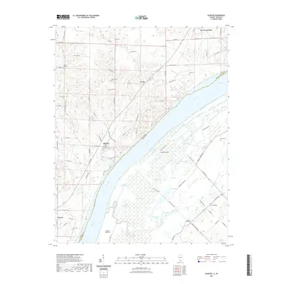 2021 Olmsted2021 Print · USGSCovers Ballard County, including Olmsted, New Grand Chain, and other nearby areas
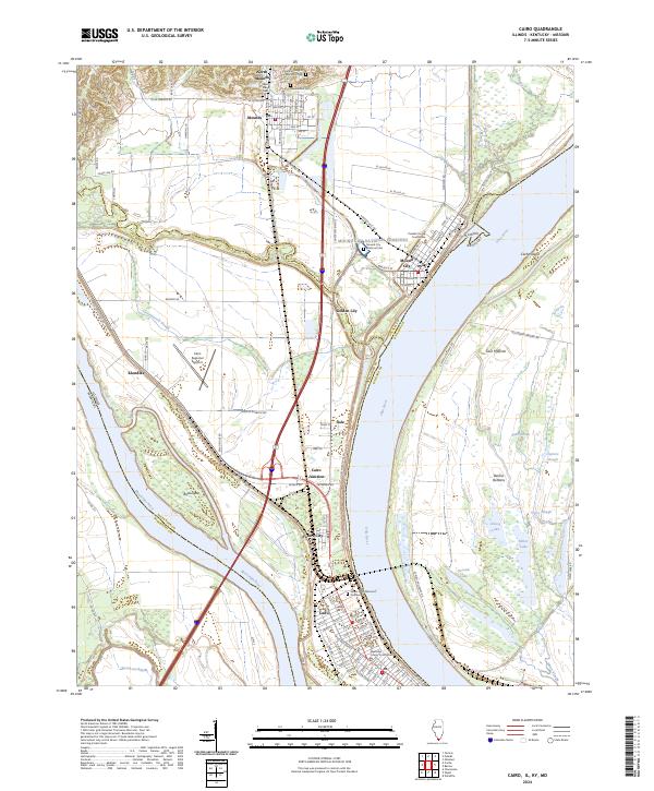
 - 2021 Map of Cairo, 2021 Print
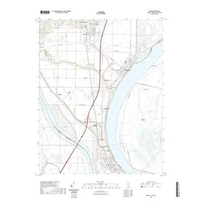 2021 Cairo2021 Print · USGSCovers Ballard County, including Cairo, Mounds, and other nearby areas
 - 2021 Map of Wyatt, 2021 Print
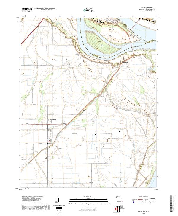 2021 Wyatt2021 Print · USGSThe confluence of the great rivers at the tri-state border defines this landscape during the early 2020s. Researchers can trace the legacy of local families through rural landmarks like Bird Cem, Wyatt Cem, and the settlement of Alfalfa Center.
 - 2022 Map of Barlow, 2022 Print
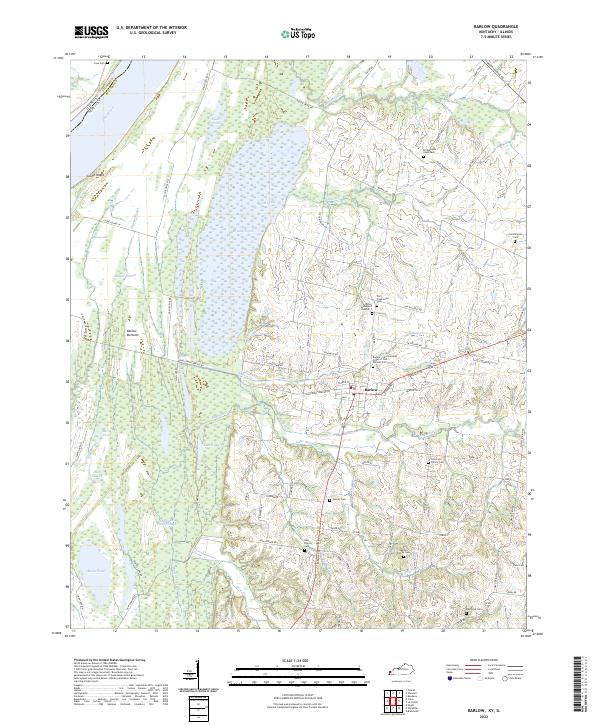 2022 Barlow2022 Print · USGSThe riverfront and wetlands of Ballard County are captured here in the early 2020s, centered on the community of Barlow. Family historians can locate numerous burial sites like Old Hazelwood Cem and Bridgewater Graveyard near the shores of the Ohio River.
 - 2022 Map of Blandville, 2022 Print
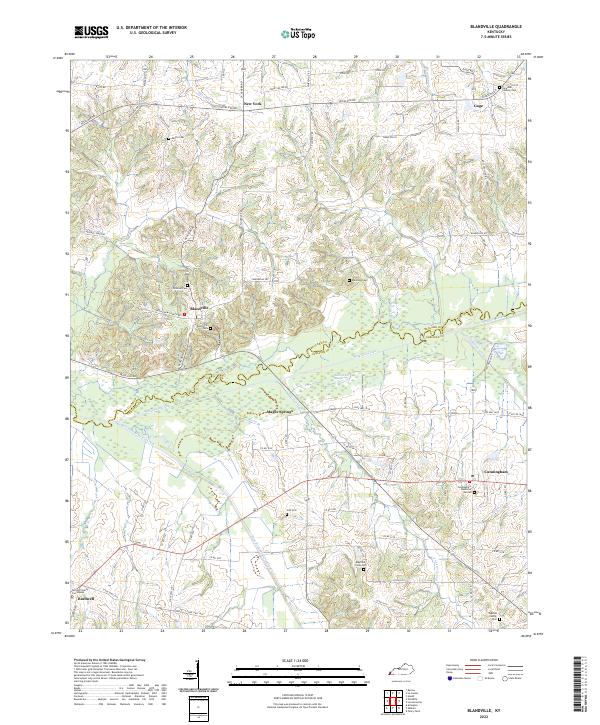 2022 Blandville2022 Print · USGSBlandville and its surrounding ridges come into focus in the early 2020s, revealing a landscape shaped by the Mayfield Creek bottoms. Family historians can trace local roots through the Old Blandville Cem, Hall Cem, and the Carlisle County Courthouse in Bardwell.
 - 2022 Map of Lovelaceville, 2022 Print
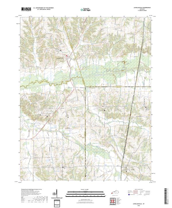 2022 Lovelaceville2022 Print · USGSWestern Kentucky's rural landscape comes alive in this survey of the four-county junction area near the turn of the decade. Researchers can trace family roots at Lovelaceville Cem or locate church sites like Owens Chapel Cem and Lowes.
 - 2022 Map of La Center, 2022 Print
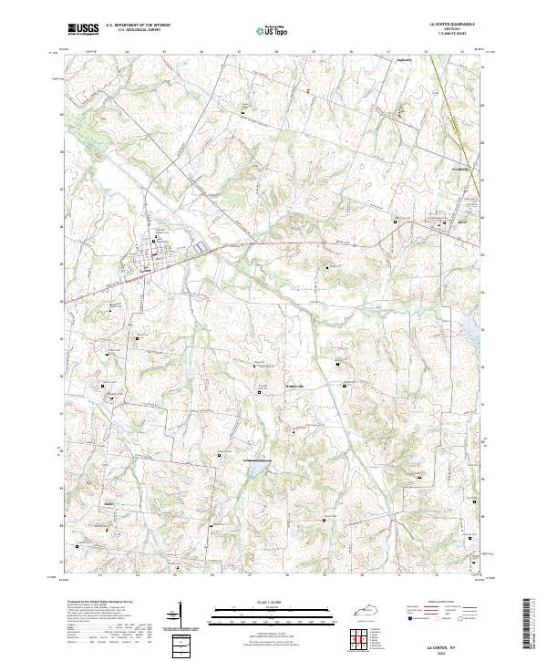 2022 La Center2022 Print · USGSWestern Kentucky's Ballard County communities are captured here in the early twenty-first century, showing a landscape of small towns and agricultural heritage. Researchers can locate numerous family burial sites like Bondurant Family Cem and Saint Marys Cem near La Center.
 - 2022 Map of Wickliffe, 2022 Print
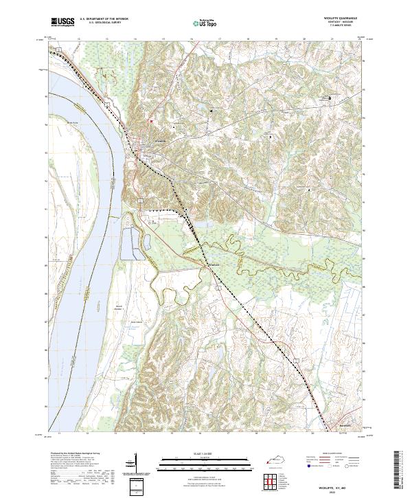 2022 Wickliffe2022 Print · USGSThe river bluffs of Ballard County come into focus in the early 2020s, showing the strategic position of Wickliffe above the Mississippi River floodplains. Genealogists can locate several key burial grounds including Cone Creek Cem and Bethlehem Cem.
 - 2022 Map of Bandana, 2022 Print
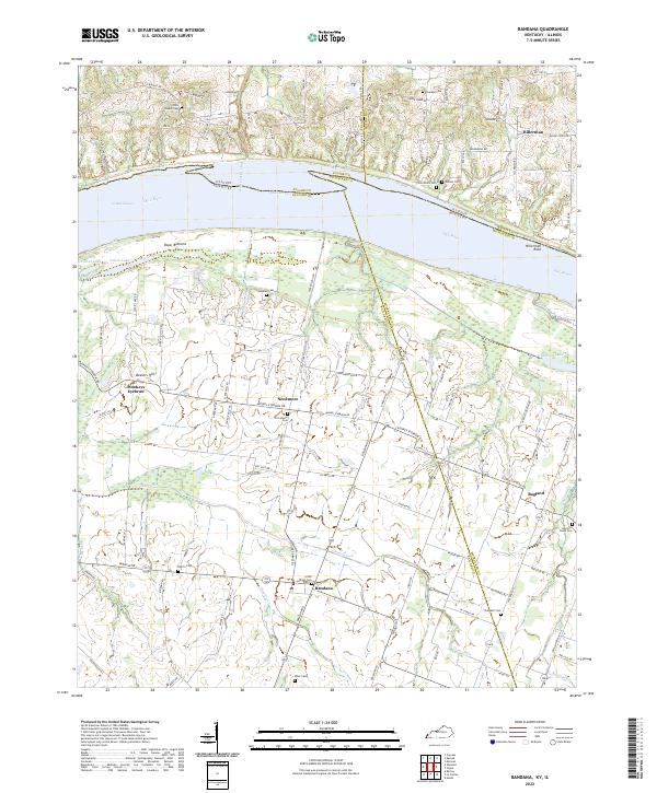 2022 Bandana2022 Print · USGSThe northern tip of Kentucky meets the Illinois border along the Ohio River in this detailed study of Ballard and McCracken counties. Researchers can trace family history through numerous rural burial sites like Providence Cem and explore local landmarks from Monkeys Eyebrow to Hillerman Rock.
 - 2022 Map of Heath, 2022 Print
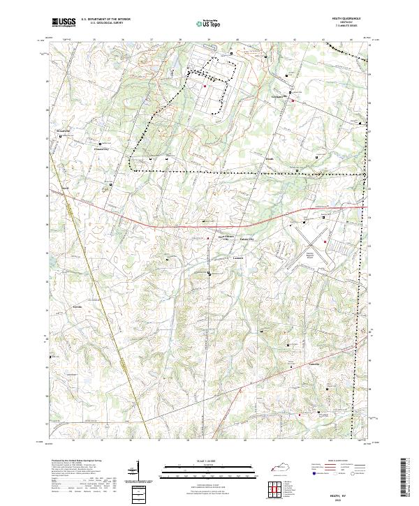 2022 Heath2022 Print · USGSMcCracken County at the start of the 2020s shows a landscape of long-standing family settlements and horse trails near the western edge of Kentucky. You can trace the development of Barkley Regional Airport alongside cemeteries like Oddfellow Cem and the Arthur-Curtis Horse Trl.
 - 2024 Map of Olmsted, 2024 Print
 2024 Olmsted2024 Print · USGSThe Illinois-Kentucky border comes alive in this contemporary survey of the Ohio River valley. Genealogists can locate family landmarks like Bethlehem Cem and Lyerly Cem or trace the riverfront at Olmsted and America.
 - 2024 Map of Cairo, 2024 Print
 2024 Cairo2024 Print · USGSThe confluence of the Ohio and Mississippi Rivers in southern Illinois creates a landscape of deep historical and civic importance. Researchers can trace the layout of Cairo and Mound City, finding landmarks like the Mound City National Cemetery and Alexander County Courthouse.
End of results
Showing maps 1-12 of 12
Top cities of Ballard County
Frequently asked questions
- What are the different types of historical maps available for Ballard County?
- What is the oldest map of Ballard County?
- Where can I purchase historical maps of Ballard County for my home or office?
- Where can I download high-res historical maps of Ballard County?
- Are there historical topographic maps available for Ballard County?
- Is there historical aerial imagery available for Ballard County?
- Where are historical maps of Ballard County sourced from?