2020s Maps of Bracken County, Kentucky
Explore 9 historic maps of Bracken County from the 2020s. These maps offer a rare glimpse into what life looked like during the 2020s — showing old roads, neighborhoods, homes, and landmarks that have changed or disappeared over time.
Whether you're researching your family's past, planning a metal detecting trip, or studying how Bracken County's landscape evolved across the 2020s, these high-resolution maps are a powerful tool for exploring the history of this region.
- Focus on a specific era: All maps on this page are from the 2020s, giving you a focused view of this time period.
- See what’s changed: Compare century-old streets, trails, and buildings to today's modern landscape using overlays and satellite layers.
- Research with precision: Use these maps for genealogy, historical research, land use analysis, or educational projects.
- View, download, or print: Maps are fully viewable online in high resolution, and can be downloaded or printed for your own records.
Start exploring Bracken County's history through authentic maps from the 2020s. This is your window into the past.
Bracken County, KY maps
(9)- 2022 Map of Sardis, 2022 Print
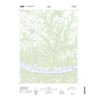
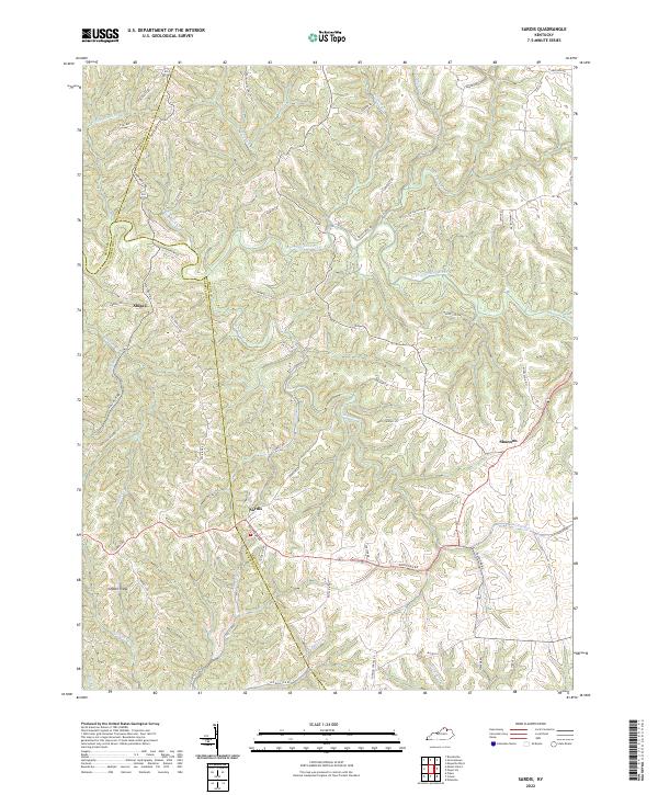 2022 Sardis2022 Print · USGSSardis and the surrounding hills of Mason and Bracken counties are captured here in the early 2020s. Researchers can trace the rural landscape across Ogden Ridge or locate family history along Old Blue Lick Rd and the banks of the N Fork Licking River.
 - 2022 Map of Mount Olivet, 2022 Print
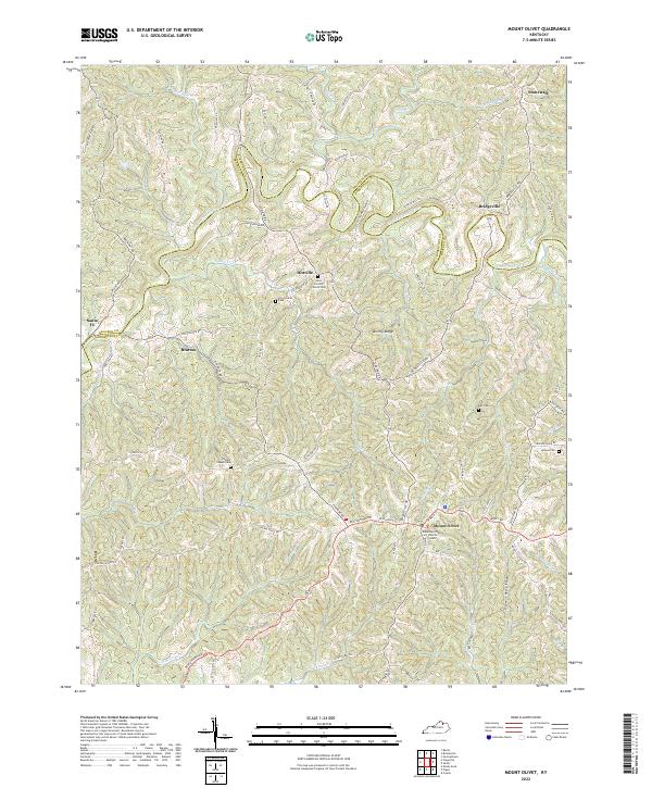 2022 Mount Olivet2022 Print · USGSMount Olivet and the surrounding Robertson County hills are shown here in recent detail, reflecting a landscape defined by ridge-top settlements and deep stream valleys. Researchers can trace family sites like Fosters Chapel Cem, Hittville, and the Robertson County Judicial Center.
 - 2022 Map of Brooksville, 2022 Print
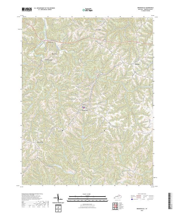 2022 Brooksville2022 Print · USGSBracken County's ridge-and-valley landscape comes into sharp focus here as it appeared in the early 2020s. Genealogists and local historians can trace the rural layout of Brooksville and Powersville, or locate family sites near Hamilton Cem and Asbury Cem.
 - 2022 Map of Germantown, 2022 Print
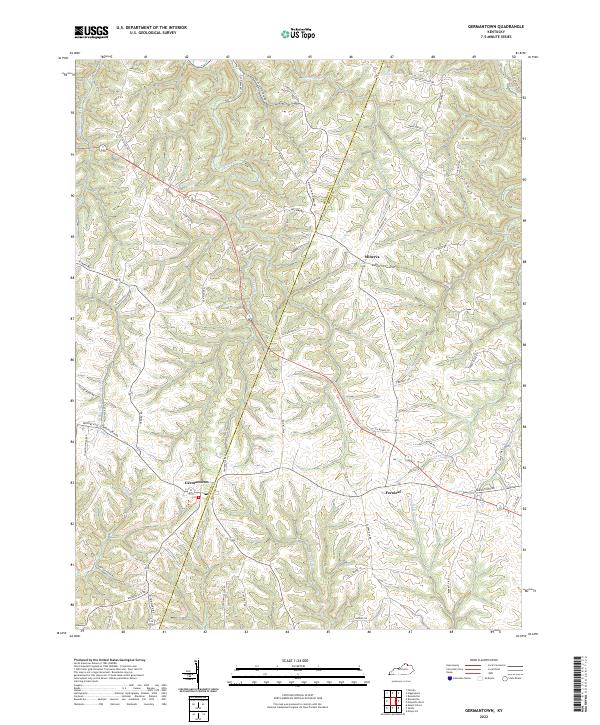 2022 Germantown2022 Print · USGSNorthern Kentucky's agricultural heartland is documented here during the early 2020s, showing the enduring rural layout of the region. Researchers can trace family road names like W Gillespie Ln and T Beckett Rd near Germantown and Minerva.
 - 2022 Map of Berlin, 2022 Print
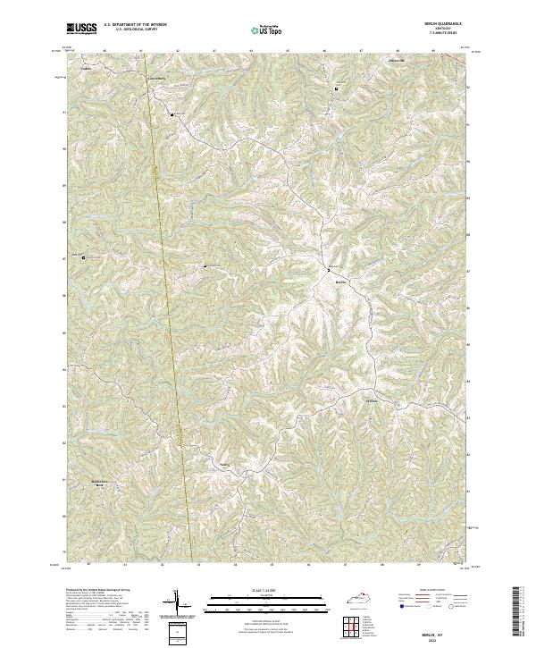 2022 Berlin2022 Print · USGSBracken and Pendleton counties come into focus in this contemporary study of rural Kentucky ridge-and-valley life. Local historians can trace family burial sites like Downard Cem and Biddle Cem or locate the historic center of Berlin.
 - 2022 Map of Claysville, 2022 Print
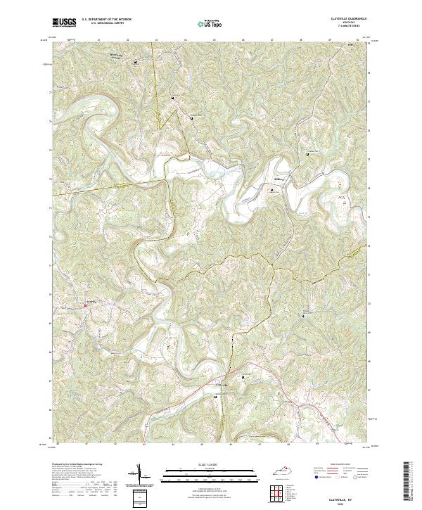 2022 Claysville2022 Print · USGSNorthern Kentucky's river valleys and ridge-top communities are documented here in the early twenty-first century. Genealogists can trace family heritage through scattered landmarks like Whitehead Cem, Browning Corner, and the settlement of Claysville.
 - 2023 Map of Higginsport, 2023 Print
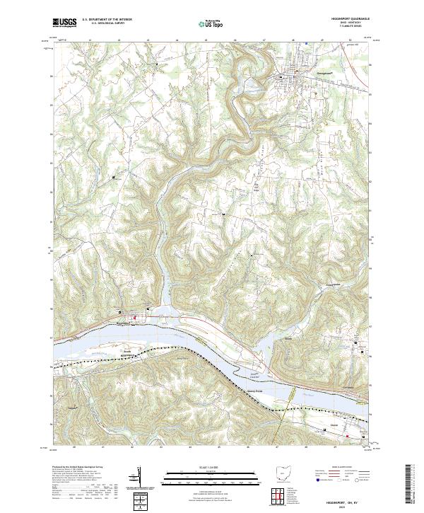 2023 Higginsport2023 Print · USGSThe Ohio River valley at the Ohio-Kentucky border remains a landscape of river towns and family-held ridges. Local historians can trace family ties through several rural sites like Thomas Cemetery, the Brown County Courthouse, and Shinkles Ridge.
 - 2023 Map of Moscow, 2023 Print
 2023 Moscow2023 Print · USGSThe Ohio River valley and its bordering hill country are surveyed here in the modern era. Genealogists can trace family burial sites at Moscow Cem, Vesper Cem, and Chilo-McKendree Chapel Cem.
 - 2023 Map of Felicity, 2023 Print
 2023 Felicity2023 Print · USGSIn this modern era, the riverbank settlements along the Ohio River maintain a quiet character south of Felicity. Researchers can trace old family burial grounds like Smyrna Cem and Hard Scrabble Cem or explore the riverfront at Utopia and Augusta Bar.
End of results
Showing maps 1-9 of 9
Top cities of Bracken County
Frequently asked questions
- What are the different types of historical maps available for Bracken County?
- What is the oldest map of Bracken County?
- Where can I purchase historical maps of Bracken County for my home or office?
- Where can I download high-res historical maps of Bracken County?
- Are there historical topographic maps available for Bracken County?
- Is there historical aerial imagery available for Bracken County?
- Where are historical maps of Bracken County sourced from?