Old Maps of Mount Savage, Kentucky for Academic Research
Study the evolution of Mount Savage with 12 high-resolution historic maps. Whether you're teaching, researching, or modeling changes in land use, these maps provide essential visual documentation of urban, environmental, and geographic change.
- Analyze long-term change: Track patterns in development, transportation, and natural features.
- Ideal for environmental or urban studies: Support academic projects with primary historical map data.
- Use in the classroom or lab: Educators and researchers rely on these maps to bring historical context to life.
These maps are a powerful tool for teaching, research, and visualizing how Mount Savage has changed over the decades.
Mount Savage, KY maps
(12)- 1903 Map of Kenova
 1903 Kenova1903 Print · USGSThe tri-state river junction at Ashland and Kenova was a bustling industrial hub after the turn of the century. Trace early rail lines and mining settlements like Coalton and Boghead, or locate family landmarks along the Little Sandy River and Means Tunnel.5 unique versions available
 - 1904 Map of Kenova
 1904 Kenova1904 Print · USGSThe tri-state confluence of the Ohio River and Big Sandy River hums with early industrial activity at the start of the century. Genealogists can trace rail-side settlements and remote homesteads along Blaine Creek and near Mt Savage or Webbville.
 - 1953 Map of Grayson, 1954 Print
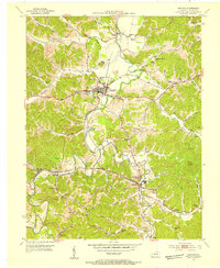 1953 Grayson1954 Print · USGSGrayson and the Little Sandy River valley are captured in the early 1950s, showing a rural landscape shaped by the rail and clay industries. Researchers can locate many family landmarks, such as Savage Memorial Ch, the Fire Clay Pit, and Pactolus.2 unique versions available
 - 1957 Map of Huntington, 1966 Print
 1957 Huntington1966 Print · USGSThe industrial heart of the Ohio River valley is captured here in the mid-sixties, showing the growth of Huntington and Ashland. Researchers can trace the extensive rail networks of the Chesapeake and Ohio RR and locate sites like the Chief Cornstalk Hunting Ground.3 unique versions available
 - 1960 Map of Huntington
 1960 Huntington1960 Print · USGSThe tri-state river valley thrived in the late fifties as a hub of heavy industry and Appalachian rail transit. Genealogists and historians can trace the connection between river towns like Ashland and Portsmouth or locate family homesteads near Coleman Ridge.
 - 1971 Map of Grayson, 1973 Print
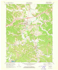 1971 Grayson1973 Print · USGSGrayson and the Little Sandy River valley are captured here in the early seventies during a period of industrial activity and infrastructure growth. Researchers can locate the Clay Furnace ruins, trace the Chesapeake and Ohio rail lines, or find family sites at Pactolus and Hitchins.2 unique versions available
 - 1982 Map of Huntington, 1983 Print
 1982 Huntington1983 Print · USGSThe tri-state region around Huntington and Ashland is shown in the early 1980s, documenting a landscape shaped by river commerce and coal-country railroads. Trace family roots and old routes through Barboursville, the Gas Field, and the Tug Fork valley.
 - 2010 Map of Grayson, 2010 Print
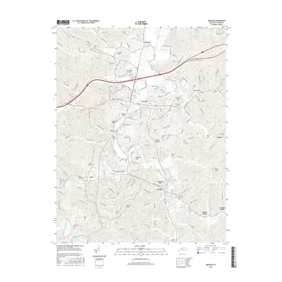
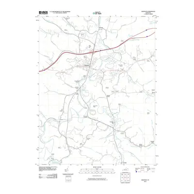 2010 Grayson2010 Print · USGSCovers Mount Savage, including Grayson, Reedville, and other nearby areas
 - 2013 Map of Grayson, 2013 Print
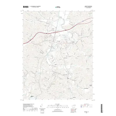
 2013 Grayson2013 Print · USGSCovers Mount Savage, including Grayson, Reedville, and other nearby areas
 - 2016 Map of Grayson, 2016 Print
 2016 Grayson2016 Print · USGSCovers Mount Savage, including Grayson, Reedville, and other nearby areas
 - 2019 Map of Grayson, 2019 Print
 2019 Grayson2019 Print · USGSCovers Mount Savage, including Grayson, Reedville, and other nearby areas
 - 2022 Map of Grayson, 2022 Print
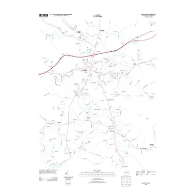
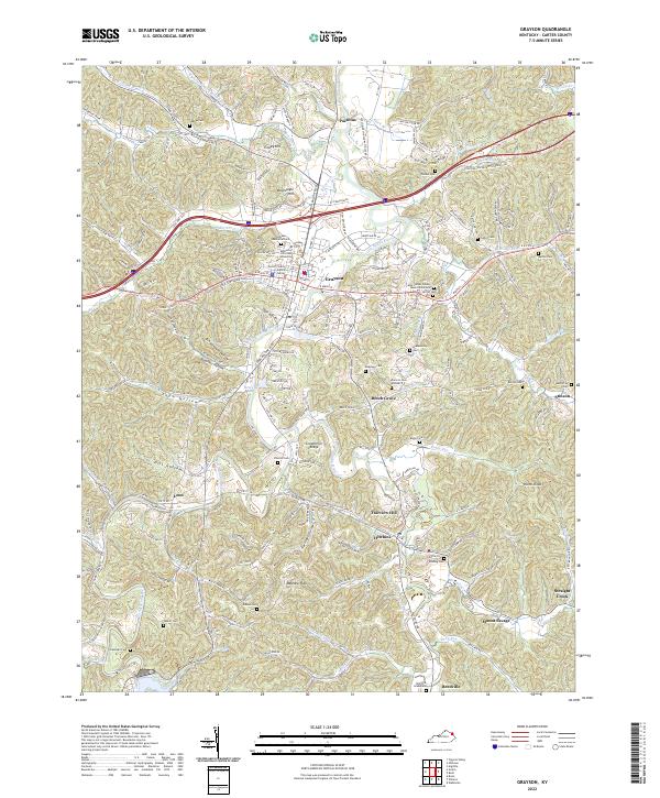 2022 Grayson2022 Print · USGSGrayson and the winding valley of the Little Sandy River are shown here in the 2020s, highlighting the modern intersection of education, law, and local heritage. Genealogists can trace numerous family burial sites such as the Womack Graveyard, Vincent Cem, and Edison Cem.
End of results
Showing maps 1-12 of 12
Top cities near Mount Savage
- Ashland historical maps
- Grayson historical maps
- Russell historical maps
- Bellefonte historical maps
- Sandy Hook historical maps
- Blaine historical maps
Frequently asked questions
- What are the different types of historical maps available for Mount Savage?
- What is the oldest map of Mount Savage?
- Where can I purchase historical maps of Mount Savage for my home or office?
- Where can I download high-res historical maps of Mount Savage?
- Are there historical topographic maps available for Mount Savage?
- Is there historical aerial imagery available for Mount Savage?
- Where are historical maps of Mount Savage sourced from?