2020s Maps of Franklin County, Kentucky
Explore 10 historic maps of Franklin County from the 2020s. These maps offer a rare glimpse into what life looked like during the 2020s — showing old roads, neighborhoods, homes, and landmarks that have changed or disappeared over time.
Whether you're researching your family's past, planning a metal detecting trip, or studying how Franklin County's landscape evolved across the 2020s, these high-resolution maps are a powerful tool for exploring the history of this region.
- Focus on a specific era: All maps on this page are from the 2020s, giving you a focused view of this time period.
- See what’s changed: Compare century-old streets, trails, and buildings to today's modern landscape using overlays and satellite layers.
- Research with precision: Use these maps for genealogy, historical research, land use analysis, or educational projects.
- View, download, or print: Maps are fully viewable online in high resolution, and can be downloaded or printed for your own records.
Start exploring Franklin County's history through authentic maps from the 2020s. This is your window into the past.
Franklin County, KY maps
(10)- 2022 Map of Switzer, 2022 Print
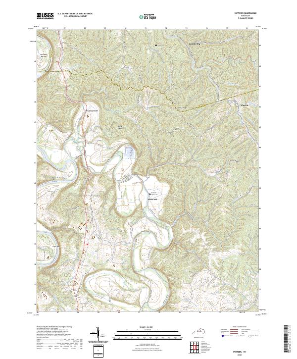 2022 Switzer2022 Print · USGSFranklin and Owen Counties are captured in this recent survey, showing the deep valleys of the Kentucky River corridor. Researchers can trace rural cemeteries and crossroads settlements like Peaks Mill, Swallowfield, and the Peaks Mill Church Cem.
 - 2022 Map of Polsgrove, 2022 Print
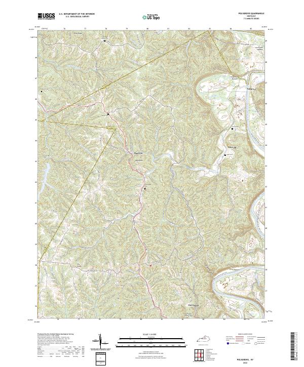 2022 Polsgrove2022 Print · USGSFranklin County and its surrounding borders are captured here in the early 2020s, showcasing a landscape of river bottoms and high ridges. Genealogists can trace family landmarks at Grub Ridge Church Cem, Moore Cem, and the settlement of Polsgrove.
 - 2022 Map of Stamping Ground, 2022 Print
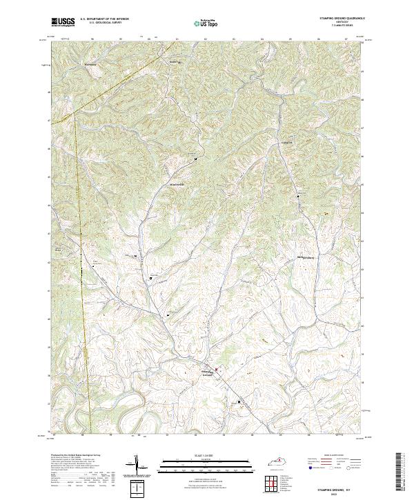 2022 Stamping Ground2022 Print · USGSNorthern Scott County maintains its rural character in the early twenty-first century, centered on the historic crossroads of Stamping Ground. Genealogists can trace family landmarks and burial sites like Bond Cem, Robey Cem, and Lindsay Cem.
 - 2022 Map of Waddy, 2022 Print
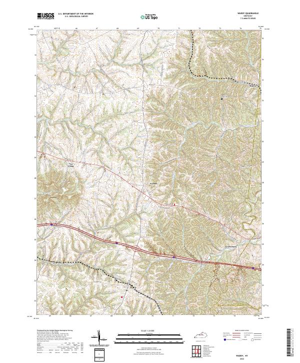 2022 Waddy2022 Print · USGSShelby County's rural landscape is captured here in the early 2020s, showing a network of historic crossroads and farm-to-market routes. Researchers can trace family-named roads and locate community centers like Waddy, Clay Village, and the Beech Ridge Cem.
 - 2022 Map of North Pleasureville, 2022 Print
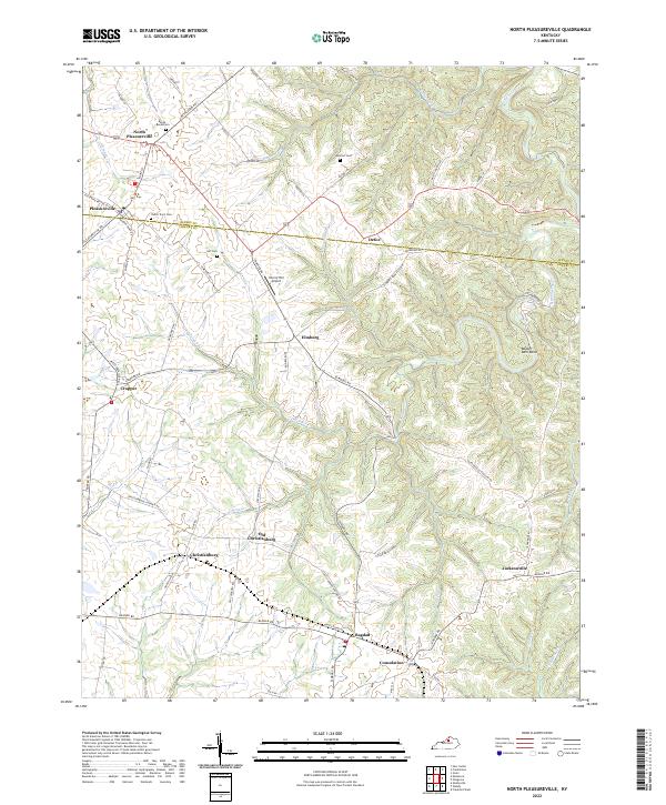 2022 North Pleasureville2022 Print · USGSThe rural borderlands of Henry and Shelby counties come alive in this detailed recent survey of North Central Kentucky. Local researchers can trace family roots at the Dutch Tract Cem or locate old community centers like Old Christianburg, Bagdad, and Defoe.
 - 2022 Map of Frankfort West, 2022 Print
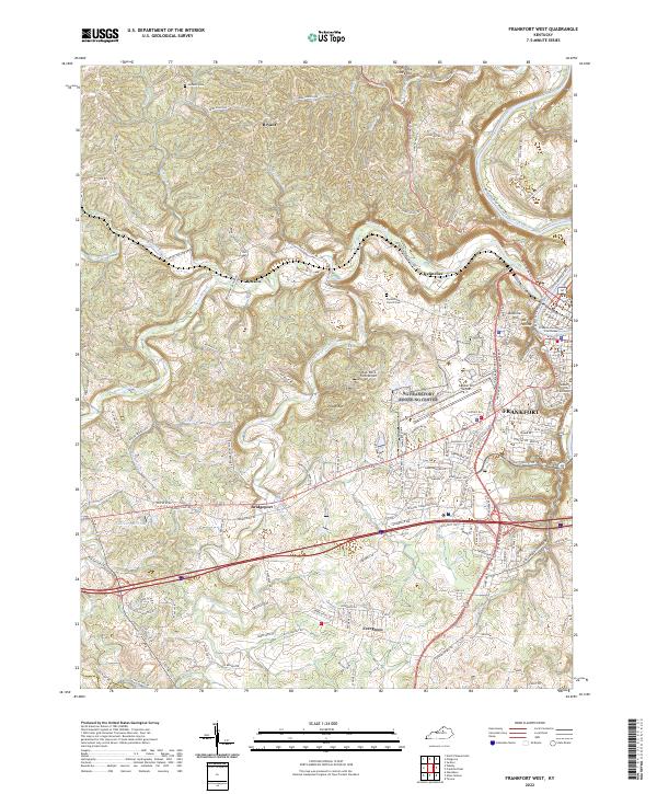 2022 Frankfort West2022 Print · USGSFrankfort and the Kentucky River valley are shown here in the 2020s, highlighting the state capital alongside rural Franklin County. Researchers can locate the Franklin County Courthouse, trace family ties at Choateville Church Cem, and explore old routes near Bridgeport.
 - 2022 Map of Alton Station, 2022 Print
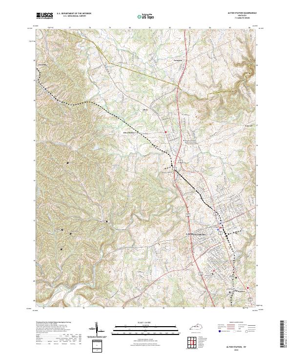 2022 Alton Station2022 Print · USGSLawrenceburg and its surrounding Anderson County communities are documented here in the early 2020s. Researchers can trace family history through several rural burial sites like the Carpenter Lane Graveyard, Akins Cem, and Buntain Cem.
 - 2022 Map of Tyrone, 2022 Print
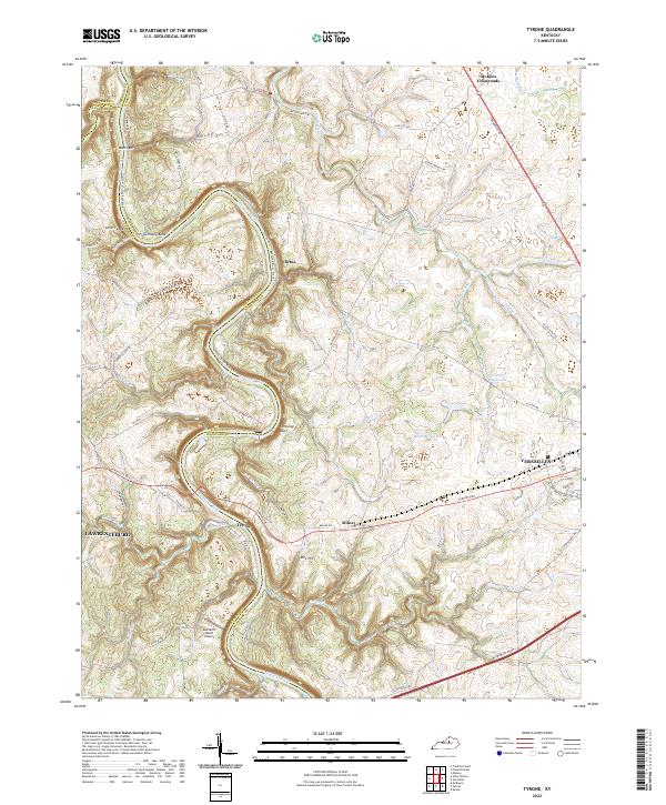 2022 Tyrone2022 Print · USGSThe Kentucky River corridor near the Anderson and Woodford county line is shown here in the early 2020s. Researchers can trace the river's path past Germany Bend, locate the river crossing at Tyrone, and find local landmarks like Buzzard's Roost Airport.
 - 2022 Map of Frankfort East, 2022 Print
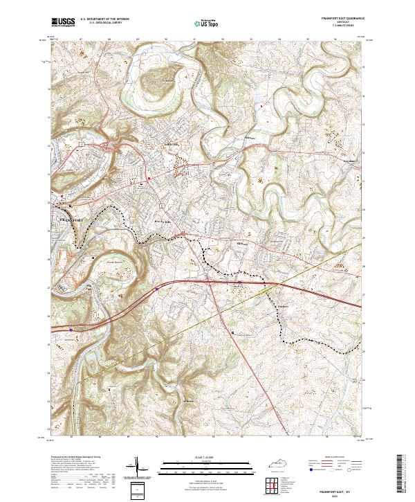 2022 Frankfort East2022 Print · USGSThe state capital and its surrounding Bluegrass hills are captured here in the early 2020s as the riverfront and suburbs continue to evolve. Researchers can locate the historic Frankfort Cem, trace the bends of Elkhorn Creek, and find smaller settlements like Duckers and Millville.
 - 2022 Map of Midway, 2022 Print
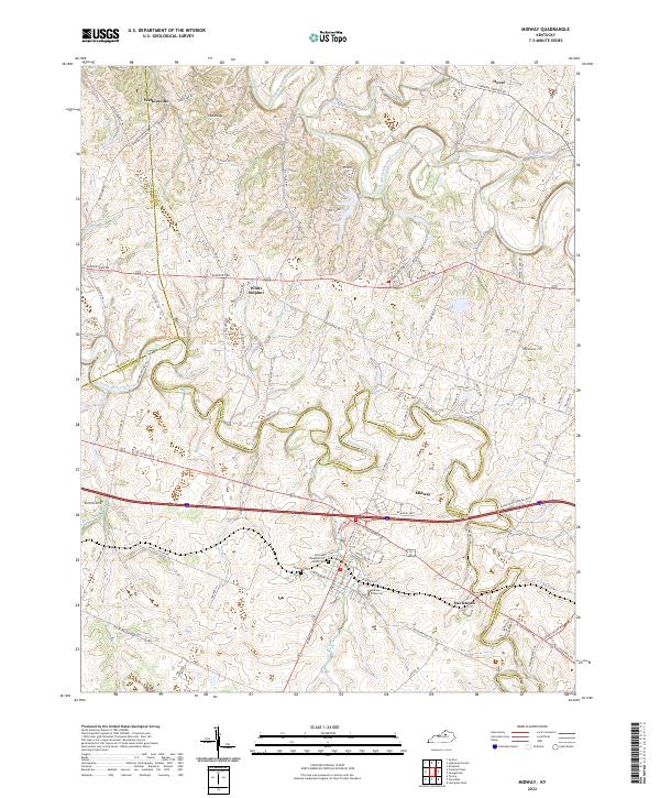 2022 Midway2022 Print · USGSMidway and the surrounding Bluegrass countryside are mapped here in the modern era, showing the intersection of Woodford, Scott, and Franklin counties. Genealogists can locate family landmarks like the Sons and Daughters of Relief Cem and trace the rural layouts of Watkinsville and Davistown.
End of results
Showing maps 1-10 of 10
Top cities of Franklin County
Frequently asked questions
- What are the different types of historical maps available for Franklin County?
- What is the oldest map of Franklin County?
- Where can I purchase historical maps of Franklin County for my home or office?
- Where can I download high-res historical maps of Franklin County?
- Are there historical topographic maps available for Franklin County?
- Is there historical aerial imagery available for Franklin County?
- Where are historical maps of Franklin County sourced from?