2020s Maps of Lancaster, Kentucky
Explore 2 historic maps of Lancaster from the 2020s. These maps offer a rare glimpse into what life looked like during the 2020s — showing old roads, neighborhoods, homes, and landmarks that have changed or disappeared over time.
Whether you're researching your family's past, planning a metal detecting trip, or studying how Lancaster's landscape evolved across the 2020s, these high-resolution maps are a powerful tool for exploring the history of this region.
- Focus on a specific era: All maps on this page are from the 2020s, giving you a focused view of this time period.
- See what’s changed: Compare century-old streets, trails, and buildings to today's modern landscape using overlays and satellite layers.
- Research with precision: Use these maps for genealogy, historical research, land use analysis, or educational projects.
- View, download, or print: Maps are fully viewable online in high resolution, and can be downloaded or printed for your own records.
Start exploring Lancaster's history through authentic maps from the 2020s. This is your window into the past.
Lancaster, KY maps
(2)- 2022 Map of Lancaster, 2022 Print
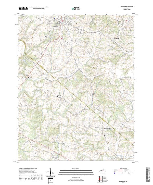 2022 Lancaster2022 Print · USGSGarrard and Lincoln counties are captured here in the early twenty-first century as rural life persists along the winding Dix River. Genealogists can trace family roots through numerous local burial grounds and landmarks including Lancaster Cemetery, Goshen Cem, and Preachersville.
 - 2022 Map of Buckeye, 2022 Print
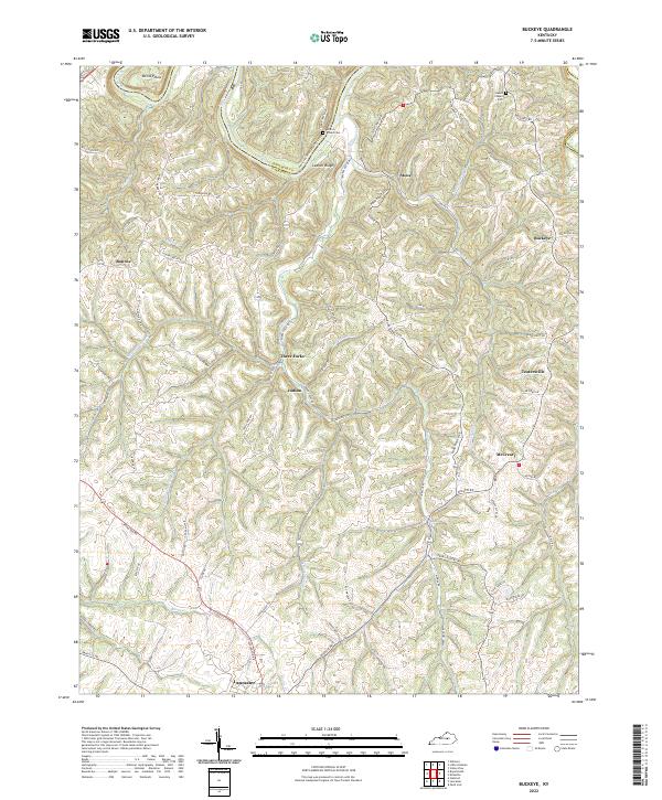 2022 Buckeye2022 Print · USGSGarrard County's dissected uplands and river bluffs are documented here during the early twenty-first century. Researchers can trace rural lineages through local landmarks like Gunns Chapel Cem and small communities such as Teatersville and Buckeye.
End of results
Showing maps 1-2 of 2
Top cities near Lancaster
- Nicholasville historical maps
- Danville historical maps
- Stanford historical maps
- Mount Vernon historical maps
- Junction City historical maps
- Brodhead historical maps
See more
Frequently asked questions
- What are the different types of historical maps available for Lancaster?
- What is the oldest map of Lancaster?
- Where can I purchase historical maps of Lancaster for my home or office?
- Where can I download high-res historical maps of Lancaster?
- Are there historical topographic maps available for Lancaster?
- Is there historical aerial imagery available for Lancaster?
- Where are historical maps of Lancaster sourced from?