1950s Maps of Marksbury, Kentucky
Explore 3 historic maps of Marksbury from the 1950s. These maps offer a rare glimpse into what life looked like during the 1950s — showing old roads, neighborhoods, homes, and landmarks that have changed or disappeared over time.
Whether you're researching your family's past, planning a metal detecting trip, or studying how Marksbury's landscape evolved across the 1950s, these high-resolution maps are a powerful tool for exploring the history of this region.
- Focus on a specific era: All maps on this page are from the 1950s, giving you a focused view of this time period.
- See what’s changed: Compare century-old streets, trails, and buildings to today's modern landscape using overlays and satellite layers.
- Research with precision: Use these maps for genealogy, historical research, land use analysis, or educational projects.
- View, download, or print: Maps are fully viewable online in high resolution, and can be downloaded or printed for your own records.
Start exploring Marksbury's history through authentic maps from the 1950s. This is your window into the past.
Marksbury, KY maps
(3)- 1950 Map of Bryantsville, 1953 Print
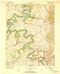 1950 Bryantsville1953 Print · USGSGarrard County and the winding Dix River are shown in the early fifties at the meeting of three counties. Local researchers can trace the Wilderness Trail and locate family landmarks like Robinson Reed Cem or the community of Bryantsville.
 - 1952 Map of Bryantsville, 1953 Print
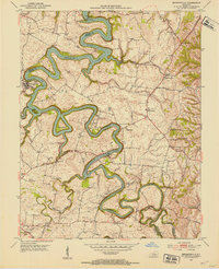 1952 Bryantsville1953 Print · USGSGarrard County in the early fifties shows a landscape shaped by the winding Herrington Lake and the historic Wilderness Trail. Researchers can trace the layout of Bryantsville, the grounds of Camp Dick Robinson, and the State Hospital.3 unique versions available
 - 1957 Map of Winchester, 1968 Print
 1957 Winchester1968 Print · USGSCentral Kentucky's landscape in the mid-twentieth century features the sprawling Fort Knox and the early parkway system. Genealogists and historians can trace rail lines like the Southern Railway and find landmarks from Bernheim Forest to Pilot Knob.3 unique versions available
End of results
Showing maps 1-3 of 3
Top cities near Marksbury
- Lexington historical maps
- Nicholasville historical maps
- Danville historical maps
- Harrodsburg historical maps
- Lancaster historical maps
- Wilmore historical maps
See more
Frequently asked questions
- What are the different types of historical maps available for Marksbury?
- What is the oldest map of Marksbury?
- Where can I purchase historical maps of Marksbury for my home or office?
- Where can I download high-res historical maps of Marksbury?
- Are there historical topographic maps available for Marksbury?
- Is there historical aerial imagery available for Marksbury?
- Where are historical maps of Marksbury sourced from?