Old Maps of Mayfield, Kentucky for Metal Detecting
Plan your next treasure hunt with 37 historic maps of Mayfield. Find old homesites, ghost towns, trails, and gathering spots that may be lost to time — perfect for identifying promising metal detecting locations.
- Locate forgotten sites: Uncover places like long-lost settlements, abandoned rail lines, or gathering spots.
- Plan better hunts: Use map overlays combined with LiDAR or satellite views to narrow in on historically rich areas.
- Made for detectorists: Thousands of hobbyists use these maps to discover relics, coins, and hidden history.
Use these historic maps to boost your research and find new opportunities beneath the surface of Mayfield.
Mayfield, KY maps
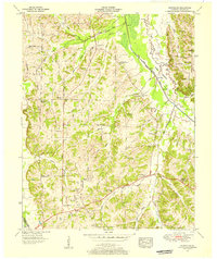
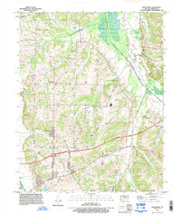
(37)- 1936 Map of Farmington
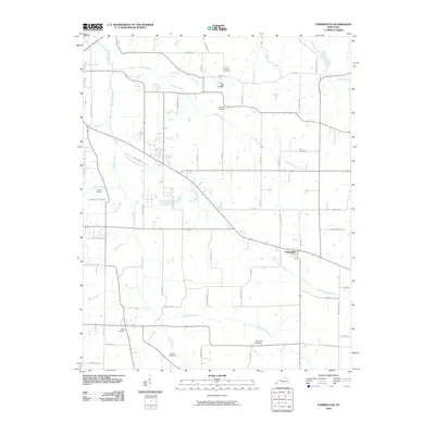
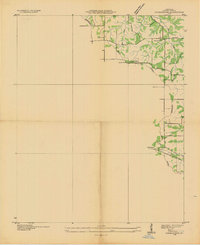 1936 Farmington1936 Print · USGSFarmington and the surrounding Graves County landscape appear here in the mid-1930s as rural electrification begins to take hold. Genealogists and local historians can trace family locations near Smyrna Ch, Cope Sch, and the settlement of Vulton Creek.
 - 1936 Map of Westplains
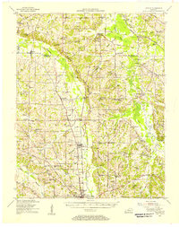
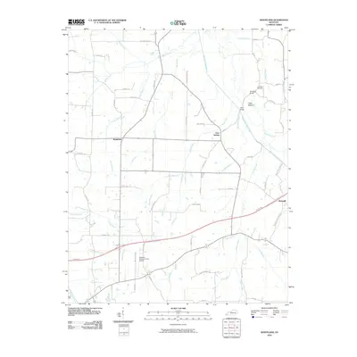
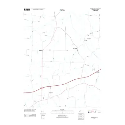
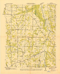 1936 Westplains1936 Print · USGSGraves County in the mid-1930s is documented here through its network of country schools, churches, and drainage ditches. Genealogists can trace family roots at Rickman Cem or Arnett Cem and locate community centers like Westplains and Hicksville.
 - 1951 Map of Farmington, 1955 Print
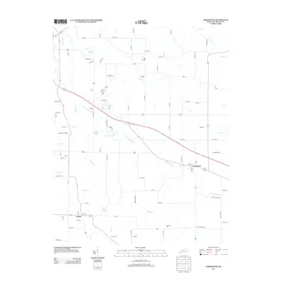
 1951 Farmington1955 Print · USGSGraves County, Kentucky, is shown in detail during the early fifties, following the ridge of the Tennessee Valley Divide. Researchers can trace family roots through numerous local landmarks, including Sedalia Sch, Bethlehem Church, and Swann Cem.3 unique versions available
 - 1951 Map of Hickory, 1956 Print
 1951 Hickory1956 Print · USGSGraves County at mid-century centers on the busy Illinois Central Railroad and the rural communities north of Mayfield. Researchers can trace dozens of family burial sites like Albritton Cem or visit local landmarks like the County War Memorial Fairgrounds.2 unique versions available
 - 1951 Map of Westplains, 1956 Print
 1951 Westplains1956 Print · USGSGraves County in the early 1950s is a landscape of high ridges and winding river bottoms divided by the Tennessee Valley Divide. Researchers can locate numerous family landmarks and rural hubs, including Spence Chapel, the Hardeman Sch, and the Old Casey Bridge.2 unique versions available
 - 1951 Map of Hickory, 1957 Print
 1951 Hickory1957 Print · USGSIn the early 1950s, this area of Graves and McCracken County was a patchwork of small tobacco farms and rail-stop towns. Researchers can locate hundreds of family sites, from the Clay Pits near Hickory to remote landmarks like Neece Chapel and Old Casey Bridge.
 - 1952 Map of Mayfield, 1953 Print
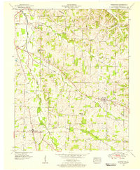
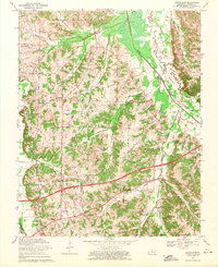
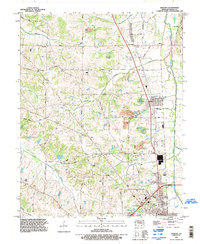
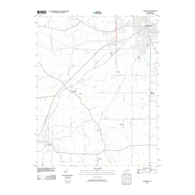
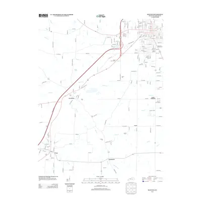
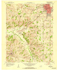 1952 Mayfield1953 Print · USGSMid-century Graves County is centered on the industrial and rail hub of Mayfield, where the railroad connects the town to its rural southern neighbors. Genealogists can locate family names and burial sites at Maplewood Cem, Bethel Cem, and the small settlement of Pryorsburg.
 - 1952 Map of Mayfield, 1957 Print
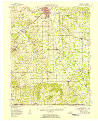 1952 Mayfield1957 Print · USGSGraves County, Kentucky, was a bustling network of rail-side towns and rural parishes at the mid-century. Researchers can trace family history through dozens of landmarks like Rozzell Cem, follow the Illinois Central Railroad, or locate the County Farm.
 - 1956 Map of Dyersburg, 1960 Print
 1956 Dyersburg1960 Print · USGSThe Four Rivers region comes alive in the mid-fifties, capturing the intricate borderlands of Tennessee, Kentucky, and Missouri. Genealogists and historians can trace the rail-and-river networks connecting Dyersburg, Caruthersville, and the shoreline of Reelfoot Lake.4 unique versions available
 - 1969 Map of Westplains, 1971 Print
 1969 Westplains1971 Print · USGSGraves County in the late sixties shows a traditional rural landscape beginning to modernize with the arrival of major infrastructure. Genealogists can trace family footprints near Clear Springs and Westplains or locate rural landmarks like Shelton Chapel and McKindree Ch.2 unique versions available
 - 1969 Map of Hickory, 1971 Print
 1969 Hickory1971 Print · USGSGraves County at the close of the sixties reveals a landscape shaped by both the Illinois Central railroad and the newer Purchase Parkway. Researchers can trace rural lineages through numerous country churches and cemeteries, such as Mt Union Ch, Salem Cem, and Mt Zion Ch.2 unique versions available
 - 1969 Map of Mayfield, 1971 Print
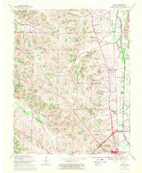
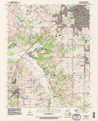
 1969 Mayfield1971 Print · USGSGraves County during the late sixties shows the expansion of MAYFIELD alongside traditional rural life. Genealogists can trace family names at St Josephs Cem or Dodson Cem and locate rural landmarks like Pryorsburg and Shady Grove Ch.2 unique versions available
 - 1986 Map of Murray
 1986 Murray1986 Print · USGSWestern Kentucky in the mid-1980s reveals a landscape defined by the Tennessee and Cumberland rivers. Genealogists and historians can trace rail-town development along the Illinois Central Gulf RR and find family-named locations like Dukedom and Water Valley.2 unique versions available
 - 1993 Map of Farmington, 1996 Print
 1993 Farmington1996 Print · USGSGraves County in the early nineties reflects a deep agricultural heritage centered on Farmington and Sedalia. Family researchers can trace ancestral locations through several burial sites like Smyrna Cem and landmarks such as the Woolen Mill.
 - 1993 Map of Westplains, 1996 Print
 1993 Westplains1996 Print · USGSGraves County, Kentucky, is shown in the early nineties as the region's modern highway system integrated with its historic rural settlements. Genealogists and local researchers can trace family landmarks and forgotten crossings like Hopewell Church, Sand Hill Cem, and Old Casey Bridge.
 - 1994 Map of Hickory, 1996 Print
 1994 Hickory1996 Print · USGSGraves County in the mid-1990s shows a landscape of traditional farming communities adapting to modern transit corridors. Researchers can trace family sites along Jewell Nance Road, locate historic burials at Old Union Cem, and see the local impact of the Purchase Parkway.
 - 1994 Map of Mayfield, 1996 Print
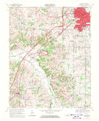
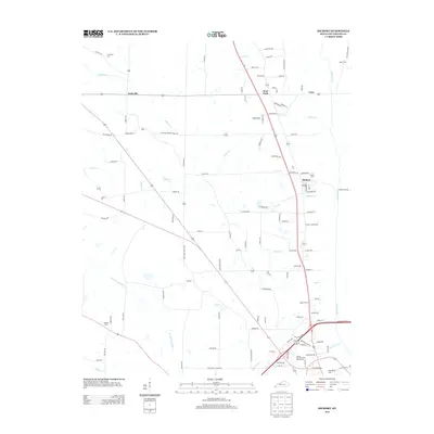
 1994 Mayfield1996 Print · USGSIn the mid-1990s, Graves County remained a hub of rail transport and clay mining around the city of Mayfield. Trace family roots and old property lines near Pryorsburg, Rozzelle Church, and the Illinois Central Railroad.
 - 2010 Map of Hickory, 2010 Print
 2010 Hickory2010 Print · USGSCovers Mayfield, including Hickory, West Viola, and other nearby areas
 - 2010 Map of Westplains, 2010 Print
 2010 Westplains2010 Print · USGSCovers Mayfield, including Westplains, Hicksville, and other nearby areas
 - 2010 Map of Mayfield, 2010 Print
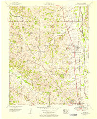
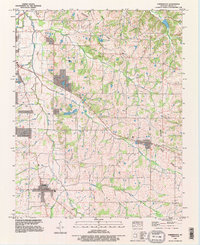
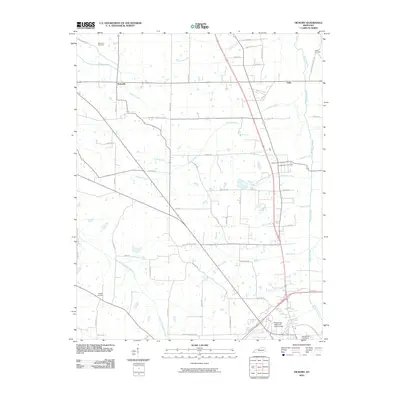
 2010 Mayfield2010 Print · USGSCovers Mayfield, including Wingo, Stubblefield, and other nearby areas
 - 2010 Map of Farmington, 2010 Print
 2010 Farmington2010 Print · USGSCovers Mayfield, including Sedalia, Farmington, and other nearby areas
 - 2013 Map of Farmington, 2013 Print
 2013 Farmington2013 Print · USGSCovers Mayfield, including Sedalia, Farmington, and other nearby areas
 - 2013 Map of Mayfield, 2013 Print
 2013 Mayfield2013 Print · USGSCovers Mayfield, including Wingo, Stubblefield, and other nearby areas
 - 2013 Map of Westplains, 2013 Print
 2013 Westplains2013 Print · USGSCovers Mayfield, including Westplains, Hicksville, and other nearby areas
 - 2013 Map of Hickory, 2013 Print
 2013 Hickory2013 Print · USGSCovers Mayfield, including Hickory, West Viola, and other nearby areas
Showing maps 1-25 of 37
Top cities near Mayfield
Frequently asked questions
- What are the different types of historical maps available for Mayfield?
- What is the oldest map of Mayfield?
- Where can I purchase historical maps of Mayfield for my home or office?
- Where can I download high-res historical maps of Mayfield?
- Are there historical topographic maps available for Mayfield?
- Is there historical aerial imagery available for Mayfield?
- Where are historical maps of Mayfield sourced from?