1900s (20th Century) Maps of Greensburg, Kentucky
Explore 10 historic maps of Greensburg from the 1900s (20th Century). These maps offer a rare glimpse into what life looked like during the 1900s — showing old roads, neighborhoods, homes, and landmarks that have changed or disappeared over time.
Whether you're researching your family's past, planning a metal detecting trip, or studying how Greensburg's landscape evolved across the 1900s, these high-resolution maps are a powerful tool for exploring the history of this region.
- Focus on a specific era: All maps on this page are from the 1900s, giving you a focused view of this time period.
- See what’s changed: Compare century-old streets, trails, and buildings to today's modern landscape using overlays and satellite layers.
- Research with precision: Use these maps for genealogy, historical research, land use analysis, or educational projects.
- View, download, or print: Maps are fully viewable online in high resolution, and can be downloaded or printed for your own records.
Start exploring Greensburg's history through authentic maps from the 1900s. This is your window into the past.
Greensburg, KY maps
(10)- 1953 Map of Summersville, 1954 Print
 1953 Summersville1954 Print · USGSGreen County, Kentucky, is shown here in the early fifties during a period of steady rural community life. Researchers can trace family sites at Vance Cem and Akin Cem or locate local landmarks like the Coakley PO and Ladies Chapel.
 - 1953 Map of Exie, 1955 Print
 1953 Exie1955 Print · USGSGreen County in the early fifties is captured here as a landscape of tight-knit rural communities and family farmsteads. Genealogists can trace family names across dozens of local sites, from Maple Hill Cem to the schoolhouse at Forest Rose Sch and the community at Donansburg.
 - 1953 Map of Gresham, 1955 Print
 1953 Gresham1955 Print · USGSGreen County in the early fifties is mapped here as a landscape of winding river bends and tight-knit rural communities. Researchers can trace family sites and local history at Gresham, Miller Chapel, and the Summershade Sch along the banks of Russell Creek.4 unique versions available
 - 1954 Map of Greensburg, 1955 Print
 1954 Greensburg1955 Print · USGSMid-century Green County and Taylor County are captured here as the Green River winds past Greensburg. Genealogists can trace family roots through numerous local landmarks like Black Gnat, Hogards Chapel, and rural schoolhouses including Fairview Sch.
 - 1957 Map of Winchester, 1968 Print
 1957 Winchester1968 Print · USGSCentral Kentucky's landscape in the mid-twentieth century features the sprawling Fort Knox and the early parkway system. Genealogists and historians can trace rail lines like the Southern Railway and find landmarks from Bernheim Forest to Pilot Knob.3 unique versions available
 - 1960 Map of Winchester
 1960 Winchester1960 Print · USGSCentral Kentucky's diverse landscape is shown here at mid-century, from the bluegrass plains to the rugged Pottsville Escarpment. Genealogists and historians can trace the rail-and-river network connecting towns like Bardstown and Stanford alongside landmarks like Lake Cumberland.
 - 1961 Map of Greensburg, 1962 Print
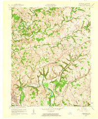 1961 Greensburg1962 Print · USGSCentral Kentucky's river valleys and oil fields come into focus in the early sixties, centered on the historic seat of Greensburg. Genealogists and historians can trace deep family roots through many rural landmarks, including Earlys Chapel, Beech Grove Ch, and the curiously named Black Gnat.2 unique versions available
 - 1961 Map of Exie, 1962 Print
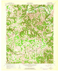 1961 Exie1962 Print · USGSGreen County's rural heartland is captured here in the early sixties, showing a landscape defined by the winding Green River and small farming hamlets. Researchers can trace family history through dozens of namesake sites like Wisdom Cem, Liletown, and the Little Barren Ch & Cem.2 unique versions available
 - 1961 Map of Summersville, 1963 Print
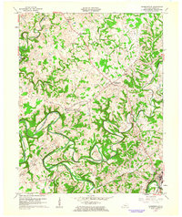 1961 Summersville1963 Print · USGSGreen County, Kentucky, in the early sixties shows a landscape defined by the winding Green River and the rural community of Summersville. Researchers can trace family history through numerous landmarks like Cave Springs Cem, Sand Lick Ch, and the outlying settlement of Bloyds Crossing.3 unique versions available
 - 1986 Map of Campbellsville
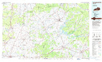 1986 Campbellsville1986 Print · USGSCentral Kentucky in the mid-eighties was a landscape of deep river valleys and high ridges. Genealogists can trace family holdings near rural settlements like Phillipsburg or locate landmarks such as Mt Gilead Ch and the Magnolia Gas Storage Field.2 unique versions available
End of results
Showing maps 1-10 of 10
Top cities near Greensburg
Frequently asked questions
- What are the different types of historical maps available for Greensburg?
- What is the oldest map of Greensburg?
- Where can I purchase historical maps of Greensburg for my home or office?
- Where can I download high-res historical maps of Greensburg?
- Are there historical topographic maps available for Greensburg?
- Is there historical aerial imagery available for Greensburg?
- Where are historical maps of Greensburg sourced from?