Old Maps of Hickman County, Kentucky for Hiking & Exploration
Hike through history with 90 historic maps of Hickman County. Explore old trails, ghost towns, and forgotten backroads — perfect for outdoor adventurers and local explorers.
- Rediscover forgotten places: Map out old mining camps, roads, and footpaths that no longer exist on modern maps.
- Layer with modern tools: Combine with LiDAR or satellite views to plan hikes through historical terrain.
- Made for exploration: Popular among hikers, overlanders, and local history lovers.
Use these maps to find adventure and explore the hidden past of Hickman County.
Hickman County, KY maps
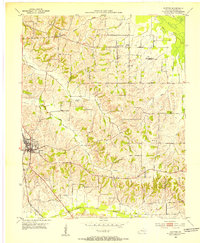
(90)- 1939 Map of Wickliffe
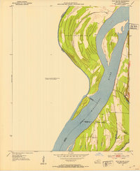
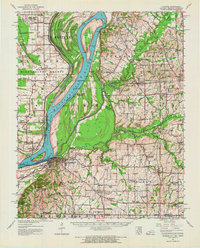
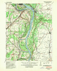 1939 Wickliffe1939 Print · USGSThe confluence of the Ohio and Mississippi Rivers in the late 1930s reveals a landscape of river-bend settlements and early flood control. Genealogists can locate numerous rural landmarks such as St Pauls Ch & Sch, Cherry Geveden Sch, and the historic site of Fort Jefferson.2 unique versions available
 - 1939 Map of Hickman, 1941 Print
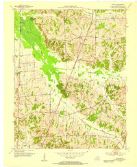
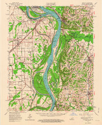
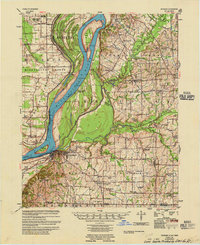
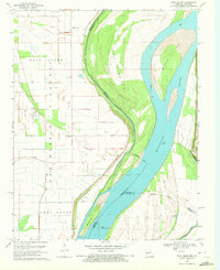
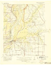 1939 Hickman1941 Print · USGSWestern Kentucky and the Missouri bootheel meet at the river in the late 1930s, showing a landscape of flood control and rural growth. Genealogists can locate family-named sites like Hubbard Cem, Stubbs Sch, and the riverside settlement of Dorena.4 unique versions available
 - 1951 Map of Cayce, 1952 Print
 1951 Cayce1952 Print · USGSThe Kentucky-Tennessee borderlands appear here in the early postwar era as a landscape of rural churches and rail crossings. Genealogists and historians can trace family locations near Cayce, Alexander Cem, and the tracks of the Gulf Mobile and Ohio.2 unique versions available
 - 1951 Map of Oakton, 1952 Print
 1951 Oakton1952 Print · USGSWestern Kentucky’s riverfront and rail corridors are captured here in the early fifties, documenting a landscape of small agricultural hubs and bluff-side terrain. Genealogists can trace early homesteads and social centers like Oakton, Whaynes Corner, and Oakwood Ch.2 unique versions available
 - 1951 Map of Wolf Island, 1953 Print
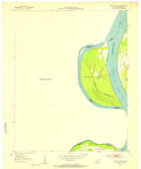
 1951 Wolf Island1953 Print · USGSThe Mississippi River floodplain at the Kentucky-Missouri border is captured here in the early fifties, showing a landscape shaped by shifting currents. Researchers can trace the mid-century channel and landforms like Wolf Island No 5, Medley Bar, and the banks near Chalk Bluff.2 unique versions available
 - 1951 Map of Wickliffe SW, 1953 Print
 1951 Wickliffe SW1953 Print · USGSThe Kentucky and Missouri borderlands along the Mississippi are captured here in the early fifties. River historians and researchers can trace the shifting banks of Lucas Bend and the precise boundaries of Islands Nos 2 3 & 4 and Wolf Island No 5.3 unique versions available
 - 1951 Map of Arlington, 1953 Print
 1951 Arlington1953 Print · USGSWestern Kentucky's river bluffs and bottomlands are frozen in time during the early fifties, showing the region's transition from the Mississippi floodplain to upland farms. Researchers can trace family history at Roselawn Cem, locate the Trevathan Sch, or explore the grounds of Columbus-Belmont State Park.2 unique versions available
 - 1951 Map of Milburn, 1953 Print
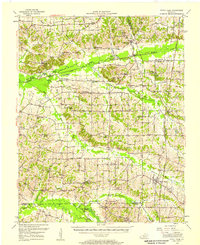
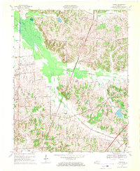
 1951 Milburn1953 Print · USGSWestern Kentucky farmland and creek bottoms appear here in the early fifties, centered on the community of Milburn. Local historians can trace family locations near Antioch Ch, Hebron Cem, and the winding banks of Obion Creek.
 - 1952 Map of Clinton, 1953 Print
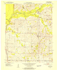
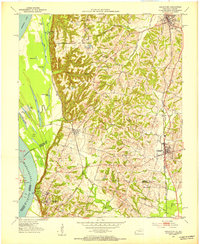
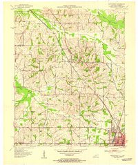
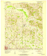
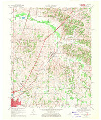
 1952 Clinton1953 Print · USGSHickman County settlement and agriculture are at their mid-century peak in this detailed study of the area surrounding the county seat. Family historians can locate ancestral sites at McWhorter Cem or trace the old ILLINOIS CENTRAL rail line through Clinton.
 - 1952 Map of Dublin, 1953 Print
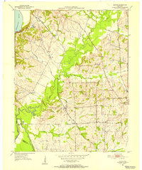
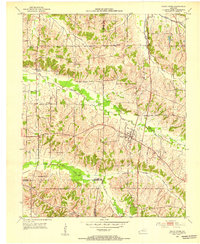
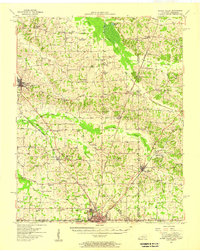
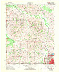
 1952 Dublin1953 Print · USGSGraves and Hickman counties come together in this early 1950s survey of the Jackson Purchase. Genealogists can trace family names and rural hubs including Dublin, the Illinois Central rail line, and numerous landmarks like McClure Chapel and Mason Cem.
 - 1952 Map of Crutchfield, 1953 Print
 1952 Crutchfield1953 Print · USGSWestern Kentucky and the Tennessee borderlands are captured here in the early fifties during a period of steady rural growth. Researchers can trace local lineage through numerous landmarks like Huddleston Cem, Ledbetter Sch, and the Carr Institute in South Fulton.
 - 1952 Map of Fancy Farm, 1953 Print
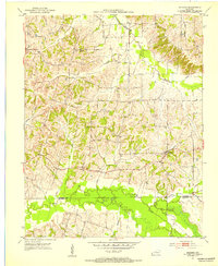
 1952 Fancy Farm1953 Print · USGSFancy Farm and the surrounding rural crossroads of Western Kentucky are captured here in the early fifties. Genealogists and local historians can trace family roots through sites like Emmaus Cem, the village of Kirbyton, and the Illinois Central rail line.
 - 1952 Map of Water Valley, 1953 Print
 1952 Water Valley1953 Print · USGSIn the early 1950s, the border between Kentucky and Tennessee was a landscape of rail-driven towns and winding bayous. Genealogists and historians can trace family roots through landmarks like Camp Beauregard Cem, the settlement of Feliciana, and the Illinois Central rail line.
 - 1952 Map of Water Valley, 1957 Print
 1952 Water Valley1957 Print · USGSWestern Kentucky and northern Tennessee are captured here in the early fifties as the Illinois Central railroad linked farming hubs and small towns. Genealogists can trace family names through dozens of landmarks like Camp Beauregard Cem, McWhort Cem, and Shiloh Sch Ch.
 - 1952 Map of Fancy Farm, 1958 Print
 1952 Fancy Farm1958 Print · USGSWestern Kentucky's rural landscapes are documented here in the early fifties, showing the tight-knit farming communities of Graves and Carlisle counties. Trace family history through local landmarks like Fancy Farm, St Charles Sch, and Milburn Cem.
 - 1952 Map of Wickliffe, 1964 Print
 1952 Wickliffe1964 Print · USGSThe confluence of the Ohio and Mississippi rivers in the early fifties shows a bustling network of river commerce and rail lines. You can trace family roots through numerous rural landmarks like North Ballard Ch & Cem, Birds Point Sch, and the rail junction at Winford Junction.
 - 1954 Map of Hickman, 1966 Print
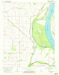
 1954 Hickman1966 Print · USGSThe tristate river country of Kentucky, Missouri, and Tennessee is captured here during the mid-century era of river control and rural rail. Genealogists can trace family landmarks like Sylvan Shade Sch, Dorena, and the river landings at Williams Ldg.
 - 1955 Map of Hickman
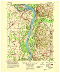
 1955 Hickman1955 Print · USGSMid-century life along the Mississippi River meanders is captured here during a period of heavy river engineering and rural expansion. Genealogists can trace family names and local sites like Sassafras Ridge Cem, Dorena Ch, and the Illinois Central rail line.2 unique versions available
 - 1955 Map of Wickliffe
 1955 Wickliffe1955 Print · USGSThe confluence of the great river systems at the Kentucky-Missouri-Illinois border is documented here in the mid-fifties. Researchers can locate vanished rural landmarks and river landings like Norfolk Ldg, Thirty Four Corner Sch, and the Mississippi Ch & Cem.
 - 1956 Map of Dyersburg, 1960 Print
 1956 Dyersburg1960 Print · USGSThe Four Rivers region comes alive in the mid-fifties, capturing the intricate borderlands of Tennessee, Kentucky, and Missouri. Genealogists and historians can trace the rail-and-river networks connecting Dyersburg, Caruthersville, and the shoreline of Reelfoot Lake.4 unique versions available
 - 1969 Map of Dublin, 1970 Print
 1969 Dublin1970 Print · USGSWestern Kentucky farming life near the border of Hickman and Graves counties is captured here in the late sixties. Genealogists and local historians can trace family locations near Watts Station, find the Salem Ch Cem, or follow the Illinois Central Railroad.2 unique versions available
 - 1969 Map of Water Valley, 1971 Print
 1969 Water Valley1971 Print · USGSThe Kentucky and Tennessee borderlands are captured here in the late sixties as the new parkway system began to reshape the rural landscape. Researchers can trace family history at Wesley Cem and Boaz Chapel or explore the site of Camp Beauregard near Water Valley.2 unique versions available
 - 1969 Map of Crutchfield, 1971 Print
 1969 Crutchfield1971 Print · USGSCrossing the Kentucky-Tennessee border in the late 1960s, this survey highlights the bustling rail-and-river geography near the state line. Genealogists can trace family names through landmarks like Riceville, Crossland Cem, and Mt Carmel Ch.
 - 1969 Map of Wolf Island, 1972 Print
 1969 Wolf Island1972 Print · USGSThe Mississippi River borderlands between Missouri and Kentucky are captured here in the late sixties. Genealogists can trace family landmarks like Ivie Cem, Mt Zion Ch, and the grounds of Towosahgy State Park.2 unique versions available
 - 1969 Map of Wickliffe SW, 1972 Print
 1969 Wickliffe SW1972 Print · USGSThe Missouri-Kentucky borderlands in the late sixties reveal a landscape shaped by the river and rail. Trace family roots at O'Bryan Cem or Travis Cem, and locate former rail lines along the Old Railroad Grade near Crosno.2 unique versions available
Showing maps 1-25 of 90
Top cities of Hickman County
Frequently asked questions
- What are the different types of historical maps available for Hickman County?
- What is the oldest map of Hickman County?
- Where can I purchase historical maps of Hickman County for my home or office?
- Where can I download high-res historical maps of Hickman County?
- Are there historical topographic maps available for Hickman County?
- Is there historical aerial imagery available for Hickman County?
- Where are historical maps of Hickman County sourced from?