Old Maps of Middletown, Kentucky for Metal Detecting
Plan your next treasure hunt with 47 historic maps of Middletown. Find old homesites, ghost towns, trails, and gathering spots that may be lost to time — perfect for identifying promising metal detecting locations.
- Locate forgotten sites: Uncover places like long-lost settlements, abandoned rail lines, or gathering spots.
- Plan better hunts: Use map overlays combined with LiDAR or satellite views to narrow in on historically rich areas.
- Made for detectorists: Thousands of hobbyists use these maps to discover relics, coins, and hidden history.
Use these historic maps to boost your research and find new opportunities beneath the surface of Middletown.
Middletown, KY maps
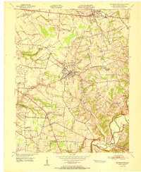
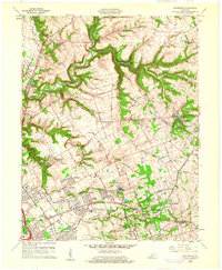
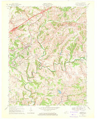
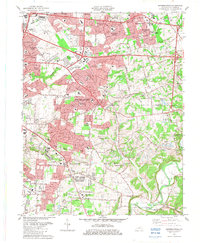
(47)- 1905 Map of Prospect, 1962 Print
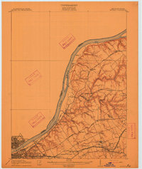
 1905 Prospect1962 Print · USGSThe Ohio River corridor north of Louisville comes alive in the early 1900s, showing a landscape of river landings and new electric railways. Researchers can find old landmarks like the Lakeland Asylum, the Kentucky Military Institute, and the Antioch Church.
 - 1907 Map of Louisville
 1907 Louisville1907 Print · USGSLouisville and the rolling hills of Jefferson and Bullitt counties are captured here in the early 1900s. Researchers can trace ancestral connections through sites like Cave Hill Cemetery, Pleasant Grove Schoolhouse, and the river crossing at Bells Mill Ford.3 unique versions available
 - 1912 Map of Prospect
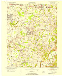
 1912 Prospect1912 Print · USGSThe northeastern outskirts of Louisville and the riverbanks of the Ohio River appear here in the early twentieth century. Researchers can trace the development of suburban settlements like Anchorage and St Matthews or locate the sprawling grounds of the Lakeland Asylum.3 unique versions available
 - 1929 Map of Taylorsville
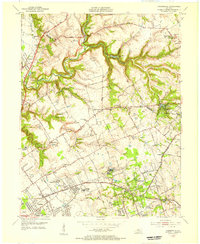
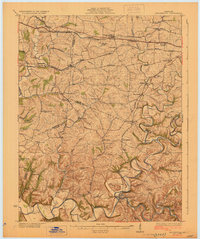 1929 Taylorsville1929 Print · USGSSpencer and Shelby counties are shown here in the late twenties, where the Salt River meets a network of early rail and pike roads. Genealogists can trace family lands near Shiloh Church, Beechwood School, and the settlement of Simpsonville.2 unique versions available
 - 1932 Map of La Grange
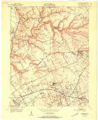
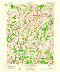
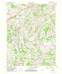
 1932 La Grange1932 Print · USGSThe Bluegrass region in the early thirties reveals a landscape defined by the Louisville and Nashville Railroad and the Ohio River. Genealogists can locate family landmarks like Henrysville Cemetery and several rural schoolhouses including Sweeney Sch.
 - 1951 Map of Anchorage
 1951 Anchorage1951 Print · USGSJefferson and Oldham Counties appear here in the early fifties, showing a landscape defined by institutional campuses and rail-centered towns. Genealogists and historians can trace Ormsby Village, Berrytown, and the Kentucky Military Institute along the Louisville and Nashville Railroad.
 - 1951 Map of Crestwood
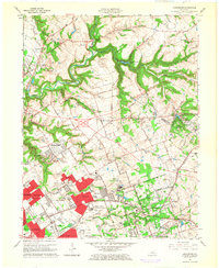
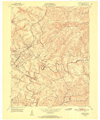 1951 Crestwood1951 Print · USGSThe railroad corridor between Oldham and Jefferson counties is well-established in the early fifties, centering on the growth of Crestwood and Pewee Valley. Researchers can locate historic institutions like the Pewee Valley Sanitarium and State Prison, or trace old family land near Pleasant Hill Cem and Glenarm.
 - 1951 Map of Jeffersontown
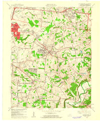
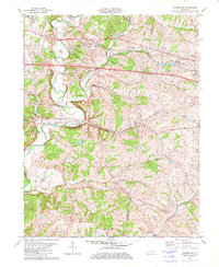
 1951 Jeffersontown1951 Print · USGSEastern Jefferson County comes alive in the early fifties as the rural landscape between Jeffersontown and Middletown begins to develop. Genealogists and historians can trace family plots like Bullitt Cem and local landmarks like Eastern High Sch.
 - 1951 Map of Fisherville
 1951 Fisherville1951 Print · USGSEastern Jefferson County and the neighboring borderlands of Shelby and Spencer counties are captured here in the early fifties. Genealogists and local historians can trace the foundations of Fisherville, the grounds of the Lincoln Institute, and rural landmarks like Bethlehem Ch.
 - 1951 Map of Louisville, 1959 Print
 1951 Louisville1959 Print · USGSGreater Louisville and Bullitt County are seen here in a period of rapid suburban growth following the war. Researchers can trace family history through dozens of landmarks like Evergreen Cemetery, Camp Taylor, and the rural schools of Okolona.
 - 1955 Map of Jeffersontown, 1956 Print
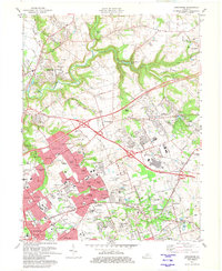
 1955 Jeffersontown1956 Print · USGSJefferson County is shown in a period of significant growth during the mid-fifties, as suburban neighborhoods began to replace rural acreage. Genealogists and local historians can trace legacy sites like Spring Meadows Childrens Home, the Southern Railway, and old churches such as Beulah Ch.
 - 1955 Map of Anchorage, 1956 Print
 1955 Anchorage1956 Print · USGSEastern Jefferson County and the edge of Oldham County appear in the mid-fifties as a region of institutional campuses and established towns. Genealogists can trace family roots through Anchorage, Lyndon, and Griffytown, or locate landmarks like Central State Hospital and St Thomas Seminary.
 - 1956 Map of Louisville, 1971 Print
 1956 Louisville1971 Print · USGSThe Ohio River valley and the Kentucky Bluegrass are captured here during a period of rapid mid-century growth and industrial activity. Genealogists and historians can trace rail-centered towns and military land use at Fort Knox and the Jefferson Proving Ground.2 unique versions available
 - 1960 Map of Crestwood, 1961 Print
 1960 Crestwood1961 Print · USGSThe rail towns of the Louisville and Nashville line prosper in the 1960s along the Oldham and Jefferson county border. Genealogists can trace family names at Pleasant Hill Cem, find the St Aloysius Sch, and locate the Pewee Valley Sanatorium.2 unique versions available
 - 1960 Map of Anchorage, 1961 Print
 1960 Anchorage1961 Print · USGSEastern Jefferson County is shown at a peak of institutional and suburban growth in the early sixties. Genealogists and historians can trace family locations near the Kentucky Military Institute, Anchorage, and Ormsby Village.
 - 1960 Map of Jeffersontown, 1961 Print
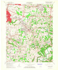
 1960 Jeffersontown1961 Print · USGSEastern Jefferson County comes alive in this early 1960s survey, showing the transition from farmland to suburban neighborhoods. Genealogists and local historians can pinpoint family landmarks like Bullitt Cem, Tucker Station, and the Spring Meadows Childrens Home.
 - 1960 Map of Fisherville, 1961 Print
 1960 Fisherville1961 Print · USGSEastern Jefferson County and its neighboring borders are captured here in the early sixties, showing a landscape defined by rail lines and river bends. Genealogists can locate Lincoln Institute at Lincoln Ridge or trace ancestral sites like Bethlehem Ch and Fisherville.
 - 1964 Map of Louisville
 1964 Louisville1964 Print · USGSThe Ohio River valley and Kentucky Bluegrass are captured in the mid-1960s, showing a region balanced between industrial growth and its agrarian roots. Genealogists and historians can trace the development of county seats like Shelbyville and Paris, or locate established institutions such as Georgetown College and Bernheim Forest.
 - 1964 Map of Jeffersontown, 1967 Print
 1964 Jeffersontown1967 Print · USGSEastern Jefferson County is shown at a peak of mid-century suburbanization as residential tracts begin to surround established towns like Jeffersontown and Middletown. Genealogists can trace family roots through sites like the Chenoweth Run Cemetery, Seatonville, and the Davis Memorial Chapel.2 unique versions available
 - 1965 Map of Anchorage, 1966 Print
 1965 Anchorage1966 Print · USGSEastern Jefferson County was undergoing a major residential and institutional transition in the mid-sixties. Researchers can trace the grounds of the Ormsby Village State Reservation, the Kentucky Military Institute, and the rail lines through Anchorage.2 unique versions available
 - 1969 Map of Crestwood, 1971 Print
 1969 Crestwood1971 Print · USGSThe rail-and-creek landscape of Oldham and Jefferson Counties is captured here in the late sixties as suburban growth meets established rural institutions. Researchers can trace historic sites like the Confederate Cem, Pewee Valley Sanitarium, and the State Prison near Floyds Fork.
 - 1981 Map of Anchorage, 1982 Print
 1981 Anchorage1982 Print · USGSSuburban Jefferson County comes into focus in the early eighties as highway expansion reshapes traditional neighborhoods. Genealogists and local historians can trace the footprint of Central State Hospital, the Kentucky Railway Museum, and settlements like Berrytown and O'Bannon.2 unique versions available
 - 1981 Map of Crestwood, 1982 Print
 1981 Crestwood1982 Print · USGSThe rail-corridor towns of Oldham County are seen here in the early eighties as they balanced rural heritage with suburban growth. Genealogists and researchers can trace family landmarks like the Confederate Cem, St Aloysius Sch, and the State Correctional Institute for Women.2 unique versions available
 - 1982 Map of Fisherville
 1982 Fisherville1982 Print · USGSEastern Jefferson County's rural landscape is captured here during the early eighties, showing the transition between farmsteads and suburban growth. Genealogists and locals can trace family lands near Fisherville, the Job Corps Center at Lincoln Ridge, and old rail stops like Boston.3 unique versions available
 - 1982 Map of Jeffersontown, 1983 Print
 1982 Jeffersontown1983 Print · USGSJeffersontown and the eastern suburbs of Louisville are shown during a period of significant growth in the early eighties. Genealogists can trace family footprints through numerous local landmarks like St Pauls Ch, Seatonville, and Tucker Station.
Showing maps 1-25 of 47
Top cities near Middletown
- Louisville historical maps
- Jeffersonville historical maps
- Jeffersontown historical maps
- Clarksville historical maps
- Mount Washington historical maps
- Lyndon historical maps
See more
Frequently asked questions
- What are the different types of historical maps available for Middletown?
- What is the oldest map of Middletown?
- Where can I purchase historical maps of Middletown for my home or office?
- Where can I download high-res historical maps of Middletown?
- Are there historical topographic maps available for Middletown?
- Is there historical aerial imagery available for Middletown?
- Where are historical maps of Middletown sourced from?