Old Maps of Fairview, Kentucky for Genealogy
Trace your family roots with 27 historic maps of Fairview. These high-res maps reveal old neighborhoods, homesites, landmarks, and streets — helping you uncover where your ancestors lived and how the area evolved over time.
- Explore historic neighborhoods: Identify where your relatives may have lived in the 1800s or 1900s.
- Compare maps over time: Trace the changes in streets, buildings, and landmarks for multi-generational research.
- Perfect for genealogy & ancestry research: Used by family historians and researchers to map out lineage and migration.
These maps are an incredible resource for exploring your personal connection to Fairview's past.
Fairview, KY maps
(27)- 1898 Map of East Cincinnati, 1964 Print
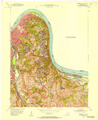
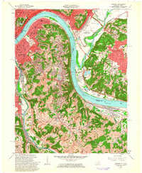
 1898 East Cincinnati1964 Print · USGSGreater Cincinnati and Northern Kentucky emerge as a bustling riverfront and rail hub at the turn of the century. Genealogists and historians can trace the early footprints of Coney Island Resort, the Longview Asylum, and the Cincinnati Waterworks.
 - 1914 Map of East Cincinnati
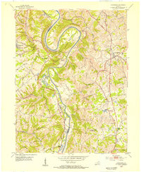
 1914 East Cincinnati1914 Print · USGSThe eastern Cincinnati suburbs and Northern Kentucky riverfront come alive in this pre-war survey of industrial and residential growth. Genealogists can trace family footprints near the St Aloysius Orphan Asylum, Alpine Bell School, or the Covington Reservoirs.4 unique versions available
 - 1929 Map of Alexandria
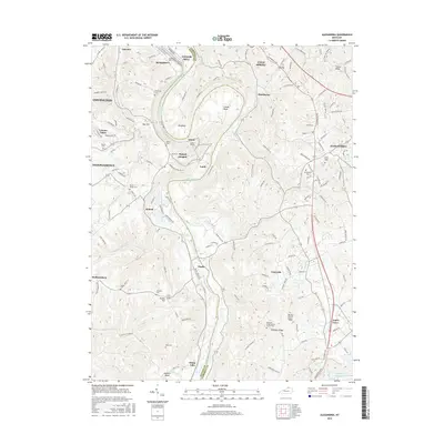
 1929 Alexandria1929 Print · USGSNorthern Kentucky and the Ohio River border appear here in the late twenties as a bustling landscape of ridge-top farms and river-valley rail towns. Genealogists can trace family roots through numerous local landmarks like Oak Island Ch, Grants Lick, and the many rural schools such as Carthage Sch.
 - 1936 Map of Alexandria
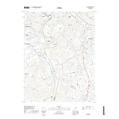
 1936 Alexandria1936 Print · USGSNorthern Kentucky and the Ohio River valley appear here in the mid-1930s, showing a landscape defined by sharp river bends and rural rail stops. Researchers can trace historic schools and parish centers like Sts Peter and Paul Sch, the winding Licking Valley Highway, and the riverside operations at Gubser Mill.2 unique versions available
 - 1952 Map of Newport, 1953 Print
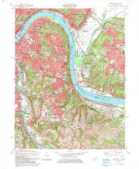
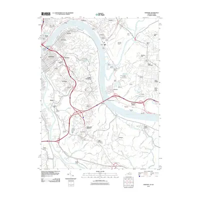
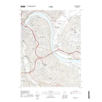
 1952 Newport1953 Print · USGSNorthern Kentucky during the early fifties shows a bustling riverfront and established hillside neighborhoods at the junction of two major rivers. Genealogists and historians can locate family landmarks like Evergreen Cemetery, Kenton Co Infirmary, and numerous schools including Bellevue High Sch.
 - 1953 Map of Alexandria, 1955 Print
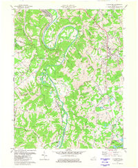
 1953 Alexandria1955 Print · USGSNorthern Kentucky in the early fifties shows a landscape of winding river valleys and hilltop communities. Researchers can trace the Louisville and Nashville rail line and locate landmarks like the Tenmile House, White Villa, and Claryville.
 - 1953 Map of Cincinnati, 1965 Print
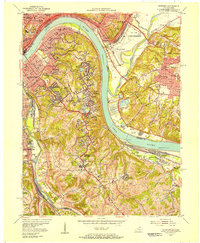
 1953 Cincinnati1965 Print · USGSThe Ohio River valley and the industrial heartland of Indiana and Ohio are captured here during the mid-century peak of rail and river commerce. Genealogists and historians can trace connections between Cincinnati and outlying military sites like Camp Atterbury and Bakalar AFB.3 unique versions available
 - 1955 Map of Newport, 1957 Print
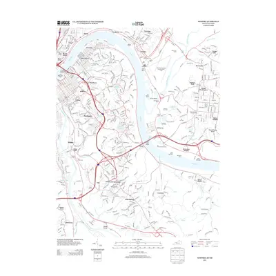
 1955 Newport1957 Print · USGSThe riverfront communities of Northern Kentucky and Southern Ohio are captured here in the mid-fifties as urban density expands into the surrounding hills. Genealogists and historians can trace institutional landmarks like Evergreen Cemetery, Lunken Airport, and the St Anne Convent.
 - 1956 Map of Louisville, 1971 Print
 1956 Louisville1971 Print · USGSThe Ohio River valley and the Kentucky Bluegrass are captured here during a period of rapid mid-century growth and industrial activity. Genealogists and historians can trace rail-centered towns and military land use at Fort Knox and the Jefferson Proving Ground.2 unique versions available
 - 1957 Map of Cincinnati
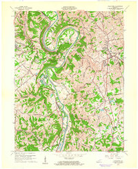
 1957 Cincinnati1957 Print · USGSThe Ohio River valley and its surrounding highlands thrived during the mid-fifties industrial peak, centered on the bustling Cincinnati and Dayton metropolitan hubs. Researchers can trace the extensive rail networks and military sites like Wright-Patterson AFB and Camp Atterbury.
 - 1961 Map of Alexandria, 1962 Print
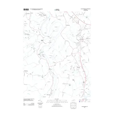
 1961 Alexandria1962 Print · USGSNorthern Kentucky in the early sixties remains a landscape of river-bend farms and ridge-line communities along the Kenton and Campbell county line. Genealogists and hikers can trace old family roads and landmark sites like Pleasant Ridge Ch, Grants Bend, and the Louisville and Nashville rail line.2 unique versions available
 - 1961 Map of Newport, 1963 Print
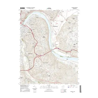
 1961 Newport1963 Print · USGSGreater Cincinnati and Northern Kentucky were entering a period of suburban maturation in the early sixties as riverfront industry met rising hilltop neighborhoods. Researchers can trace local landmarks like Coney Island Amusement Park, Evergreen Cemetery, and the VA Hospital at Fort Thomas.3 unique versions available
 - 1964 Map of Louisville
 1964 Louisville1964 Print · USGSThe Ohio River valley and Kentucky Bluegrass are captured in the mid-1960s, showing a region balanced between industrial growth and its agrarian roots. Genealogists and historians can trace the development of county seats like Shelbyville and Paris, or locate established institutions such as Georgetown College and Bernheim Forest.
 - 1981 Map of Alexandria, 1982 Print
 1981 Alexandria1982 Print · USGSIn the early eighties, this Campbell County corridor shows the winding Licking River and its rural settlements. Genealogists can trace landmarks like St Matthew Ch, Aspen Grove, and the Louisville and Nashville rail line.2 unique versions available
 - 1983 Map of Newport, 1984 Print
 1983 Newport1984 Print · USGSGreater Cincinnati and Northern Kentucky come alive in this early 1980s survey of the riverfront and its surrounding hilltops. Genealogists and local historians can map out long-standing landmarks like Evergreen Cemetery, CINCINNATI MUNICIPAL AIRPORT (LUNKEN FIELD), and the St Ursula Convent and Academy.2 unique versions available
 - 1986 Map of Cincinnati
 1986 Cincinnati1986 Print · USGSGreater Cincinnati and its tri-state surrounds are captured here in the mid-eighties as suburban growth reached into the neighboring hills and river valleys. Researchers can trace the development of transit hubs like Greater Cincinnati International Airport and historic sites such as Spring Grove Cemetery.3 unique versions available
 - 1986 Map of Falmouth
 1986 Falmouth1986 Print · USGSNorthern Kentucky and the Ohio River valley are shown here in the mid-1980s, highlighting the region's complex river-and-rail geography. Genealogists and researchers can trace the roads connecting Big Bone Lick, Zion Church, and river towns like Falmouth and Augusta.2 unique versions available
 - 2010 Map of Alexandria, 2010 Print
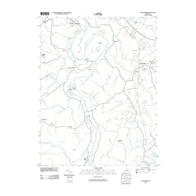 2010 Alexandria2010 Print · USGSCovers Fairview, including Covington, Independence, and other nearby areas
 - 2010 Map of Newport, 2010 Print
 2010 Newport2010 Print · USGSCovers Fairview, including Cincinnati, Covington, and other nearby areas
 - 2013 Map of Alexandria, 2013 Print
 2013 Alexandria2013 Print · USGSCovers Fairview, including Covington, Independence, and other nearby areas
 - 2013 Map of Newport, 2013 Print
 2013 Newport2013 Print · USGSCovers Fairview, including Cincinnati, Covington, and other nearby areas
 - 2016 Map of Newport, 2016 Print
 2016 Newport2016 Print · USGSCovers Fairview, including Cincinnati, Covington, and other nearby areas
 - 2016 Map of Alexandria, 2016 Print
 2016 Alexandria2016 Print · USGSCovers Fairview, including Covington, Independence, and other nearby areas
 - 2019 Map of Alexandria, 2019 Print
 2019 Alexandria2019 Print · USGSCovers Fairview, including Covington, Independence, and other nearby areas
 - 2019 Map of Newport, 2019 Print
 2019 Newport2019 Print · USGSCovers Fairview, including Cincinnati, Covington, and other nearby areas
Showing maps 1-25 of 27
Top cities near Fairview
- Cincinnati historical maps
- Covington historical maps
- Florence historical maps
- Independence historical maps
- Norwood historical maps
- Erlanger historical maps
See more
Frequently asked questions
- What are the different types of historical maps available for Fairview?
- What is the oldest map of Fairview?
- Where can I purchase historical maps of Fairview for my home or office?
- Where can I download high-res historical maps of Fairview?
- Are there historical topographic maps available for Fairview?
- Is there historical aerial imagery available for Fairview?
- Where are historical maps of Fairview sourced from?