2020s Maps of Knott County, Kentucky
Explore 15 historic maps of Knott County from the 2020s. These maps offer a rare glimpse into what life looked like during the 2020s — showing old roads, neighborhoods, homes, and landmarks that have changed or disappeared over time.
Whether you're researching your family's past, planning a metal detecting trip, or studying how Knott County's landscape evolved across the 2020s, these high-resolution maps are a powerful tool for exploring the history of this region.
- Focus on a specific era: All maps on this page are from the 2020s, giving you a focused view of this time period.
- See what’s changed: Compare century-old streets, trails, and buildings to today's modern landscape using overlays and satellite layers.
- Research with precision: Use these maps for genealogy, historical research, land use analysis, or educational projects.
- View, download, or print: Maps are fully viewable online in high resolution, and can be downloaded or printed for your own records.
Start exploring Knott County's history through authentic maps from the 2020s. This is your window into the past.
Knott County, KY maps
(15)- 2022 Map of David, 2022 Print
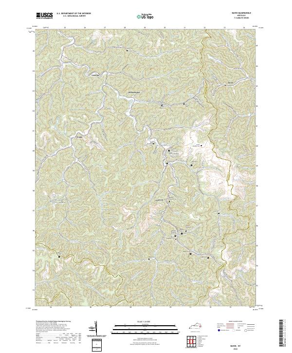 2022 David2022 Print · USGSMagoffin County in the early 2020s remains a landscape of deep hollows and family-centric settlements. Genealogists can trace decades of local history through dozens of family burial sites like John B Shepard Cem, Wireman Cem, and Bailey Cem.
 - 2022 Map of Hindman, 2022 Print
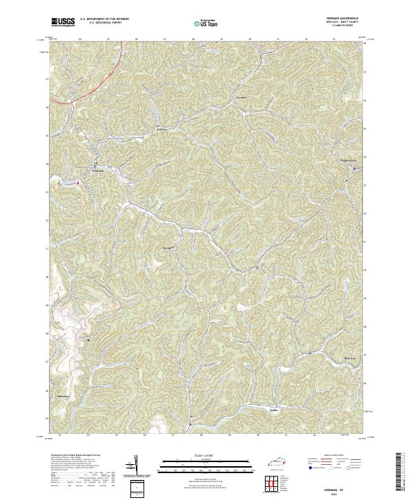 2022 Hindman2022 Print · USGSKnott County's narrow valleys and steep ridges are shown in high detail at the start of the 2020s. Genealogists and local historians can trace family-named landmarks like Madden Cem or follow the roads connecting Hindman, Pippa Passes, and Brinkley.
 - 2022 Map of Wayland, 2022 Print
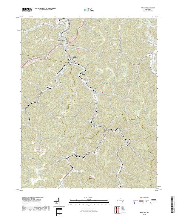 2022 Wayland2022 Print · USGSThe mountain valleys of Floyd and Knott Counties are detailed here in this contemporary topographic survey. Researchers can trace family history through numerous labeled burial sites like Triplett Conley Cem and Gibson Cem or explore settlements such as Wayland and Garrett.
 - 2022 Map of Mayking, 2022 Print
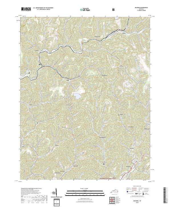 2022 Mayking2022 Print · USGSDeep in the Kentucky mountains, this modern survey shows the intricate settlement patterns of the 2020s. Genealogists can trace family sites like Melvin Adams Cem or find the community of Pistol City near the Sandlick Gap.
 - 2022 Map of Blackey, 2022 Print
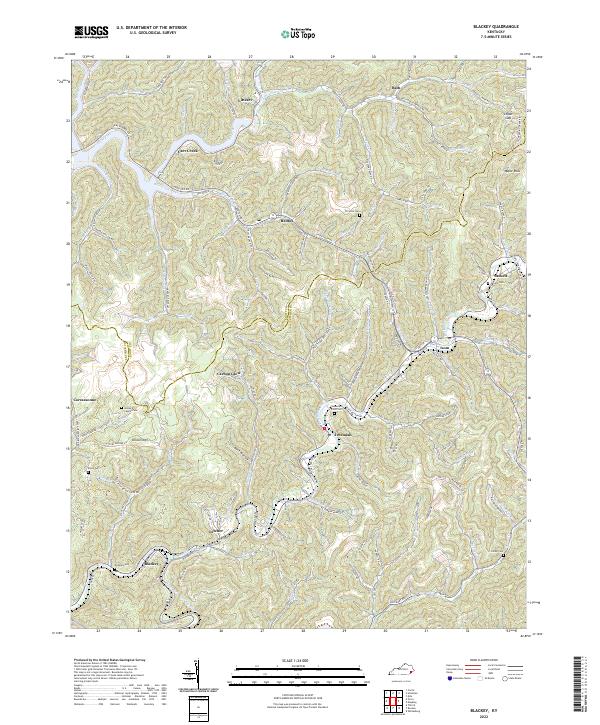 2022 Blackey2022 Print · USGSThe coal country of Knott and Letcher counties is captured here in the early twenty-first century, showing the enduring hollows of the Cumberland Plateau. Researchers can trace family roots at the James D Caudill Cem, Horse Mill Point Cem, or in communities like Carbon Glow.
 - 2022 Map of Wheelwright, 2022 Print
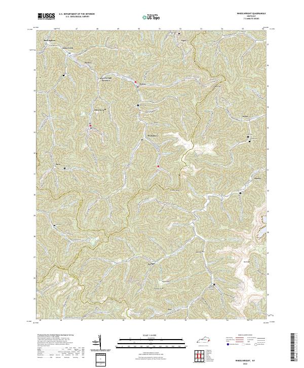 2022 Wheelwright2022 Print · USGSThe coal country of the Cumberland Plateau is mapped here in detail during the early 2020s. Researchers can trace family homesteads and burial sites like Tackett Cem near Melvin or locate the historic street plans of Wheelwright and Weeksbury.
 - 2022 Map of Handshoe, 2022 Print
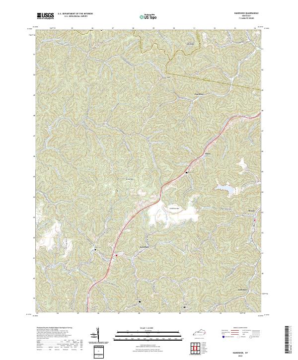 2022 Handshoe2022 Print · USGSKnott County's narrow hollows and high ridges are shown in detail as they appeared in 2022. Researchers can trace family history through locations like Soft Shell, Handshoe, and several small mountain burial sites such as Bolen Cem and Click Cem.
 - 2022 Map of Kite, 2022 Print
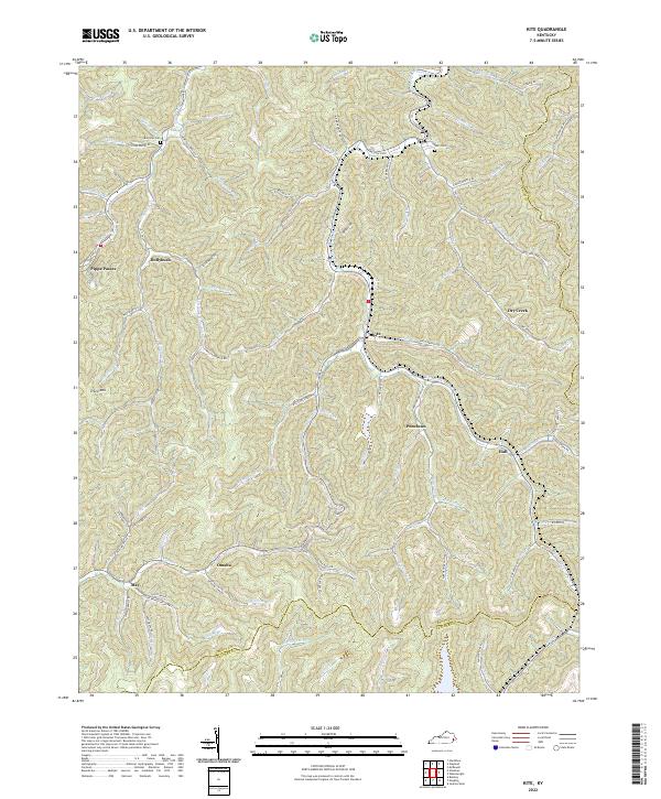 2022 Kite2022 Print · USGSKnott County in the early 2020s remains a landscape defined by the deep hollows of the Cumberland Plateau. Researchers can trace remote family cemeteries like Bald Hill Cem and historic creek-side settlements including Pippa Passes, Kite, and Puncheon.
 - 2022 Map of Hazard South, 2022 Print
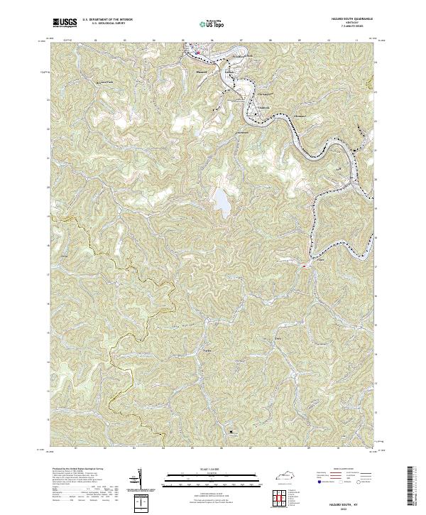 2022 Hazard South2022 Print · USGSPerry County's coal country is on full display in the early 2020s, centered on the river-bend city of Hazard. Genealogists can trace family landmarks like Englewood Cem or locate homesites in Stillhouse Hollow and along the L & N RR corridor near Viper.
 - 2022 Map of Carrie, 2022 Print
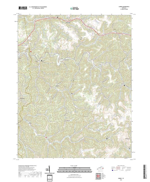 2022 Carrie2022 Print · USGSIn the heart of the Kentucky mountains, this recent survey shows the deep-hollow settlements and high ridge gaps of Knott and Perry counties. Researchers can trace family history through numerous landmarks like the Clear Creek Cem, Fisty, and the Big Branch Church Cem.
 - 2022 Map of Tiptop, 2022 Print
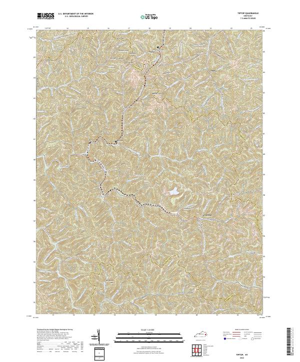 2022 Tiptop2022 Print · USGSThe headwaters of the Kentucky and Licking rivers meet at the borders of Breathitt and Magoffin counties in the early 2020s. Genealogists can locate family sites like the Benton Mann Cem and John Bailey Cem near the mountain community of Evanston.
 - 2022 Map of Hazard North, 2022 Print
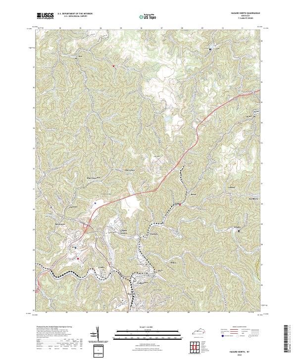 2022 Hazard North2022 Print · USGSThe North Fork Kentucky River valley comes alive in this contemporary study of the coal country around Hazard. Trace local family history and rail routes through Blue Diamond, Hardburly, and the Nobel Cockrell Cemetery.
 - 2022 Map of Noble, 2022 Print
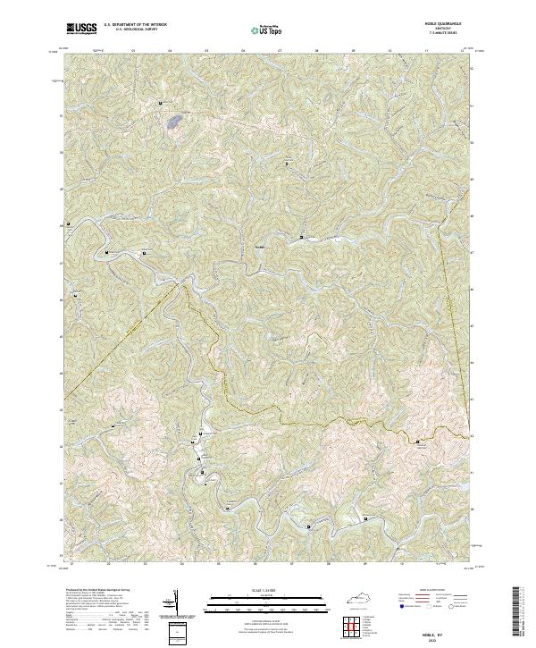 2022 Noble2022 Print · USGSBreathitt County in the early 2020s remains a landscape of deep hollows and family-held ridges centered on the settlement of Noble. Genealogists and local historians can trace legacy burial grounds like Napier Cemeteries and Haddix Cem or follow the path of Troublesome Creek.
 - 2022 Map of Vicco, 2022 Print
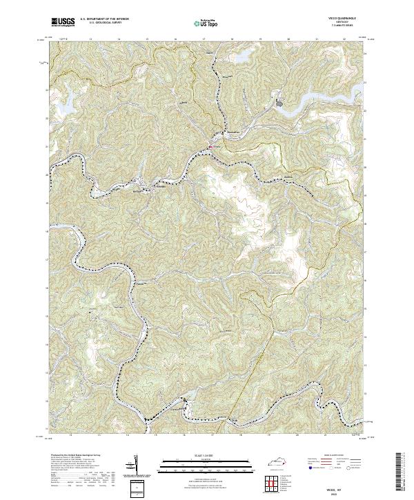 2022 Vicco2022 Print · USGSAppalachian coal country in the early 2020s shows a dense network of valley settlements and family landmarks. Trace local roots at Cornett Hill Cem or explore the river-and-rail geography of Vicco, Cornettsville, and Sassafras.
 - 2022 Map of Vest, 2022 Print
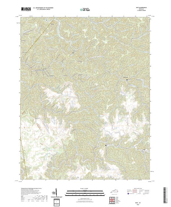 2022 Vest2022 Print · USGSTracing the creek valleys of Knott and Breathitt counties in 2022, this map shows a landscape shaped by water and tradition. Genealogists can locate family landmarks such as Compton Cem and the communities of Decoy and Elmrock along the winding hollows.
End of results
Showing maps 1-15 of 15
Top cities of Knott County
Frequently asked questions
- What are the different types of historical maps available for Knott County?
- What is the oldest map of Knott County?
- Where can I purchase historical maps of Knott County for my home or office?
- Where can I download high-res historical maps of Knott County?
- Are there historical topographic maps available for Knott County?
- Is there historical aerial imagery available for Knott County?
- Where are historical maps of Knott County sourced from?