Old Maps of Knott County, Kentucky for Academic Research
Study the evolution of Knott County with 129 high-resolution historic maps. Whether you're teaching, researching, or modeling changes in land use, these maps provide essential visual documentation of urban, environmental, and geographic change.
- Analyze long-term change: Track patterns in development, transportation, and natural features.
- Ideal for environmental or urban studies: Support academic projects with primary historical map data.
- Use in the classroom or lab: Educators and researchers rely on these maps to bring historical context to life.
These maps are a powerful tool for teaching, research, and visualizing how Knott County has changed over the decades.
Knott County, KY maps
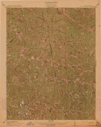
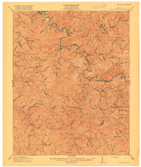
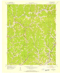
(129)- 1886 Map of Prestonsburg
 1886 Prestonsburg1886 Print · USGSEastern Kentucky's river-and-rail economy is captured here in the late nineteenth century as steam power reached deep into the mountains. Genealogists can trace family homesteads near Prestonburgh, Paintsville, and early settlements like Peach Orchard or Boon's Camp.
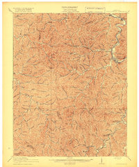
 - 1889 Map of Salyersville, 1949 Print
 1889 Salyersville1949 Print · USGSEastern Kentucky at the close of the nineteenth century reveals a complex landscape of river-valley settlements and highland hollows. Genealogists can trace early homesteads and communities like Salyersville, Hazel Green, and Jackson along the winding Licking River and Quicksand Creek.
 - 1890 Map of Whitesburg
 1890 Whitesburg1890 Print · USGSThe Cumberland Plateau in the 1880s is a world of deep hollows and isolated mountain settlements. Genealogists can trace family roots in early communities like Whitesburgh and Pikeville or locate crossings at Pound Gap and Shelby Gap.
 - 1891 Map of Hazard
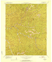
 1891 Hazard1891 Print · USGSEastern Kentucky's coal country is shown here in the late nineteenth century, focusing on the river-fed valleys of the Cumberland Plateau. Researchers can trace the early layouts of Hazard and Hyden or locate family homesteads near Crockettsville and Dwarf.5 unique versions available
 - 1891 Map of Salyersville
 1891 Salyersville1891 Print · USGSEastern Kentucky's rugged plateau is captured in the late nineteenth century as small river towns and remote hollows defined the region. Genealogists can trace family roots through mountain settlements like Salyersville, Hazel Green, and Maytown along the Licking River.2 unique versions available
 - 1892 Map of Whitesburg
 1892 Whitesburg1892 Print · USGSEastern Kentucky and the Virginia borderlands appear here in the late nineteenth century as a landscape of isolated mountain hollows. Genealogists and historians can trace early family settlements along Kingdom Come Creek, Beef Hide, and the strategic passage at Pound Gap.4 unique versions available
 - 1892 Map of Prestonsburg
 1892 Prestonsburg1892 Print · USGSEastern Kentucky is shown in the late nineteenth century as a landscape of river-centered trade and early mountain settlement. Genealogists and historians can trace family-named locations like Laynesville, Oil Spring, and the post office at Eden (Inez P.O.).4 unique versions available
 - 1899 Map of Salyersville
 1899 Salyersville1899 Print · USGSEastern Kentucky's mountain communities were well-established along the winding river forks at the turn of the century. Genealogists and local historians can trace family-named landmarks and old settlements like Hazel Green, Ezel, and West Liberty along the Licking River.4 unique versions available
 - 1912 Map of Hindman
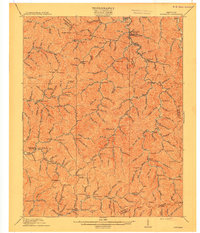
 1912 Hindman1912 Print · USGSThe Kentucky hills around Hindman appear in remarkable detail during the early twentieth century, showing a landscape defined by isolated hollows. Genealogists can trace early homesteads and communities like Elmrock, Kite, and Democrat, as well as numerous numbered schoolhouses along Troublesome Creek.
 - 1913 Map of Oven Fork
 1913 Oven Fork1913 Print · USGSLetcher County's steep ridges and narrow hollows are shown here in the early twentieth century, just as the Lexington and Eastern Ry arrived. Genealogists can trace family settlements from Whitesburg to Blackey, and locate early schools and landmarks like Campbranch Chapel or Pound Gap.
 - 1914 Map of Vergie
 1914 Vergie1914 Print · USGSPike County's coal hollows and creek-side settlements are captured here during the rail-driven expansion of the early twentieth century. Genealogists can locate family homesites near numerous numbered schoolhouses, the Sandy Valley & Elkhorn RR, and early post offices at Virgie and McDowell.
 - 1914 Map of Troublesome
 1914 Troublesome1914 Print · USGSEastern Kentucky's mountain hollows and ridge-top boundaries are captured here during the early 20th century. Genealogists and historians can trace numerous rural educational sites like Balls Fork School and Caney School, or locate small settlements such as Buckhorn and Dwarf.3 unique versions available
 - 1915 Map of Prestonsburg
 1915 Prestonsburg1915 Print · USGSEastern Kentucky's coal and rail landscape is meticulously detailed in the years before the Great War. Genealogists and historians can trace families across Big Lick School, the Cliff Mine, and early post offices like Maytown Langley PO.2 unique versions available
 - 1915 Map of Hindman
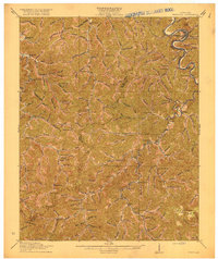
 1915 Hindman1915 Print · USGSEastern Kentucky's high ridges and deep hollows are captured here during the mid-1910s, showing a landscape defined by isolated farmsteads and rural school districts. Genealogists can trace family footprints near Hindman or locate small settlements like Handshoe, Iris, and the WC TU School.4 unique versions available
 - 1915 Map of Whitesburg
 1915 Whitesburg1915 Print · USGSLetcher County at the start of the twentieth century shows a landscape of deep hollows and growing rail towns. Genealogists can trace family roots through numerous numbered schoolhouses and settlements like Whitesburg, Blackey, and Indian Bottom.4 unique versions available
 - 1916 Map of Pikeville
 1916 Pikeville1916 Print · USGSEastern Kentucky's coal and river country comes into focus in the mid-1910s as the railroad moves deep into the hollows. Genealogists and local historians can locate early family-named landmarks and mountain communities like Weeksbury, Virgie, and James Chapel.5 unique versions available
 - 1916 Map of Cornettsville
 1916 Cornettsville1916 Print · USGSEastern Kentucky's coal and timber country comes alive in this survey of the North Fork Kentucky River valley during the mid-1910s. Genealogists can trace family footprints through numerous rural school sites like Redoak School and vanished river stops such as Dean Sta and Cornettsville.3 unique versions available
 - 1918 Map of Prestonsburg
 1918 Prestonsburg1918 Print · USGSEastern Kentucky's river-and-rail corridors are captured here just before the close of the Great War. Genealogists can trace family roots through hillside settlements and early postal stops like Maytown Langley PO, Ivyton, and Big Lick School.3 unique versions available
 - 1951 Map of Tiptop, 1952 Print
 1951 Tiptop1952 Print · USGSBreathitt and Magoffin counties are captured here in the early fifties, showcasing the intricate system of hollows and ridges that defined the coalfield economy. Genealogists can locate family landmarks like the John Bailey Cem and Decoy PO alongside the Chesapeake and Ohio rail line.4 unique versions available
 - 1954 Map of Noble, 1955 Print
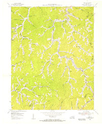
 1954 Noble1955 Print · USGSThe Kentucky coalfields of Breathitt and Perry counties are shown here in the mid-fifties, centered on the winding Troublesome Creek. Genealogists can trace family landmarks like Noble Gems and John Noble, or locate the Baptist Childrens Home.4 unique versions available
 - 1954 Map of Hindman, 1955 Print
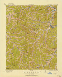
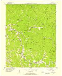
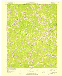 1954 Hindman1955 Print · USGSKnott County, Kentucky, is shown in the mid-1950s as a region of tight-knit hollow communities and mountain schools. Genealogists and local historians can trace family locations along Troublesome Creek and locate institutions like Caney Junior College or Delta Theta Tau Sch.2 unique versions available
 - 1954 Map of Vest, 1955 Print
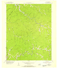 1954 Vest1955 Print · USGSKnott County's narrow valleys and ridge-top boundaries are captured here in the mid-fifties, showing the region's rural character before modern consolidation. Genealogists can locate family-named hollows like John Riley Br and local institutions such as Decoy Sch and Baker Sch.5 unique versions available
 - 1954 Map of Kite, 1956 Print
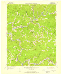
 1954 Kite1956 Print · USGSEastern Kentucky's narrow valleys and coal-country settlements are meticulously detailed here during the mid-1950s. Genealogists and historians can trace numerous remote mountain schools and family cemeteries, including Kite Sch, Hollybush Ch, and Hall Cem.3 unique versions available
 - 1954 Map of Vicco, 1956 Print
 1954 Vicco1956 Print · USGSThe coal and rail corridors of Perry and Knott counties are captured here in the mid-1950s. Researchers can trace family sites at the Open Door Childrens Home or locate early rural schools and churches like Logwood Sch and Little Dove Ch.4 unique versions available
 - 1954 Map of Mayking, 1956 Print
 1954 Mayking1956 Print · USGSThe mountain hollows of Letcher County are captured here in the mid-1950s, a period when coal company data helped map these steep-walled valleys. Genealogists can trace family names through landmarks like Camp Branch Chapel, Upper Colly Sch, and Sergent.3 unique versions available
Showing maps 1-25 of 129
Top cities of Knott County
Frequently asked questions
- What are the different types of historical maps available for Knott County?
- What is the oldest map of Knott County?
- Where can I purchase historical maps of Knott County for my home or office?
- Where can I download high-res historical maps of Knott County?
- Are there historical topographic maps available for Knott County?
- Is there historical aerial imagery available for Knott County?
- Where are historical maps of Knott County sourced from?