Old Maps of Larue County, Kentucky
Explore 102 old maps of Larue County, spanning from 1934 to today. These high-resolution historic maps reveal how streets, neighborhoods, landmarks, and natural features evolved over time — perfect for genealogy, metal detecting, research, and local history exploration.
What you can do with these maps:
- See how Larue County changed over time: Compare historical maps to modern-day views to trace roads, homesites, rail lines & more.
- View detailed metadata: Each map includes creators, publishers, year, scale, and archive source.
- Overlay maps with satellite & LiDAR: Visualize the past alongside modern tools to explore terrain & human change.
- Trusted historical sources: Maps sourced from the USGS, Library of Congress, and other archives.
- Access maps your way: View online, download high-res files, or order prints for personal or research use.
Start exploring old maps of Larue County to uncover forgotten places, hidden landmarks, and the deep history beneath your feet.
Larue County, KY maps
(102)- 1934 Map of Munfordville
 1934 Munfordville1934 Print · USGSHart County communities line the corridor of the Green River and the Nashville Road during the mid-1930s. Genealogists can trace family footprints through dozens of local landmarks like Poundstone Roller Mill, Big Springs Cem, and Priceville.
 - 1935 Map of Elizabethtown
 1935 Elizabethtown1935 Print · USGSElizabethtown and the surrounding Hardin County rural landscape are captured here in the mid-1930s. Researchers can trace family roots through a dense network of country schools and churches like Glendale Sch, St Ignatius Ch, and Bland Cem.
 - 1937 Map of Munfordville
 1937 Munfordville1937 Print · USGSThe Green River valley in the 1930s was a landscape of river fords and knob-country schools. Genealogists can trace family footprints across dozens of local sites like Falling Springs Ch, Big Springs Cem, and the old Rider Mill.
 - 1938 Map of Elizabethtown
 1938 Elizabethtown1938 Print · USGSHardin and Larue counties are shown here in the 1930s, captured at the height of the steam-rail era. Genealogists can trace family names through dozens of rural landmarks, from Mather Mill and Star Mills to St Ignatius Ch and the Childrens Home.3 unique versions available
 - 1949 Map of Sonora, 1952 Print
 1949 Sonora1952 Print · USGSCentral Kentucky's rural landscape comes alive in the late 1940s as the railroad connects small farm towns and mill sites. Genealogists can trace family names at St. Ignatius Ch, Little Zion Ch, or the small community at Star Mills.
 - 1949 Map of Tonieville, 1952 Print
 1949 Tonieville1952 Print · USGSLarue and Hardin counties appear here at the close of the 1940s, showing a rural landscape anchored by the Nolin River. Genealogists can trace family footprints through sites like Siberia Sch, St Anthonys Ch, and the settlement at Eagle Mills.
 - 1949 Map of Elizabethtown, 1952 Print
 1949 Elizabethtown1952 Print · USGSPost-war Hardin County is centered on the railroad junction at Elizabethtown as the regional economy transitioned into the late 1940s. Genealogists can locate family landmarks like Helm Cem, Chestnut Grove Sch, and Locust Grove Ch.
 - 1949 Map of Elizabethtown, 1959 Print
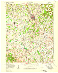 1949 Elizabethtown1959 Print · USGSHardin and LaRue Counties are captured here in the late Forties, showing a landscape defined by the intersection of major rail lines and rural community life. Genealogists can locate numerous country schools and churches, including Bethlehem Academy, St Johns Ch, and Glendale Sch.
 - 1953 Map of Howardstown, 1954 Print
 1953 Howardstown1954 Print · USGSSettlement along the Rolling Fork is captured here in the early fifties at the intersection of Nelson and Larue counties. Genealogists and local historians can locate rural landmarks like St Vincent de Paul Cem, Gleanings, and the Levelwood Sch.4 unique versions available
 - 1953 Map of Nelsonville, 1954 Print
 1953 Nelsonville1954 Print · USGSThe Nelsonville region at the junction of Larue, Nelson, and Hardin counties is captured here in the early fifties as a landscape of river-valley rails and ridge-top farms. Family historians can trace ancestral roots through sites like Spencer Sch, Salem Ch, and the Castleman Cem.2 unique versions available
 - 1953 Map of Saloma, 1954 Print
 1953 Saloma1954 Print · USGSTaylor and Marion counties are shown in the early fifties during a peak era for rural Kentucky schoolhouses and country churches. Genealogists can trace family footprints near Saloma, White Rose, and landmarks like Arvins Grove Sch or St Matthews Cem.
 - 1953 Map of Hibernia, 1954 Print
 1953 Hibernia1954 Print · USGSThe rural uplands of Taylor and Green Counties are documented here in the early fifties, centering on the community of Hibernia. Family researchers can locate numerous local landmarks including Morning Star Sch, Liberty Ch, and the Webster Cem.
 - 1953 Map of New Haven, 1954 Print
 1953 New Haven1954 Print · USGSNelson County's knob country is captured here in the early 1950s, centered on the historic Abbey of Our Lady of Gethsemani. Genealogists can trace family names at Beeler-Vittitow Cem or follow the LOUISVILLE AND NASHVILLE rail line through New Haven and New Hope.4 unique versions available
 - 1953 Map of Magnolia, 1955 Print
 1953 Magnolia1955 Print · USGSLarue and Hart counties are captured here in the early 1950s, showing a landscape defined by the South Fork Nolin River and rural ridge-top life. Researchers can trace family roots through landmarks like Aetna Furnace, Holly Grove Cem, and the community around Magnolia.
 - 1953 Map of Hodgenville, 1955 Print
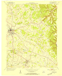 1953 Hodgenville1955 Print · USGSHodgenville and the surrounding Larue County countryside are captured here in the early fifties, centered on the Nolin River and the Illinois Central line. Researchers can locate the Abraham Lincoln Boyhood Home and family landmarks like Red Hill Cem and South Fork Ch.3 unique versions available
 - 1953 Map of Raywick, 1955 Print
 1953 Raywick1955 Print · USGSMarion County in the early fifties is captured here as a landscape of river-bottom farms and rural church communities. Genealogists can trace family roots through the St Francis Xavier Cem, the settlement of Raywick, and Highview Sch.3 unique versions available
 - 1954 Map of Upton, 1955 Print
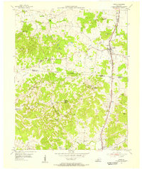 1954 Upton1955 Print · USGSCentered on the Hardin and Hart county line in the mid-fifties, this area shows a landscape of rail-linked towns and karst springs. Researchers can trace family history through sites like Lucas Grove Ch, Upton Cem, and the old mill at Riders Mill.
 - 1954 Map of Hammonville, 1955 Print
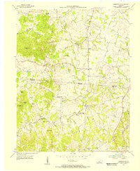 1954 Hammonville1955 Print · USGSThe borderlands of Larue and Hart Counties come into focus during the mid-fifties, capturing a landscape of family farms and rural missions. Researchers can trace ancestral roots at Pleasant Valley Cem, Hodge Cem, and the hilltop Oak Hill Mission.3 unique versions available
 - 1957 Map of Winchester, 1968 Print
 1957 Winchester1968 Print · USGSCentral Kentucky's landscape in the mid-twentieth century features the sprawling Fort Knox and the early parkway system. Genealogists and historians can trace rail lines like the Southern Railway and find landmarks from Bernheim Forest to Pilot Knob.3 unique versions available
 - 1960 Map of Winchester
 1960 Winchester1960 Print · USGSCentral Kentucky's diverse landscape is shown here at mid-century, from the bluegrass plains to the rugged Pottsville Escarpment. Genealogists and historians can trace the rail-and-river network connecting towns like Bardstown and Stanford alongside landmarks like Lake Cumberland.
 - 1960 Map of Tonieville, 1962 Print
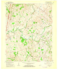 1960 Tonieville1962 Print · USGSLarue and Hardin counties appear in the early sixties as a network of river-powered mills and rail-side junctions. You can trace the family history and industry of the Nolin River valley through Eagle Mills, Mathers Mill, and the Barren Run Cems.2 unique versions available
 - 1960 Map of Elizabethtown, 1962 Print
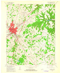 1960 Elizabethtown1962 Print · USGSElizabethtown and the surrounding Hardin County countryside are captured here in the early sixties as the toll road era begins. Researchers can trace family roots at Helm Cem and Browns Cem or locate old schoolhouses like Lincoln Trail Sch.2 unique versions available
 - 1961 Map of Hibernia, 1962 Print
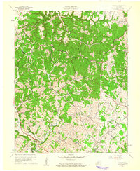 1961 Hibernia1962 Print · USGSTaylor and Green Counties show a landscape of winding creek valleys and hilltop settlements during the early sixties. Genealogists can trace family landmarks like Taylor Chapel, Beams Cem, and the cluster of Oil Wells near the village of Mac.2 unique versions available
 - 1961 Map of Sonora, 1962 Print
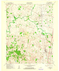 1961 Sonora1962 Print · USGSHardin and LaRue counties appear here during the early sixties, centered on the vital transportation corridor of the Louisville and Nashville railroad. Genealogists can trace local roots through landmarks like Glen Dale Childrens Home, St Ignatius Ch, and Bland Cem.
 - 1961 Map of Magnolia, 1963 Print
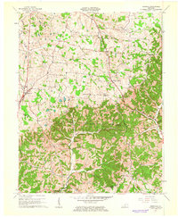 1961 Magnolia1963 Print · USGSMagnolia and Mount Sherman are shown here in the early 1960s as the local landscape integrated industrial gas storage into its rural character. Researchers can locate family landmarks like Russell Cem and historic community hubs such as Aetna Furnace or Benningfield Chapel.2 unique versions available
Showing maps 1-25 of 102
Top cities of Larue County
Frequently asked questions
- What are the different types of historical maps available for Larue County?
- What is the oldest map of Larue County?
- Where can I purchase historical maps of Larue County for my home or office?
- Where can I download high-res historical maps of Larue County?
- Are there historical topographic maps available for Larue County?
- Is there historical aerial imagery available for Larue County?
- Where are historical maps of Larue County sourced from?