1950s Maps of Larue County, Kentucky
Explore 11 historic maps of Larue County from the 1950s. These maps offer a rare glimpse into what life looked like during the 1950s — showing old roads, neighborhoods, homes, and landmarks that have changed or disappeared over time.
Whether you're researching your family's past, planning a metal detecting trip, or studying how Larue County's landscape evolved across the 1950s, these high-resolution maps are a powerful tool for exploring the history of this region.
- Focus on a specific era: All maps on this page are from the 1950s, giving you a focused view of this time period.
- See what’s changed: Compare century-old streets, trails, and buildings to today's modern landscape using overlays and satellite layers.
- Research with precision: Use these maps for genealogy, historical research, land use analysis, or educational projects.
- View, download, or print: Maps are fully viewable online in high resolution, and can be downloaded or printed for your own records.
Start exploring Larue County's history through authentic maps from the 1950s. This is your window into the past.
Larue County, KY maps
(11)- 1953 Map of Howardstown, 1954 Print
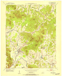
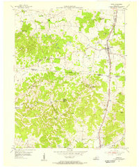
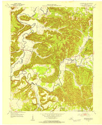 1953 Howardstown1954 Print · USGSSettlement along the Rolling Fork is captured here in the early fifties at the intersection of Nelson and Larue counties. Genealogists and local historians can locate rural landmarks like St Vincent de Paul Cem, Gleanings, and the Levelwood Sch.4 unique versions available
 - 1953 Map of Nelsonville, 1954 Print
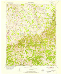
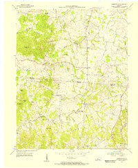
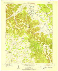 1953 Nelsonville1954 Print · USGSThe Nelsonville region at the junction of Larue, Nelson, and Hardin counties is captured here in the early fifties as a landscape of river-valley rails and ridge-top farms. Family historians can trace ancestral roots through sites like Spencer Sch, Salem Ch, and the Castleman Cem.2 unique versions available
 - 1953 Map of Saloma, 1954 Print
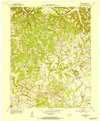 1953 Saloma1954 Print · USGSTaylor and Marion counties are shown in the early fifties during a peak era for rural Kentucky schoolhouses and country churches. Genealogists can trace family footprints near Saloma, White Rose, and landmarks like Arvins Grove Sch or St Matthews Cem.
 - 1953 Map of Hibernia, 1954 Print
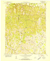 1953 Hibernia1954 Print · USGSThe rural uplands of Taylor and Green Counties are documented here in the early fifties, centering on the community of Hibernia. Family researchers can locate numerous local landmarks including Morning Star Sch, Liberty Ch, and the Webster Cem.
 - 1953 Map of New Haven, 1954 Print
 1953 New Haven1954 Print · USGSNelson County's knob country is captured here in the early 1950s, centered on the historic Abbey of Our Lady of Gethsemani. Genealogists can trace family names at Beeler-Vittitow Cem or follow the LOUISVILLE AND NASHVILLE rail line through New Haven and New Hope.4 unique versions available
 - 1953 Map of Magnolia, 1955 Print
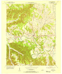
 1953 Magnolia1955 Print · USGSLarue and Hart counties are captured here in the early 1950s, showing a landscape defined by the South Fork Nolin River and rural ridge-top life. Researchers can trace family roots through landmarks like Aetna Furnace, Holly Grove Cem, and the community around Magnolia.
 - 1953 Map of Hodgenville, 1955 Print
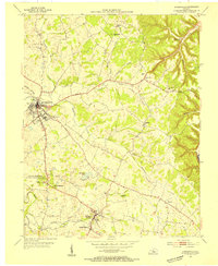 1953 Hodgenville1955 Print · USGSHodgenville and the surrounding Larue County countryside are captured here in the early fifties, centered on the Nolin River and the Illinois Central line. Researchers can locate the Abraham Lincoln Boyhood Home and family landmarks like Red Hill Cem and South Fork Ch.3 unique versions available
 - 1953 Map of Raywick, 1955 Print
 1953 Raywick1955 Print · USGSMarion County in the early fifties is captured here as a landscape of river-bottom farms and rural church communities. Genealogists can trace family roots through the St Francis Xavier Cem, the settlement of Raywick, and Highview Sch.3 unique versions available
 - 1954 Map of Upton, 1955 Print
 1954 Upton1955 Print · USGSCentered on the Hardin and Hart county line in the mid-fifties, this area shows a landscape of rail-linked towns and karst springs. Researchers can trace family history through sites like Lucas Grove Ch, Upton Cem, and the old mill at Riders Mill.
 - 1954 Map of Hammonville, 1955 Print
 1954 Hammonville1955 Print · USGSThe borderlands of Larue and Hart Counties come into focus during the mid-fifties, capturing a landscape of family farms and rural missions. Researchers can trace ancestral roots at Pleasant Valley Cem, Hodge Cem, and the hilltop Oak Hill Mission.3 unique versions available
 - 1957 Map of Winchester, 1968 Print
 1957 Winchester1968 Print · USGSCentral Kentucky's landscape in the mid-twentieth century features the sprawling Fort Knox and the early parkway system. Genealogists and historians can trace rail lines like the Southern Railway and find landmarks from Bernheim Forest to Pilot Knob.3 unique versions available
End of results
Showing maps 1-11 of 11
Top cities of Larue County
Frequently asked questions
- What are the different types of historical maps available for Larue County?
- What is the oldest map of Larue County?
- Where can I purchase historical maps of Larue County for my home or office?
- Where can I download high-res historical maps of Larue County?
- Are there historical topographic maps available for Larue County?
- Is there historical aerial imagery available for Larue County?
- Where are historical maps of Larue County sourced from?