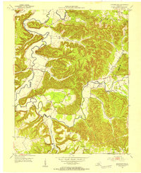
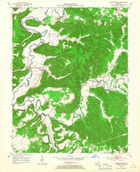
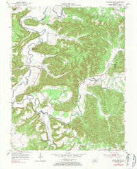
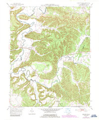
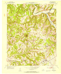
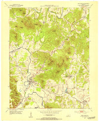
1953 Map of Howardstown
USGS Topo · Published 1954About this map
The Rolling Fork carves a winding path through the borderlands of Nelson and Larue counties, defining a landscape of sharp ridges and deep hollows. In the early 1950s, the settlement of Howardstown serves as a local hub near Newton Point, while smaller communities like Gleanings and Stiles anchor the surrounding rural landscape. This terrain is marked by notable high points such as Mt Pisgah and the narrow ridge of Devils Backbone, with numerous cemeteries and churches indicating established family roots in the region.
Find a feature on this map
42 named features on this map. Tap any name to fly to it.
Don’t see what you’re looking for? This feature index may not catch every label — zoom into the map to look around manually.
Map Details
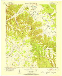
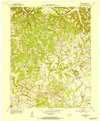
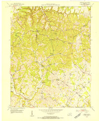
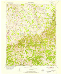
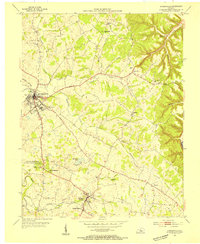
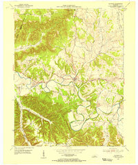
Editions of this 1953 Howardstown Map
4 editions found
Other maps of this area
1953 · Loretto
USGS Topo · 1:24,000
1953 · Nelsonville
USGS Topo · 1:24,000
1953 · Saloma
USGS Topo · 1:24,000
1953 · Hibernia
USGS Topo · 1:24,000
1953 · New Haven
USGS Topo · 1:24,000
1953 · Magnolia
USGS Topo · 1:24,000
1953 · Hodgenville
USGS Topo · 1:24,000
1953 · Raywick
USGS Topo · 1:24,000

1957 · Winchester
USGS Topo · 1:250,000

1960 · Winchester
USGS Topo · 1:250,000