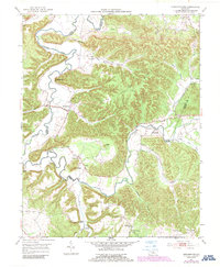
1953 Map of Howardstown
USGS Topo · Published 1987About this map
Rolling Fork carves a winding path through the borderlands of Nelson, LaRue, and Marion counties, defining a landscape of narrow hollows and prominent ridges. Settlement patterns in the early 1950s follow the river and its tributaries, with Howardstown serving as a primary hub. The map captures a rural Kentucky society organized around local institutions like Beech Grove Ch, Mt Pisgah, and the Levelwood Sch.
Find a feature on this map
37 named features on this map. Tap any name to fly to it.
Don’t see what you’re looking for? This feature index may not catch every label — zoom into the map to look around manually.
Map Details
Editions of this 1953 Howardstown Map
4 editions found
Other maps of this area

1953 · Howardstown
USGS Topo · 1:24,000

1953 · Loretto
USGS Topo · 1:24,000

1953 · Nelsonville
USGS Topo · 1:24,000

1953 · Saloma
USGS Topo · 1:24,000

1953 · Hibernia
USGS Topo · 1:24,000

1953 · New Haven
USGS Topo · 1:24,000

1953 · Magnolia
USGS Topo · 1:24,000
1953 · Hodgenville
USGS Topo · 1:24,000

1953 · Raywick
USGS Topo · 1:24,000

1957 · Winchester
USGS Topo · 1:250,000