
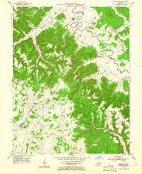
1953 Map of Nelsonville
USGS Topo · Published 1954About this map
Nelsonville and the winding course of the Rolling Fork anchor this 1953 landscape where Nelson, Hardin, and Larue counties converge. The rugged topography is defined by prominent ridges like Cecil Ridge and Farmers Ridge, which separate a dense network of hollows including Pearl Hollow and Fatty Hollow. The Louisville and Nashville railroad corridor traces the northern river valley, providing a vital link for these rural communities during the mid-century era.
Find a feature on this map
49 named features on this map. Tap any name to fly to it.
Don’t see what you’re looking for? This feature index may not catch every label — zoom into the map to look around manually.
Map Details
Editions of this 1953 Nelsonville Map
2 editions found
Other maps of this area

1935 · Elizabethtown
USGS Topo · 1:48,000

1936 · Vine Grove
USGS Topo · 1:62,500

1938 · Elizabethtown
USGS Topo · 1:62,500

1943 · Vine Grove
USGS Topo · 1:62,500

1946 · Colesburg
USGS Topo · 1:24,000

1946 · Vine Grove
USGS Topo · 1:62,500

1949 · Cravens
USGS Topo · 1:24,000

1949 · Tonieville
USGS Topo · 1:24,000

1949 · Elizabethtown
USGS Topo · 1:24,000

1949 · Shepherdsville
USGS Topo · 1:62,500