2020s Maps of Hodgenville, Kentucky
Explore 2 historic maps of Hodgenville from the 2020s. These maps offer a rare glimpse into what life looked like during the 2020s — showing old roads, neighborhoods, homes, and landmarks that have changed or disappeared over time.
Whether you're researching your family's past, planning a metal detecting trip, or studying how Hodgenville's landscape evolved across the 2020s, these high-resolution maps are a powerful tool for exploring the history of this region.
- Focus on a specific era: All maps on this page are from the 2020s, giving you a focused view of this time period.
- See what’s changed: Compare century-old streets, trails, and buildings to today's modern landscape using overlays and satellite layers.
- Research with precision: Use these maps for genealogy, historical research, land use analysis, or educational projects.
- View, download, or print: Maps are fully viewable online in high resolution, and can be downloaded or printed for your own records.
Start exploring Hodgenville's history through authentic maps from the 2020s. This is your window into the past.
Hodgenville, KY maps
(2)- 2022 Map of Hodgenville, 2022 Print
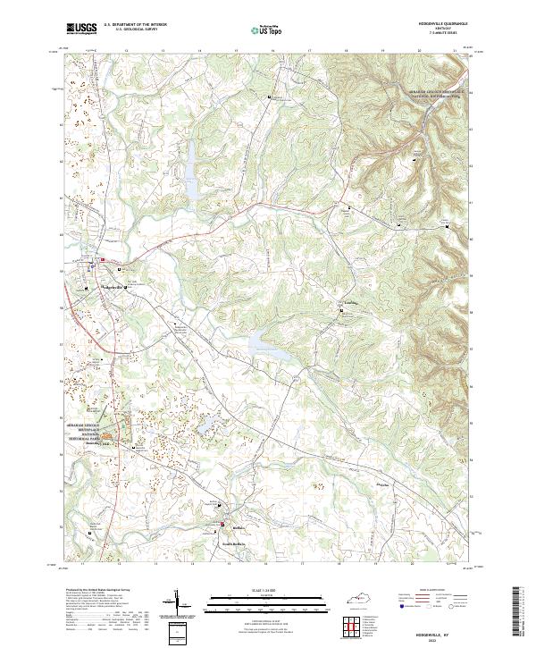 2022 Hodgenville2022 Print · USGSLarue County at the start of the 2020s remains a landscape defined by its deep ties to presidential history and rural tradition. Researchers can locate family burial sites like Saint Joachim Cem or trace the early settlement boundaries near Buffalo and the Abraham Lincoln Birthplace.
 - 2022 Map of Tonieville, 2022 Print
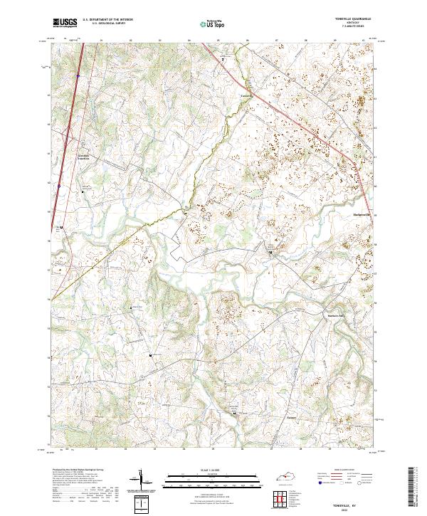 2022 Tonieville2022 Print · USGSLarue and Hardin County rural life is centered on the winding Nolin River and its tributaries in the early 2020s. Genealogists can trace numerous local burial sites including Siberia Cem, Williams Cem, and the historic Nolynn Baptist Church Cem.
End of results
Showing maps 1-2 of 2
Top cities near Hodgenville
- Elizabethtown historical maps
- Radcliff historical maps
- Vine Grove historical maps
- New Haven historical maps
- Bonnieville historical maps
- Sonora historical maps
Frequently asked questions
- What are the different types of historical maps available for Hodgenville?
- What is the oldest map of Hodgenville?
- Where can I purchase historical maps of Hodgenville for my home or office?
- Where can I download high-res historical maps of Hodgenville?
- Are there historical topographic maps available for Hodgenville?
- Is there historical aerial imagery available for Hodgenville?
- Where are historical maps of Hodgenville sourced from?