Old Maps of Kuttawa, Kentucky for Hiking & Exploration
Hike through history with 28 historic maps of Kuttawa. Explore old trails, ghost towns, and forgotten backroads — perfect for outdoor adventurers and local explorers.
- Rediscover forgotten places: Map out old mining camps, roads, and footpaths that no longer exist on modern maps.
- Layer with modern tools: Combine with LiDAR or satellite views to plan hikes through historical terrain.
- Made for exploration: Popular among hikers, overlanders, and local history lovers.
Use these maps to find adventure and explore the hidden past of Kuttawa.
Kuttawa, KY maps
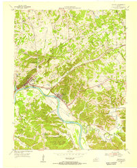
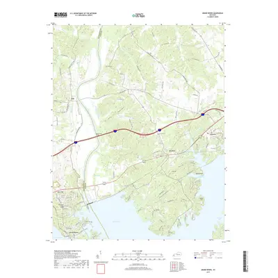
(28)- 1928 Map of Eddyville
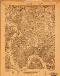 1928 Eddyville1928 Print · USGSWestern Kentucky's river valleys and mining districts are captured here in the late twenties before modern dams reshaped the Cumberland. Trace the old ferry crossings, family-run stops like Shelby's Store, and vanished school sites like Cherry Sch and Wilson Sch.
 - 1931 Map of Eddyville
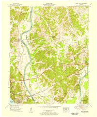
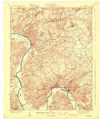 1931 Eddyville1931 Print · USGSWestern Kentucky life along the winding Cumberland River is captured here in the late twenties, before the landscape was altered by massive dam projects. Genealogists and historians can trace family roots through dozens of rural landmarks like Shelby's Store, the Nancy Hanks Mine, and Williams Chapel Sch.
 - 1936 Map of Eddyville
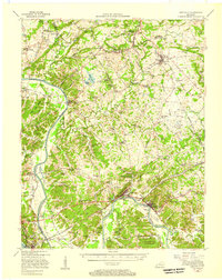
 1936 Eddyville1936 Print · USGSWestern Kentucky's river valleys appear here in the mid-1930s, showing the narrow land between the Tennessee and Cumberland rivers before the creation of major reservoirs. Genealogists can locate family landmarks like Sevenee Furnace Ch, Poplar Creek Sch, and the riverside Eureka Ferry.
 - 1936 Map of Grand Rivers
 1936 Grand Rivers1936 Print · USGSGrand Rivers sits at a strategic Kentucky crossroads in the mid-1930s, documenting the narrow land between two great river systems. Genealogists and local historians can trace the early layout of Grand Rivers and the Lyon and Livingston County line near the Cumberland River.
 - 1949 Map of Paducah
 1949 Paducah1949 Print · USGSThe confluence of the Ohio, Mississippi, Tennessee, and Cumberland rivers at the close of the 1940s reveals a region bound by water and rail. Researchers can trace historic river landings, timberlands in the Shawnee National Forest, and the coal-mining infrastructure around West Frankfort and Herrin.2 unique versions available
 - 1950 Map of Paducah
 1950 Paducah1950 Print · USGSThe confluence of the great midwestern rivers defines this mid-century landscape at the intersection of Illinois, Kentucky, and Missouri. Genealogists and historians can trace the rail-and-river economy through the hubs of Paducah, Cairo, and Metropolis or locate family roots near the Wildcat Hills.
 - 1954 Map of Paducah
 1954 Paducah1954 Print · USGSSouthern Illinois and Western Kentucky intersect at the great river confluences during this mid-century era of rail and river industry. Genealogists and historians can trace family roots and commerce through river towns like Cairo, Metropolis, and Golconda, or along the tracks of the Illinois Central Railroad.2 unique versions available
 - 1954 Map of Eddyville, 1955 Print
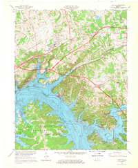
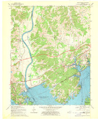
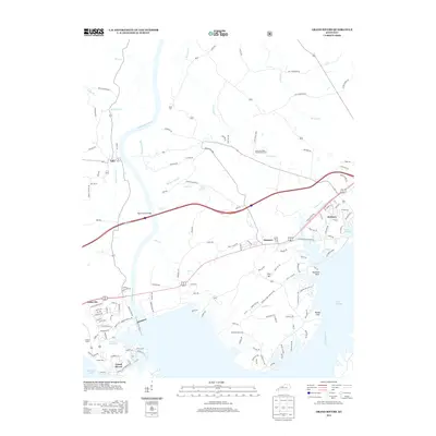
 1954 Eddyville1955 Print · USGSWestern Kentucky river life is captured here in the mid-fifties, just before massive reservoir projects reshaped the valley. Researchers can trace the original riverfronts of Eddyville and Kuttawa, identifying landmarks like the State Penitentiary and the Illinois Central rail line.
 - 1955 Map of Grand Rivers, 1956 Print
 1955 Grand Rivers1956 Print · USGSThe Land Between the Lakes region appears here in the mid-fifties, showing the intersection of river trade and modern reservoir development. Genealogists and historians can trace family landings such as Doom Landing, old churches like Suwanee Furnace Church, and the McPhail School.
 - 1955 Map of Eddyville, 1957 Print
 1955 Eddyville1957 Print · USGSMid-century Lyon County and the surrounding river country still center on the Cumberland River and the Illinois Central rail line. Genealogists and historians can trace the foundations of local life at the Eddyville Ferry, Suwanee Furnace, and the State Penal Farm.
 - 1961 Map of Paducah
 1961 Paducah1961 Print · USGSThe Lower Ohio Valley at mid-century is a landscape defined by its great rivers and newly formed reservoirs. Researchers can trace the riverfronts of Paducah and Metropolis, or locate smaller settlements like Old Shawneetown and Cave in Rock along the banks.2 unique versions available
 - 1964 Map of Paducah
 1964 Paducah1964 Print · USGSThe river-and-rail corridor of Southern Illinois and Western Kentucky is captured here during the height of the mid-century industrial era. Genealogists and researchers can trace local landmarks across several counties, from the rail yards of Paducah to the waters of Crab Orchard Lake and Kentucky Reservoir.2 unique versions available
 - 1967 Map of Eddyville, 1968 Print
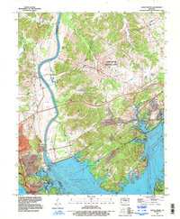
 1967 Eddyville1968 Print · USGSLyon County and the Cumberland River area are captured here during the mid-sixties, showcasing the rising waters of Lake Barkley. Genealogists and historians can trace family locations near Eddyville and Kuttawa, or find landmarks like Glenn Chapel and the State Penitentiary.2 unique versions available
 - 1967 Map of Grand Rivers, 1970 Print
 1967 Grand Rivers1970 Print · USGSIn the late 1960s, the landscape around the newly formed Lake Barkley was a hub of infrastructure and recreation. Trace the development of Grand Rivers and Kuttawa alongside landmarks like the Barkley Dam and Kentucky State Penitentiary Farm.
 - 1984 Map of Paducah, 1986 Print
 1984 Paducah1986 Print · USGSThe river-driven economy of western Kentucky and southern Illinois is captured here in the mid-eighties, showing the massive impact of the Kentucky Lake and Lake Barkley reservoirs. Genealogists and historians can trace rail lines like the Illinois Central Gulf RR and explore sites from Fort Massac State Park to the Kentucky State Penitentiary.
 - 1986 Map of Paducah, 1987 Print
 1986 Paducah1987 Print · USGSThe tri-river confluence of the Ohio, Tennessee, and Cumberland rivers is captured here in the mid-1980s during a period of established river power and industry. Researchers can trace local heritage through landmarks like Friendship Church, the Smithland Locks and Dam, and the Illinois Central Gulf RR.
 - 1987 Map of Paducah, 1988 Print
 1987 Paducah1988 Print · USGSThe Lower Ohio Valley and the Illinois Ozarks come alive in this late twentieth-century regional survey. Genealogists and local historians can trace river-town roots and state park landmarks from Metropolis to Cape Girardeau and Trail of Tears State Park.
 - 1993 Map of Grand Rivers, 1996 Print
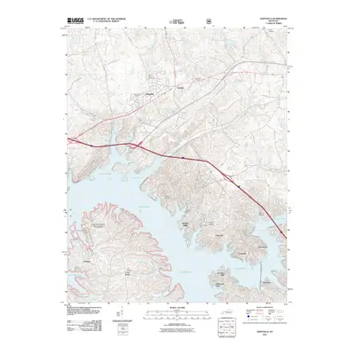
 1993 Grand Rivers1996 Print · USGSGrand Rivers and the narrow land bridge between two massive reservoirs are captured here in the 1990s. Researchers can trace the development of the Barkley Dam, locate the Western Kentucky Correctional Complex, or explore shoreline features like Money Cliff and Buzzard Rock.
 - 2011 Map of Grand Rivers, 2011 Print
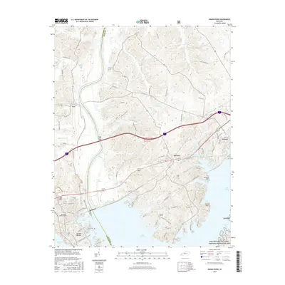
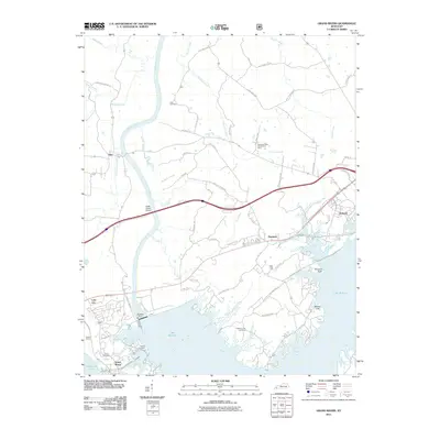 2011 Grand Rivers2011 Print · USGSCovers Kuttawa, including Grand Rivers, Iuka, and other nearby areas
 - 2011 Map of Eddyville, 2011 Print
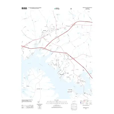
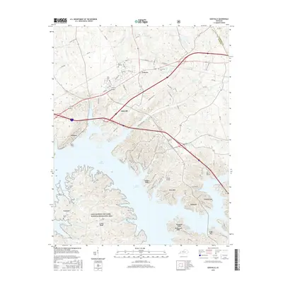
 2011 Eddyville2011 Print · USGSCovers Kuttawa, including Eddyville, Greenacres, and other nearby areas
 - 2013 Map of Grand Rivers, 2013 Print
 2013 Grand Rivers2013 Print · USGSCovers Kuttawa, including Grand Rivers, Iuka, and other nearby areas
 - 2013 Map of Eddyville, 2013 Print
 2013 Eddyville2013 Print · USGSCovers Kuttawa, including Eddyville, Greenacres, and other nearby areas
 - 2016 Map of Eddyville, 2016 Print
 2016 Eddyville2016 Print · USGSCovers Kuttawa, including Eddyville, Greenacres, and other nearby areas
 - 2016 Map of Grand Rivers, 2016 Print
 2016 Grand Rivers2016 Print · USGSCovers Kuttawa, including Grand Rivers, Iuka, and other nearby areas
 - 2019 Map of Grand Rivers, 2019 Print
 2019 Grand Rivers2019 Print · USGSCovers Kuttawa, including Grand Rivers, Iuka, and other nearby areas
Showing maps 1-25 of 28
Top cities near Kuttawa
- Princeton historical maps
- Benton historical maps
- Calvert City historical maps
- Eddyville historical maps
- Salem historical maps
- Fredonia historical maps
See more
Frequently asked questions
- What are the different types of historical maps available for Kuttawa?
- What is the oldest map of Kuttawa?
- Where can I purchase historical maps of Kuttawa for my home or office?
- Where can I download high-res historical maps of Kuttawa?
- Are there historical topographic maps available for Kuttawa?
- Is there historical aerial imagery available for Kuttawa?
- Where are historical maps of Kuttawa sourced from?