1900s (20th Century) Maps of Mason County, Kentucky
Explore 27 historic maps of Mason County from the 1900s (20th Century). These maps offer a rare glimpse into what life looked like during the 1900s — showing old roads, neighborhoods, homes, and landmarks that have changed or disappeared over time.
Whether you're researching your family's past, planning a metal detecting trip, or studying how Mason County's landscape evolved across the 1900s, these high-resolution maps are a powerful tool for exploring the history of this region.
- Focus on a specific era: All maps on this page are from the 1900s, giving you a focused view of this time period.
- See what’s changed: Compare century-old streets, trails, and buildings to today's modern landscape using overlays and satellite layers.
- Research with precision: Use these maps for genealogy, historical research, land use analysis, or educational projects.
- View, download, or print: Maps are fully viewable online in high resolution, and can be downloaded or printed for your own records.
Start exploring Mason County's history through authentic maps from the 1900s. This is your window into the past.
Mason County, KY maps
(27)- 1915 Map of Maysville, 1962 Print
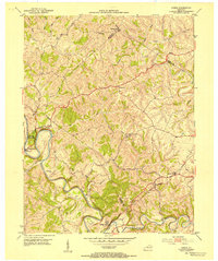
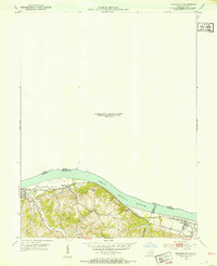
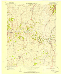
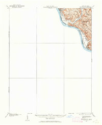 1915 Maysville1962 Print · USGSThe Ohio River valley near the Kentucky border comes to life in this survey from the years before the Great War. Genealogists and local historians can trace rural family-named landmarks like Porter Ridge and remote schoolhouses including Stephenson School and Flaugher School.
 - 1919 Map of Maysville, 1936 Print
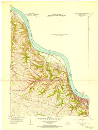
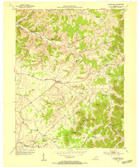
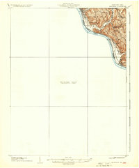 1919 Maysville1936 Print · USGSThe Ohio River bluffs above Ripley were a patchwork of ridge-top farms and rural school districts during the early twentieth century. Researchers can trace the paths of old township roads to find Hawk School, the landing at Aberdeen, and family-named landmarks like Flaugher Ridge.
 - 1928 Map of Higginsport
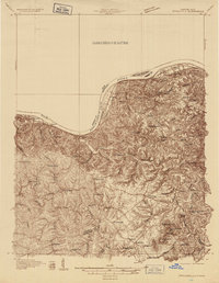
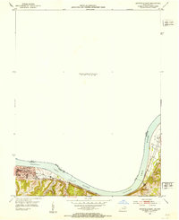
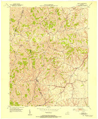
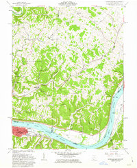
 1928 Higginsport1928 Print · USGSThe Kentucky side of the Ohio River is captured in the late twenties just as the rail-and-river economy flourished. Researchers can trace the riverbank rail lines of the Chesapeake and Ohio or locate early rural landmarks like Locust Grove Sch and the town of Augusta.
 - 1929 Map of Springdale
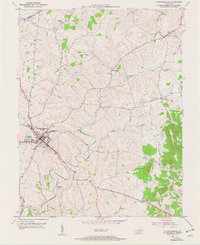
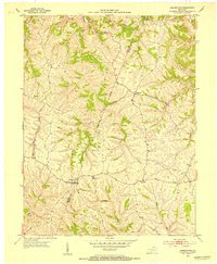
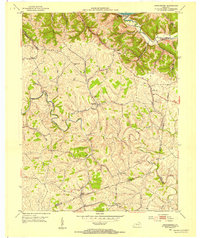
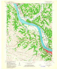
 1929 Springdale1929 Print · USGSThe Ohio River valley and Kentucky's northern hills are captured here in the late twenties, showing a landscape defined by the Chesapeake and Ohio railroad. Genealogists can trace early homesteads and landmarks near Tollesboro, Ruggles Camp, and the many rural sites like Ebenezer Ch.2 unique versions available
 - 1931 Map of Higginsport, 1948 Print
 1931 Higginsport1948 Print · USGSThe Ohio River corridor and Brown County hinterlands come alive in this early twentieth-century survey of the borderlands near Georgetown. Local historians can trace long-gone rural schoolhouses like McFadden School or locate the historic Brown County Infirmary and the Abandoned Columbus and Sardinia Road.
 - 1935 Map of Springdale
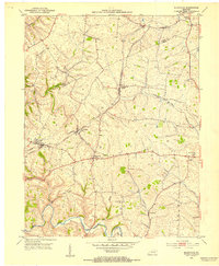
 1935 Springdale1935 Print · USGSThe Ohio River valley at the height of the mid-1930s reveals a landscape shaped by river commerce and the Chesapeake and Ohio railroad. Researchers can locate numerous vanished country schools like Hamilton School, the infrastructure of Dam 33, and rural centers such as Tollesboro.
 - 1951 Map of Flemingsburg, 1953 Print
 1951 Flemingsburg1953 Print · USGSThe county seat of Flemingsburg and its surrounding Kentucky farmland are captured here in the early fifties, showing a landscape defined by rail lines and rural junctions. Genealogists can trace family locations through Fitche Chapel Cem, Arnold Cem, and the path of the Flemingsburg and Northern railroad.3 unique versions available
 - 1952 Map of Cowan, 1953 Print
 1952 Cowan1953 Print · USGSThe rural landscapes of Fleming and Nicholas counties are captured here in the early fifties, centered on the winding Licking River. Genealogists and historians can locate family landmarks such as Cowan, Blue Licks Spr, and Furman Chapel Ch.3 unique versions available
 - 1952 Map of Maysville East, 1953 Print
 1952 Maysville East1953 Print · USGSThe Ohio River valley near the Mason County line is captured here in the early fifties, showing the vital river-and-rail corridor. Researchers can trace the riverfront development of Maysville or locate landmarks near Sand Hill and the Chesapeake and Ohio railroad.
 - 1952 Map of Germantown, 1953 Print
 1952 Germantown1953 Print · USGSBracken and Mason Counties are shown here in the early fifties, where the hill-and-hollow topography dictates the local road network. Genealogists and historians can trace family locations near Germantown, the old Fairgrounds, and rural landmarks like Sharon Ch.2 unique versions available
 - 1952 Map of Elizaville, 1953 Print
 1952 Elizaville1953 Print · USGSFleming and Mason counties appear here in the early fifties, showing the rural Kentucky landscape before the era of modern highway expansion. Genealogists and local historians can trace family ties at Clover Hill Ch or locate old rail stops like Flemingsburg Junction and Nepton.3 unique versions available
 - 1952 Map of Higginsport, 1953 Print
 1952 Higginsport1953 Print · USGSThe Ohio River borderlands of Kentucky and Ohio come into focus in the early 1950s, showing the riverside rail and road networks. Genealogists and local historians can trace family locations near Augusta, Dover, and the Rosemont Cem on the Kentucky shore.
 - 1952 Map of Maysville West, 1953 Print
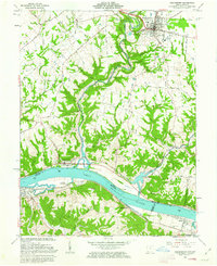
 1952 Maysville West1953 Print · USGSThe Mason County riverfront comes to life in the early 1950s, centered on the historic river town of Maysville and its vital rail connections. Genealogists can trace family footprints near Pleasant Green Ch or follow the old Chesapeake and Ohio line past South Ripley.
 - 1952 Map of Sardis, 1953 Print
 1952 Sardis1953 Print · USGSKentucky's ridge-and-hollow landscape comes into sharp focus in the early fifties at the junction of Mason, Bracken, and Robertson counties. Family historians can trace rural home sites and community landmarks like Salem Ch, Abigail, and the winding North Fork Licking River.2 unique versions available
 - 1952 Map of Orangeburg, 1954 Print
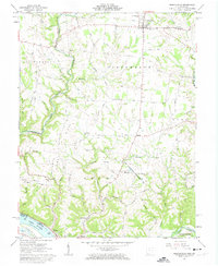
 1952 Orangeburg1954 Print · USGSMason County hill country in the early fifties is mapped here, showing the rural life centered on the North Fork Licking River. Genealogists can locate family landmarks like Stone Lick Ch, Antioch Ch, and the hamlet of Orangeburg.3 unique versions available
 - 1952 Map of Mays Lick, 1954 Print
 1952 Mays Lick1954 Print · USGSMason County’s rolling farmland and river valleys are captured here in the early fifties, as the Louisville and Nashville railroad served the rural interior. Researchers can locate family landmarks like Finch Cem, St Patricks Cem, and the historic school sites at Mays Lick and Lewisburg.3 unique versions available
 - 1953 Map of Tollesboro, 1954 Print
 1953 Tollesboro1954 Print · USGSLewis County hills and hollows are captured in the early fifties, showing a rural landscape defined by ridge-top farms and creek-side hamlets. Researchers can trace family roots through Tollesboro and locate landmarks like Canaan Sch and Eskalapia Mountain.2 unique versions available
 - 1957 Map of Huntington, 1966 Print
 1957 Huntington1966 Print · USGSThe industrial heart of the Ohio River valley is captured here in the mid-sixties, showing the growth of Huntington and Ashland. Researchers can trace the extensive rail networks of the Chesapeake and Ohio RR and locate sites like the Chief Cornstalk Hunting Ground.3 unique versions available
 - 1960 Map of Huntington
 1960 Huntington1960 Print · USGSThe tri-state river valley thrived in the late fifties as a hub of heavy industry and Appalachian rail transit. Genealogists and historians can trace the connection between river towns like Ashland and Portsmouth or locate family homesteads near Coleman Ridge.
 - 1961 Map of Maysville East, 1963 Print
 1961 Maysville East1963 Print · USGSThe Ohio River valley and the Kentucky-Ohio border come into focus in this early 1960s survey. Genealogists can trace local roots through numerous family and church landmarks like Hiett Chapel Cem, Ravenscroft Chapel, and the community at Beetle.4 unique versions available
 - 1961 Map of Maysville West, 1963 Print
 1961 Maysville West1963 Print · USGSThe Ohio River dominates this early 1960s landscape, connecting the bustling riverfront of Maysville with the quiet ridges of Union. Genealogists can trace family names through Maplewood Cem, Fitchs Chapel Cem, and the Lawrence Creek Ch.4 unique versions available
 - 1961 Map of Russellville, 1963 Print
 1961 Russellville1963 Print · USGSBrown County, Ohio, is captured in the early sixties as a landscape of ridge-top farms and deep creek hollows. Genealogists can trace family footprints at Linwood Cem and the John Rankin Home, or locate rural landmarks like the Covered Bridge and Redoak Ch.3 unique versions available
 - 1961 Map of Higginsport, 1963 Print
 1961 Higginsport1963 Print · USGSThe Ohio River corridor comes alive in the early sixties as it winds between the riverfront communities of Higginsport, Augusta, and Dover. Researchers can trace the Chesapeake and Ohio rail line, rural family cemeteries like Sallee Cemetery, and the civic layout of Georgetown.3 unique versions available
 - 1982 Map of Morehead, 1983 Print
 1982 Morehead1983 Print · USGSThe foothills of northeastern Kentucky come alive in the early eighties, showcasing a landscape defined by timber, limestone caves, and major reservoirs. Local researchers can trace the development of Morehead State University or locate old crossings at Plummers Mill and Salt Lick.
 - 1986 Map of Maysville
 1986 Maysville1986 Print · USGSThe Ohio River valley in the mid-eighties reveals a landscape of industrial river towns and sprawling public lands spanning the Kentucky and Ohio border. Researchers can trace the rail corridors of the Chesapeake and Ohio Railway or locate landmarks like Confidence Cemetery and the Fleming-Mason Airport.
Showing maps 1-25 of 27
Top cities of Mason County
Frequently asked questions
- What are the different types of historical maps available for Mason County?
- What is the oldest map of Mason County?
- Where can I purchase historical maps of Mason County for my home or office?
- Where can I download high-res historical maps of Mason County?
- Are there historical topographic maps available for Mason County?
- Is there historical aerial imagery available for Mason County?
- Where are historical maps of Mason County sourced from?