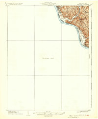
1915 Map of Maysville
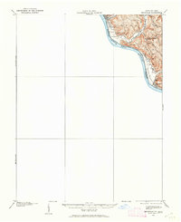
USGS Topo · Published 1962About this map
The Ohio River defines the bend between Ohio and Kentucky in this 1915 survey, where the river's path is marked by the Charleston Bar and the dividing line between Brown and Mason counties. Along the northern shore, the river towns of Ripley and Aberdeen serve as primary points of entry to a landscape defined by sharp elevation changes and deep hollows. The rural character of Union and Huntington townships is visible through a network of ridge-top settlements and localized education centers like Buckeye School, Hawk School, and Fitch School.
Find a feature on this map
27 named features on this map. Tap any name to fly to it.
Don’t see what you’re looking for? This feature index may not catch every label — zoom into the map to look around manually.
Map Details
Editions of this 1915 Maysville Map
This is the sole edition of this map. No revisions or reprints were ever made.
Historical Maps of Maysville Through Time
4 maps found