Old Maps of Metcalfe County, Kentucky for Academic Research
Study the evolution of Metcalfe County with 87 high-resolution historic maps. Whether you're teaching, researching, or modeling changes in land use, these maps provide essential visual documentation of urban, environmental, and geographic change.
- Analyze long-term change: Track patterns in development, transportation, and natural features.
- Ideal for environmental or urban studies: Support academic projects with primary historical map data.
- Use in the classroom or lab: Educators and researchers rely on these maps to bring historical context to life.
These maps are a powerful tool for teaching, research, and visualizing how Metcalfe County has changed over the decades.
Metcalfe County, KY maps
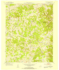
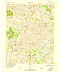
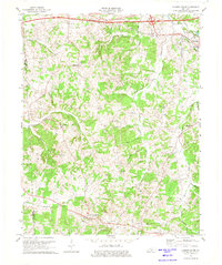
(87)- 1935 Map of Horse Cave
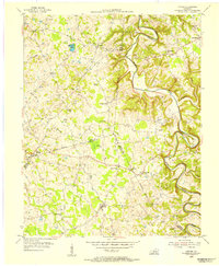
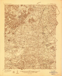 1935 Horse Cave1935 Print · USGSHart and Barren counties in the mid-1930s reveal a landscape shaped by cave tourism and rural education. Genealogists can trace family footprints through dozens of local landmarks like Ragman Seminary, Bunnells Crossing, and New Hope Ch.
 - 1938 Map of Horse Cave
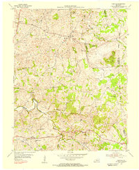
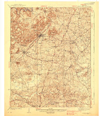 1938 Horse Cave1938 Print · USGSKentucky's cave country thrives in the late 1930s as a hub of early auto tourism and rail commerce. Genealogists can trace family roots through dozen of rural landmarks like Walton Academy, Mammoth Onyx Cave, and the Big Meadow Ch.2 unique versions available
 - 1953 Map of Gradyville, 1954 Print
 1953 Gradyville1954 Print · USGSAdair County life in the early fifties is centered on the creek valleys and crossroads of the Gradyville area. Researchers can trace family history through numerous small burial grounds and rural schools like Jones Chapel Sch and Wheeler Cem.2 unique versions available
 - 1953 Map of Sulphur Well, 1954 Print
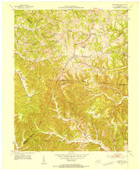
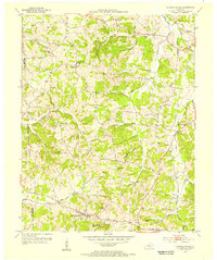
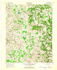
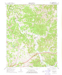
 1953 Sulphur Well1954 Print · USGSMetcalfe County is shown here in the early fifties, characterized by its river-valley farming communities and rural schoolhouse network. Researchers can trace family history through sites like Seven Springs Cem, Sugar Plant Sch, and the settlement at Sulphur Well.2 unique versions available
 - 1953 Map of Sulphur Lick, 1954 Print
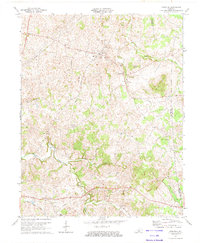
 1953 Sulphur Lick1954 Print · USGSMonroe County and the hills along the Barren River are captured here in the early fifties, before modern consolidation changed the local landscape. Genealogists and historians can trace family roots through numerous small landmarks like Miller Cave, Skaggs Creek Ch, and the Wade Cem.3 unique versions available
 - 1953 Map of Breeding, 1954 Print
 1953 Breeding1954 Print · USGSThe hill country of south-central Kentucky is captured here in the early fifties, showing the rural communities along the Adair and Cumberland county lines. Researchers can trace the locations of old schoolhouses and country churches like Rowetown Sch, Chestnut Grove Ch, and Saltpeter Cave.3 unique versions available
 - 1953 Map of Waterview, 1954 Print
 1953 Waterview1954 Print · USGSCumberland County at the mid-century remains a landscape of river-centered life and small rural school districts. Genealogists can locate Cloyds Landing, the Oliver Ferry crossing, and numerous local landmarks like Baise Chapel and Beech Grove Sch.2 unique versions available
 - 1953 Map of Edmonton, 1954 Print
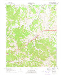
 1953 Edmonton1954 Print · USGSThe rural Kentucky landscape around Edmonton comes to life in the early fifties, showing a region of tight-knit ridge communities and river-bottom farms. Researchers can trace ancestral locations through numerous burial sites and schools like Walnut Grove Sch, Winfrey Chapel, and the Moore Spring post office.2 unique versions available
 - 1953 Map of Summer Shade, 1955 Print
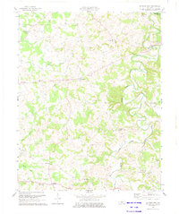
 1953 Summer Shade1955 Print · USGSThe rural uplands of south-central Kentucky are shown here in the mid-fifties as a network of ridge-top settlements and creek-side farms. Researchers can trace ancestral locations like Randolph, Summer Shade, and Goodluck, alongside remote landmarks like Harvey Cave and Hickory College Ch.
 - 1953 Map of Center, 1955 Print
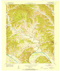
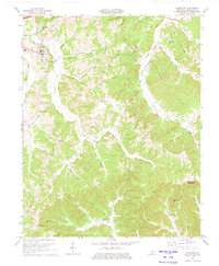
 1953 Center1955 Print · USGSHart and Metcalfe counties come alive in the mid-fifties as a landscape of remote farmsteads and river bends. Genealogists can locate family landmarks like Allens Grove Ch, Bastin Cem, and the small settlement of Whickerville.
 - 1953 Map of Dubre, 1955 Print
 1953 Dubre1955 Print · USGSThe rural uplands of Cumberland and Metcalfe counties are captured here in the early fifties, showing a landscape defined by creek-side settlements and ridge-top schools. Genealogists can trace family footprints at Mud Camp, Temple Hill Ch, and the many hollows near Marrowbone Creek.2 unique versions available
 - 1953 Map of East Fork, 1955 Print
 1953 East Fork1955 Print · USGSCentral Kentucky's rural landscape is captured here in the early 1950s, centered on the winding East Fork Little Barren River. Genealogists can trace family names through numerous landmarks like Ackee Cem, Mud Slash Sch, and Union Chapel.2 unique versions available
 - 1954 Map of Park, 1955 Print
 1954 Park1955 Print · USGSSouth-central Kentucky during the mid-fifties reveals a landscape of limestone sinkholes and prominent knobs at the junction of two major early highways. Trace family roots at Bear Wallow, find the Oak Ridge Sch, or locate numerous early Oil Wells around Rex.2 unique versions available
 - 1954 Map of Hiseville, 1956 Print
 1954 Hiseville1956 Print · USGSBarren and Metcalfe counties come alive in the mid-fifties, showing a landscape of established family farms and small rural crossroads. Researchers can trace ancestral locations near Hiseville, the State Fish Hatchery, and several schools like Dry Hollow Sch.2 unique versions available
 - 1956 Map of Corbin, 1966 Print
 1956 Corbin1966 Print · USGSThe Kentucky and Tennessee borderlands are captured here in the mid-fifties, showing the region's shift toward modern interstate travel and reservoir development. Genealogists and historians can trace old community lines near Albany and Monticello or locate early rail junctions along the Southern and Tennessee Central lines.3 unique versions available
 - 1957 Map of Winchester, 1968 Print
 1957 Winchester1968 Print · USGSCentral Kentucky's landscape in the mid-twentieth century features the sprawling Fort Knox and the early parkway system. Genealogists and historians can trace rail lines like the Southern Railway and find landmarks from Bernheim Forest to Pilot Knob.3 unique versions available
 - 1958 Map of Corbin
 1958 Corbin1958 Print · USGSThe Upper Cumberland borderlands appear in the late 1950s as massive reservoirs and early atomic-era growth reshape the region. Trace family roots and vanished landmarks near Lake Cumberland, Oak Ridge, and the Cumberland National Forest.
 - 1960 Map of Winchester
 1960 Winchester1960 Print · USGSCentral Kentucky's diverse landscape is shown here at mid-century, from the bluegrass plains to the rugged Pottsville Escarpment. Genealogists and historians can trace the rail-and-river network connecting towns like Bardstown and Stanford alongside landmarks like Lake Cumberland.
 - 1961 Map of Center, 1963 Print
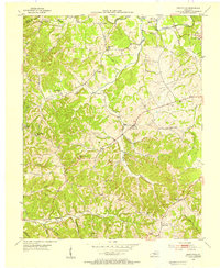
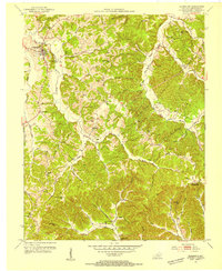
 1961 Center1963 Print · USGSThe rural borderlands of Hart, Green, and Metcalfe counties are captured here in the early sixties, showing a landscape defined by river bends and country crossroads. Researchers can locate dozens of family burial sites like Sydnor Cem or trace the early energy infrastructure around Whickerville and Center.4 unique versions available
 - 1973 Map of Hiseville, 1974 Print
 1973 Hiseville1974 Print · USGSThe Barren and Metcalfe county line comes alive in the early seventies, showing a landscape of sinkholes and knobs. Trace family roots at Queens Chapel, Griderville, or the oil-producing fields near Coral Hill.2 unique versions available
 - 1973 Map of East Fork, 1974 Print
 1973 East Fork1974 Print · USGSCentral Kentucky's rural landscape at the dawn of the seventies shows a mix of traditional crossroads and new infrastructure. Researchers can trace family history through sites like Union Chapel, Foundation Ch, and the many cemeteries near East Fork.
 - 1973 Map of Gradyville, 1974 Print
 1973 Gradyville1974 Print · USGSAdair County during the early 1970s is seen here as a landscape of rural hamlets and creek-side farms connected by a developing highway system. Genealogists and local historians can trace family roots through numerous sites like New Tarters Chapel, Janes Chapel, and Stapp Cem.
 - 1973 Map of Sulphur Well, 1975 Print
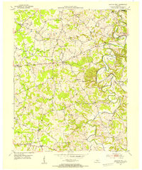
 1973 Sulphur Well1975 Print · USGSMetcalfe County's rural crossroads and river valleys are captured here in the early 1970s. Researchers can trace the layout of small settlements like Sulphur Well and Wisdom or locate family sites near Ebenezer Ch and Knob Lick.2 unique versions available
 - 1974 Map of Edmonton, 1975 Print
 1974 Edmonton1975 Print · USGSMetcalfe County in the mid-seventies shows a landscape of ridge-top farms and river hollows at a time when oil and gas exploration was dotting the hillsides. Researchers can trace local genealogy through several country churches like Lone Star Ch or locate the former Moore Spring (Subtle PO).2 unique versions available
 - 1974 Map of Summer Shade, 1975 Print
 1974 Summer Shade1975 Print · USGSSouthern Metcalfe County is captured here in the mid-seventies, showing a landscape of ridge-top farms and deep creek hollows. Genealogists and historians can trace family locations near Summer Shade, Hickory College Ch, and the old Metcalfe County Ford.
Showing maps 1-25 of 87
Top cities of Metcalfe County
Frequently asked questions
- What are the different types of historical maps available for Metcalfe County?
- What is the oldest map of Metcalfe County?
- Where can I purchase historical maps of Metcalfe County for my home or office?
- Where can I download high-res historical maps of Metcalfe County?
- Are there historical topographic maps available for Metcalfe County?
- Is there historical aerial imagery available for Metcalfe County?
- Where are historical maps of Metcalfe County sourced from?