2020s Maps of Muhlenberg County, Kentucky
Explore 16 historic maps of Muhlenberg County from the 2020s. These maps offer a rare glimpse into what life looked like during the 2020s — showing old roads, neighborhoods, homes, and landmarks that have changed or disappeared over time.
Whether you're researching your family's past, planning a metal detecting trip, or studying how Muhlenberg County's landscape evolved across the 2020s, these high-resolution maps are a powerful tool for exploring the history of this region.
- Focus on a specific era: All maps on this page are from the 2020s, giving you a focused view of this time period.
- See what’s changed: Compare century-old streets, trails, and buildings to today's modern landscape using overlays and satellite layers.
- Research with precision: Use these maps for genealogy, historical research, land use analysis, or educational projects.
- View, download, or print: Maps are fully viewable online in high resolution, and can be downloaded or printed for your own records.
Start exploring Muhlenberg County's history through authentic maps from the 2020s. This is your window into the past.
Muhlenberg County, KY maps
(16)- 2022 Map of Sacramento, 2022 Print
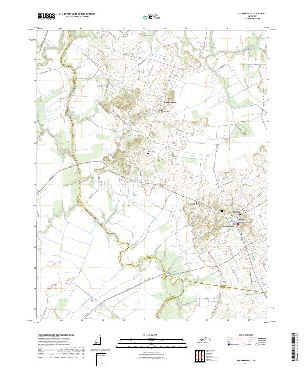 2022 Sacramento2022 Print · USGSWestern Kentucky farmland at the confluence of McLean, Hopkins, and Muhlenberg counties is detailed in this 2022 survey. Genealogists can trace family burial sites at Poplar Grove Cem and West Schoolhouse Cem near the Pond River.
 - 2022 Map of Drakesboro, 2022 Print
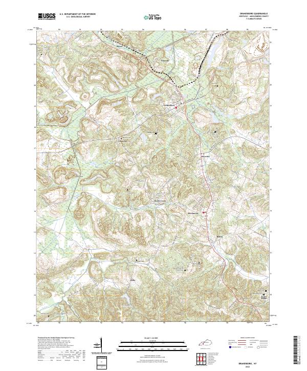 2022 Drakesboro2022 Print · USGSMuhlenberg County's musical and industrial heartland is detailed here in the early twenty-first century. Researchers can trace family lines through Ebenezer Cem and Johnston Cem or locate regional landmarks like Kirkwood Lake.
 - 2022 Map of Livermore, 2022 Print
 2022 Livermore2022 Print · USGSMcLean County's river valleys and upland cemeteries come into focus during this modern survey of the Western Kentucky Coal Field region. Trace family history at Saint Charles Catholic Church Cemetery or explore the landscape around Island and Livermore.
 - 2022 Map of Rosewood, 2022 Print
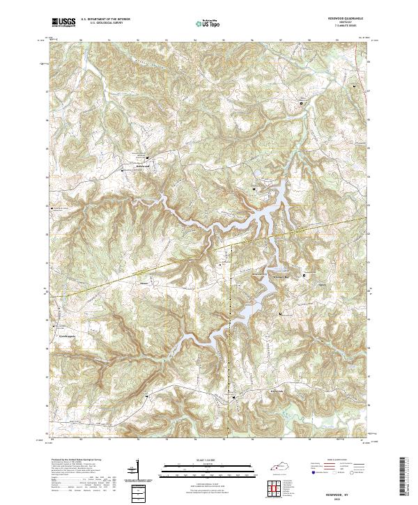 2022 Rosewood2022 Print · USGSThe tri-county borders of Muhlenberg, Todd, and Logan meet in this portion of Kentucky, where high ridges overlook the deep waters of Whiskey Bay. Genealogists can trace local lineages through numerous family burial sites, including Rosewood Cem Number 2 and the Green Brier School House Cem.
 - 2022 Map of Millport, 2022 Print
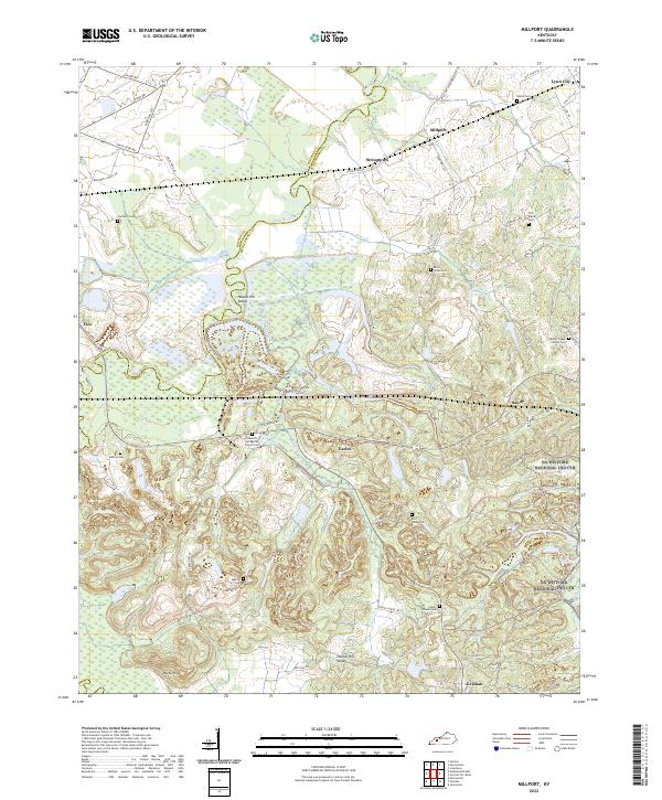 2022 Millport2022 Print · USGSMuhlenberg and Hopkins Counties are captured here at the start of the 2020s, where the winding Pond River divides the landscape. Genealogists can trace family roots through numerous burial sites like Salem Cem, East Union Cem, and McNary Cem.
 - 2022 Map of Haleys Mill, 2022 Print
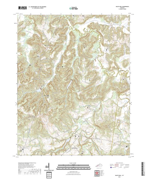 2022 Haleys Mill2022 Print · USGSChristian County's rural heartland is meticulously documented in this recent survey of the region's cemeteries and waterways. Genealogists and local historians can trace family ties at Lite Family Cemetery, Hale Cemetery, and Johnsons Chapel Methodist Church Cemetery.
 - 2022 Map of Equality, 2022 Print
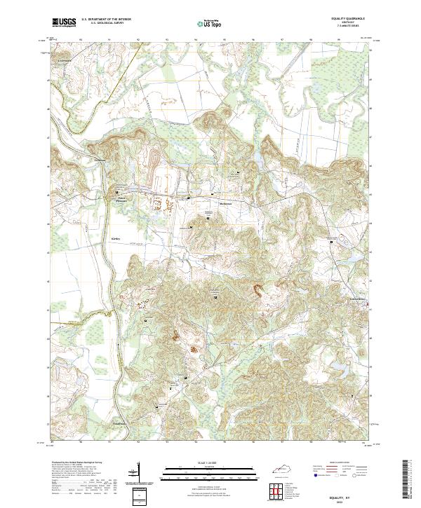 2022 Equality2022 Print · USGSThe river-driven landscape of Ohio and McLean counties is captured here in the early 2020s, centered on the confluence of the Green River and Rough River. Researchers can trace dozens of family burial sites including the Patterson Ingleheart Cem and Nellie Davis Cem.
 - 2022 Map of Dunmor, 2022 Print
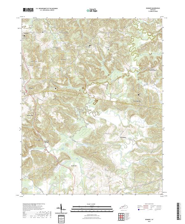 2022 Dunmor2022 Print · USGSThe borderlands of Muhlenberg, Butler, and Logan counties come to life in this detailed survey of rural Kentucky settlements. Genealogists and historians can trace family roots through sites like Penrod Baptist Church Cem, Diamond Springs, and Harreldsville.
 - 2022 Map of Kirkmansville, 2022 Print
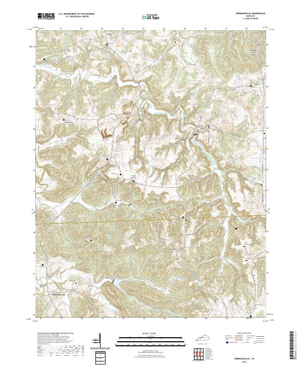 2022 Kirkmansville2022 Print · USGSThe rural borderlands of Muhlenberg and Todd counties come into focus in this contemporary survey of the Pond River valley. Researchers can pinpoint dozens of small family and church sites like Joines Chapel Cem, Edwards Farm Cem, and the settlement at Kirkmansville.
 - 2022 Map of Central City West, 2022 Print
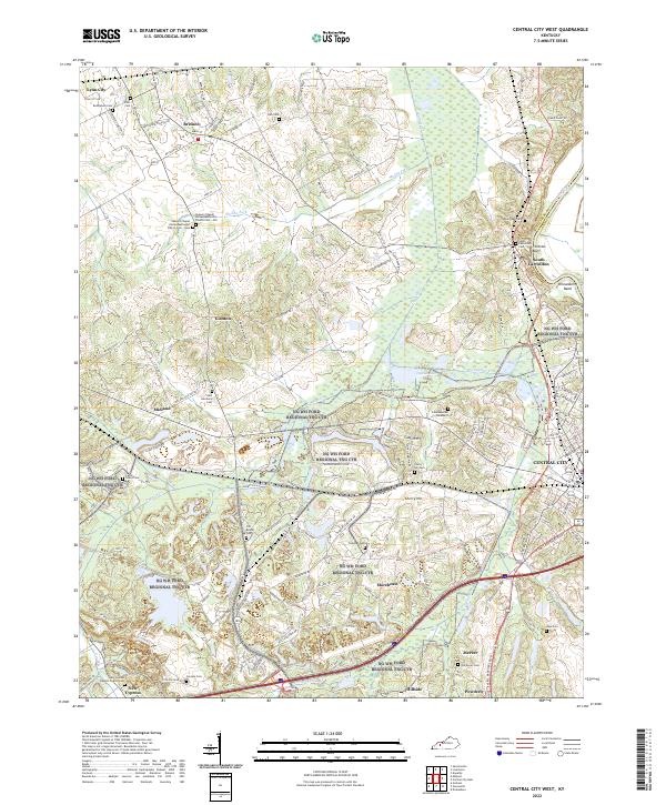 2022 Central City West2022 Print · USGSMuhlenberg County at the turn of the 2020s shows a landscape where industrial transit and ancestral grounds sit side by side. Genealogists can locate family sites like Shavers Chapel Old Cemetery or Old Dovey Cem, while tracing the legacy of the Green River and the rural roads near Bremen.
 - 2022 Map of Greenville, 2022 Print
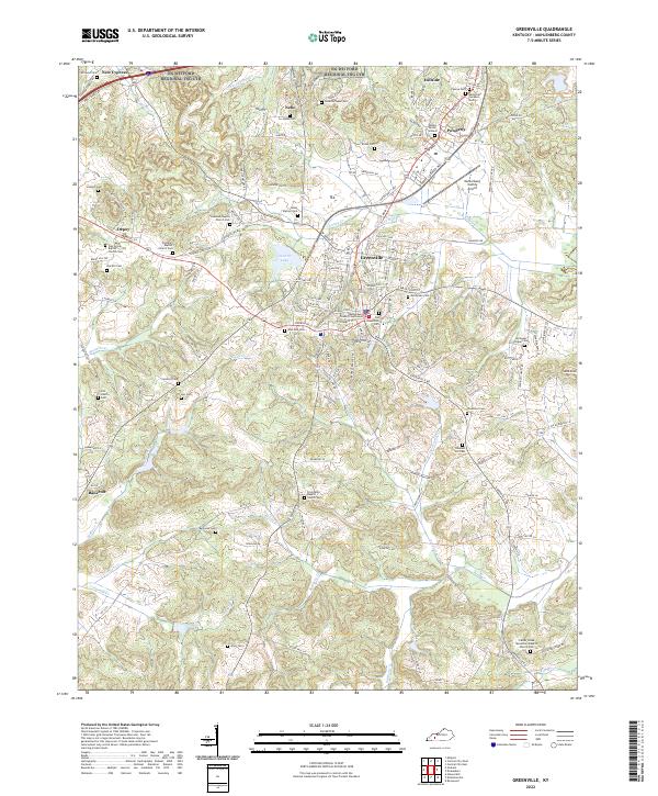 2022 Greenville2022 Print · USGSGreenville and the surrounding Muhlenberg County hill country are shown in detail during the early 2020s. Genealogists can trace family connections through a high density of rural burial sites like Caney Station Cem, Eaves Cem, and Reynolds Cem.
 - 2022 Map of Central City East, 2022 Print
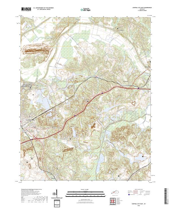 2022 Central City East2022 Print · USGSEastern Muhlenberg County at the start of the 2020s shows a landscape shaped by river transport and industrial transit. Researchers can trace deep family roots through numerous sites like Rose Hill Cem, the Mount Zion Presbyterian Church, and the river landing at Ceralvo.
 - 2022 Map of Madisonville East, 2022 Print
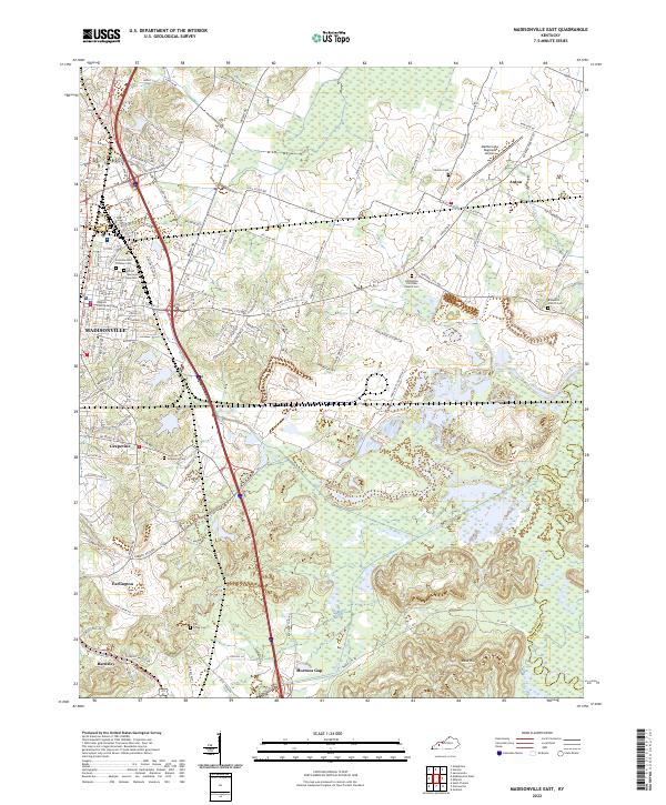 2022 Madisonville East2022 Print · USGSHopkins County, Kentucky, is shown in the modern era as a landscape of river-fed lowlands and established communities. Genealogists can trace family roots through several local burial grounds, including Eastside Odd Fellows Cem and Grapevine Cem.
 - 2022 Map of Graham, 2022 Print
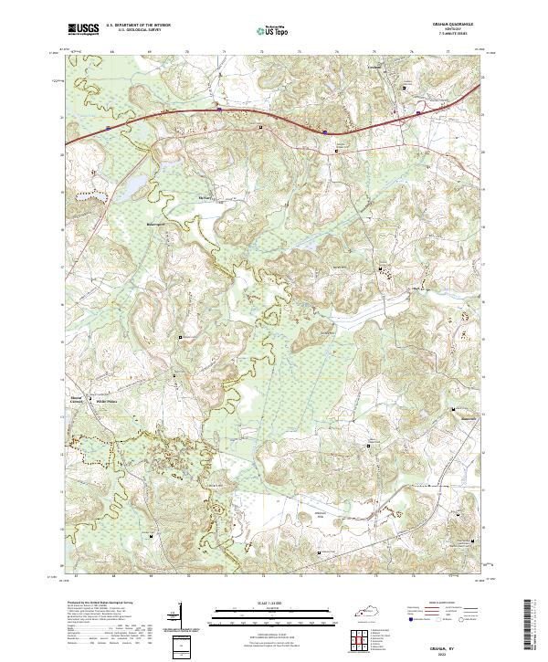 2022 Graham2022 Print · USGSWestern Kentucky's rural landscape is captured here at the junction of three counties, where river bottomlands meet established uplands. You can trace family roots at Graham Hill Cem or explore the geography around McNary, Bakersport, and the Pond River.
 - 2022 Map of Rochester, 2022 Print
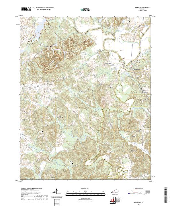 2022 Rochester2022 Print · USGSThe confluence of the Green and Mud Rivers near the Butler and Muhlenberg county lines is shown here in the early 2020s. Genealogists can trace numerous family burial sites, including Mud River Mine Cem, Greenhill-Tater Hill Cem, and Midway Cem.
 - 2022 Map of Paradise, 2022 Print
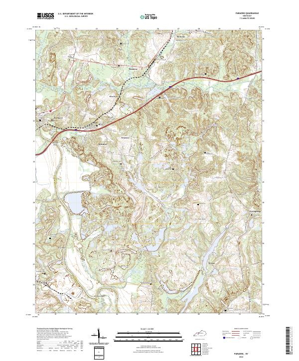 2022 Paradise2022 Print · USGSWestern Kentucky river country is mapped here just north of the Paradise coal fields, where family legacies are preserved in names like Adam Brown Cem. Genealogists can trace early homesteads and communities like McHenry, Nineteen, and Wysox.
End of results
Showing maps 1-16 of 16
Top cities of Muhlenberg County
- Central City historical maps
- Greenville historical maps
- Powderly historical maps
- Drakesboro historical maps
- Bremen historical maps
- South Carrollton historical maps
Frequently asked questions
- What are the different types of historical maps available for Muhlenberg County?
- What is the oldest map of Muhlenberg County?
- Where can I purchase historical maps of Muhlenberg County for my home or office?
- Where can I download high-res historical maps of Muhlenberg County?
- Are there historical topographic maps available for Muhlenberg County?
- Is there historical aerial imagery available for Muhlenberg County?
- Where are historical maps of Muhlenberg County sourced from?