Old Maps of Owen County, Kentucky for Academic Research
Study the evolution of Owen County with 42 high-resolution historic maps. Whether you're teaching, researching, or modeling changes in land use, these maps provide essential visual documentation of urban, environmental, and geographic change.
- Analyze long-term change: Track patterns in development, transportation, and natural features.
- Ideal for environmental or urban studies: Support academic projects with primary historical map data.
- Use in the classroom or lab: Educators and researchers rely on these maps to bring historical context to life.
These maps are a powerful tool for teaching, research, and visualizing how Owen County has changed over the decades.
Owen County, KY maps
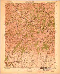
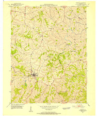
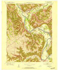
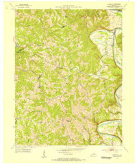
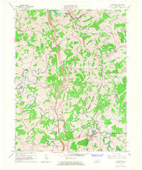
(42)- 1906 Map of Lockport
 1906 Lockport1906 Print · USGSCovers Owen County, including Monterey, Gratz, and other nearby areas2 unique versions available
 - 1908 Map of Lockport
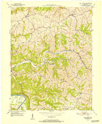
 1908 Lockport1908 Print · USGSCovers Owen County, including Monterey, Gratz, and other nearby areas3 unique versions available
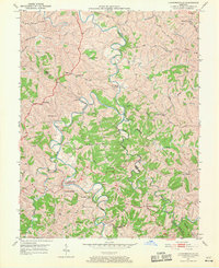
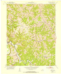
 - 1939 Map of Sadieville
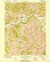
 1939 Sadieville1939 Print · USGSCovers Owen County, including Georgetown, Stamping Ground, and other nearby areas2 unique versions available
 - 1943 Map of Vevay South
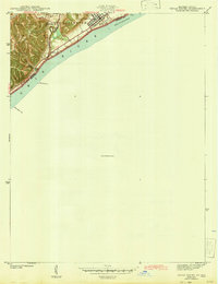 1943 Vevay South1943 Print · USGSCovers Owen County, including Vevay, Ghent, and other nearby areas
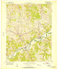
 - 1950 Map of New Liberty, 1952 Print
 1950 New Liberty1952 Print · USGSCovers Owen County, including New Liberty, Wheatley, and other nearby areas4 unique versions available
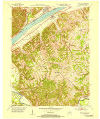
 - 1950 Map of Glencoe, 1952 Print
 1950 Glencoe1952 Print · USGSCovers Owen County, including Glencoe, Eagle Hill, and other nearby areas2 unique versions available
 - 1950 Map of Owenton, 1952 Print
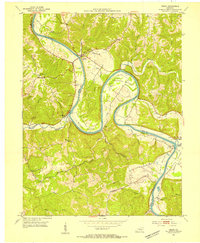
 1950 Owenton1952 Print · USGSCovers Owen County, including Owenton, Sweet Owen, and other nearby areas4 unique versions available
 - 1950 Map of Lawrenceville, 1970 Print
 1950 Lawrenceville1970 Print · USGSCovers Owen County, including Lawrenceville, Holiday Ford, and other nearby areas
 - 1951 Map of Sanders, 1953 Print
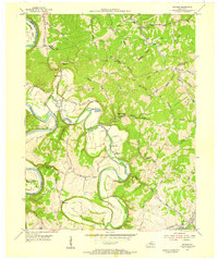
 1951 Sanders1953 Print · USGSCovers Owen County, including Sanders, Carson, and other nearby areas
 - 1952 Map of Vevay South, 1954 Print
 1952 Vevay South1954 Print · USGSCovers Owen County, including Vevay, Ghent, and other nearby areas2 unique versions available
 - 1952 Map of Worthville, 1954 Print
 1952 Worthville1954 Print · USGSCovers Owen County, including Worthville, Moxley, and other nearby areas3 unique versions available
 - 1953 Map of Monterey, 1954 Print
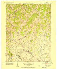
 1953 Monterey1954 Print · USGSCovers Owen County, including Monterey, Ep, and other nearby areas3 unique versions available
 - 1953 Map of Gratz, 1954 Print
 1953 Gratz1954 Print · USGSCovers Owen County, including Monterey, Gratz, and other nearby areas3 unique versions available
 - 1953 Map of Sadieville, 1954 Print
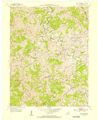
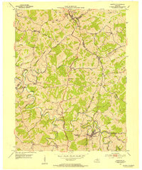 1953 Sadieville1954 Print · USGSCovers Owen County, including Sadieville, Corinth, and other nearby areas
 - 1953 Map of Polsgrove, 1955 Print
 1953 Polsgrove1955 Print · USGSCovers Owen County, including Polsgrove, Flag Fork, and other nearby areas4 unique versions available
 - 1953 Map of Stamping Ground, 1955 Print
 1953 Stamping Ground1955 Print · USGSCovers Owen County, including Stamping Ground, Minorsville, and other nearby areas3 unique versions available
 - 1953 Map of New Columbus, 1955 Print
 1953 New Columbus1955 Print · USGSCovers Owen County, including Natlee, Rockdale, and other nearby areas3 unique versions available
 - 1954 Map of Switzer, 1955 Print
 1954 Switzer1955 Print · USGSCovers Owen County, including Swallowfield, Peaks Mill, and other nearby areas4 unique versions available
 - 1956 Map of Louisville, 1971 Print
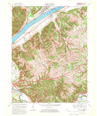
 1956 Louisville1971 Print · USGSCovers Owen County, including Louisville, Lexington, and other nearby areas2 unique versions available
 - 1964 Map of Louisville
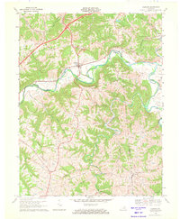
 1964 Louisville1964 Print · USGSCovers Owen County, including Louisville, Lexington, and other nearby areas
 - 1965 Map of Sadieville, 1966 Print
 1965 Sadieville1966 Print · USGSCovers Owen County, including Sadieville, Corinth, and other nearby areas2 unique versions available
 - 1967 Map of Vevay South, 1969 Print
 1967 Vevay South1969 Print · USGSCovers Owen County, including Vevay, Ghent, and other nearby areas3 unique versions available
 - 1969 Map of Glencoe, 1971 Print
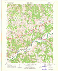
 1969 Glencoe1971 Print · USGSCovers Owen County, including Glencoe, Eagle Hill, and other nearby areas
 - 1969 Map of Sanders, 1972 Print
 1969 Sanders1972 Print · USGSCovers Owen County, including Sanders, Carson, and other nearby areas2 unique versions available
 - 1986 Map of Lexington
 1986 Lexington1986 Print · USGSCovers Owen County, including Lexington, Georgetown, and other nearby areas
Showing maps 1-25 of 42
Top cities of Owen County
Frequently asked questions
- What are the different types of historical maps available for Owen County?
- What is the oldest map of Owen County?
- Where can I purchase historical maps of Owen County for my home or office?
- Where can I download high-res historical maps of Owen County?
- Are there historical topographic maps available for Owen County?
- Is there historical aerial imagery available for Owen County?
- Where are historical maps of Owen County sourced from?