2020s Maps of Owen County, Kentucky
Explore 14 historic maps of Owen County from the 2020s. These maps offer a rare glimpse into what life looked like during the 2020s — showing old roads, neighborhoods, homes, and landmarks that have changed or disappeared over time.
Whether you're researching your family's past, planning a metal detecting trip, or studying how Owen County's landscape evolved across the 2020s, these high-resolution maps are a powerful tool for exploring the history of this region.
- Focus on a specific era: All maps on this page are from the 2020s, giving you a focused view of this time period.
- See what’s changed: Compare century-old streets, trails, and buildings to today's modern landscape using overlays and satellite layers.
- Research with precision: Use these maps for genealogy, historical research, land use analysis, or educational projects.
- View, download, or print: Maps are fully viewable online in high resolution, and can be downloaded or printed for your own records.
Start exploring Owen County's history through authentic maps from the 2020s. This is your window into the past.
Owen County, KY maps
(14)- 2022 Map of Worthville, 2022 Print
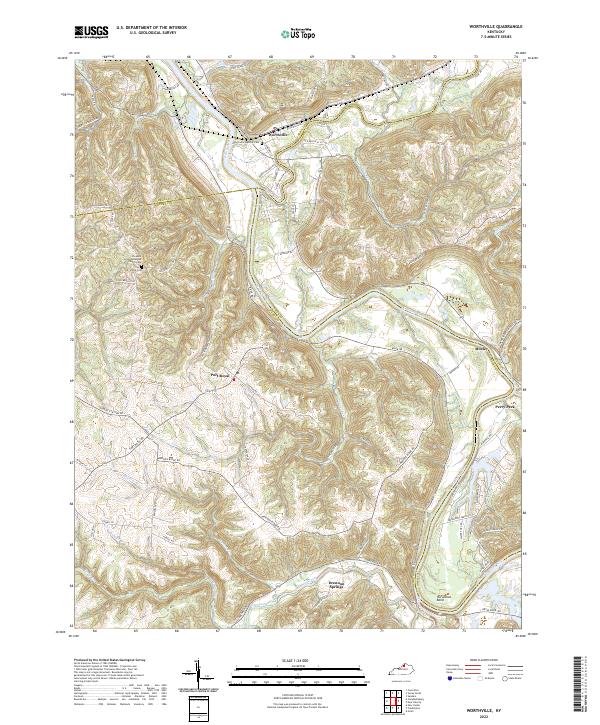 2022 Worthville2022 Print · USGSThe confluence of the Kentucky River and Eagle Creek highlights this 2022 survey of north-central Kentucky. Researchers can trace family history through sites like the Worthville Masonic Cem, Pleasant Union Methodist Church Cem, and the old settlement at Port Royal.
 - 2022 Map of Gratz, 2022 Print
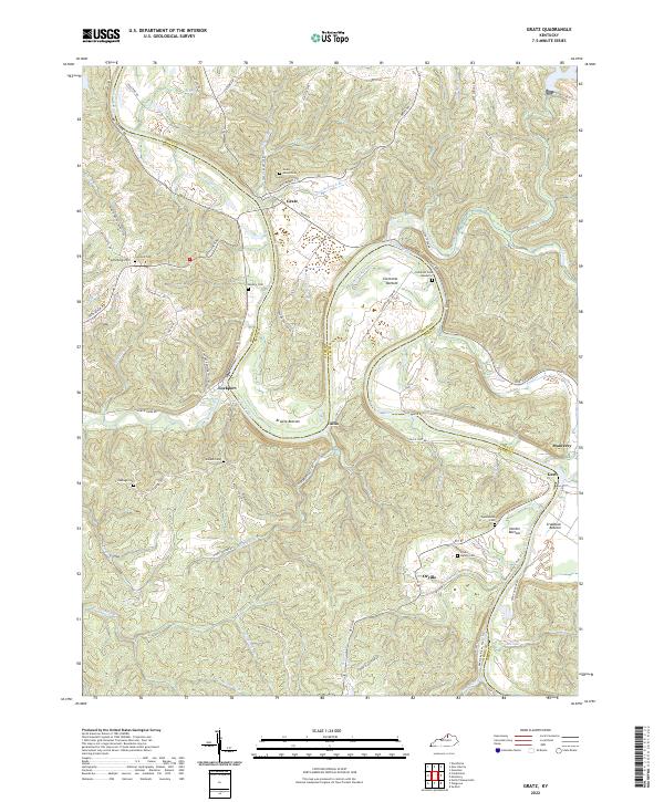 2022 Gratz2022 Print · USGSThe Kentucky River valley in Owen and Henry Counties remained a landscape of winding water and ridge-top roads into the early 2020s. Genealogists and historians can locate numerous family burial sites like Minish Cem and Wallace Cem near river towns like Lockport.
 - 2022 Map of New Liberty, 2022 Print
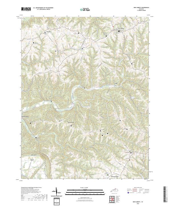 2022 New Liberty2022 Print · USGSOwen County's ridge-and-hollow country is captured here in the early twenty-first century, showing a landscape defined by small farm settlements and the Kentucky River. Local researchers can locate dozens of family burial sites like the Benjamin Hancock Cem and rural congregations such as Mount Zion Church.
 - 2022 Map of New Columbus, 2022 Print
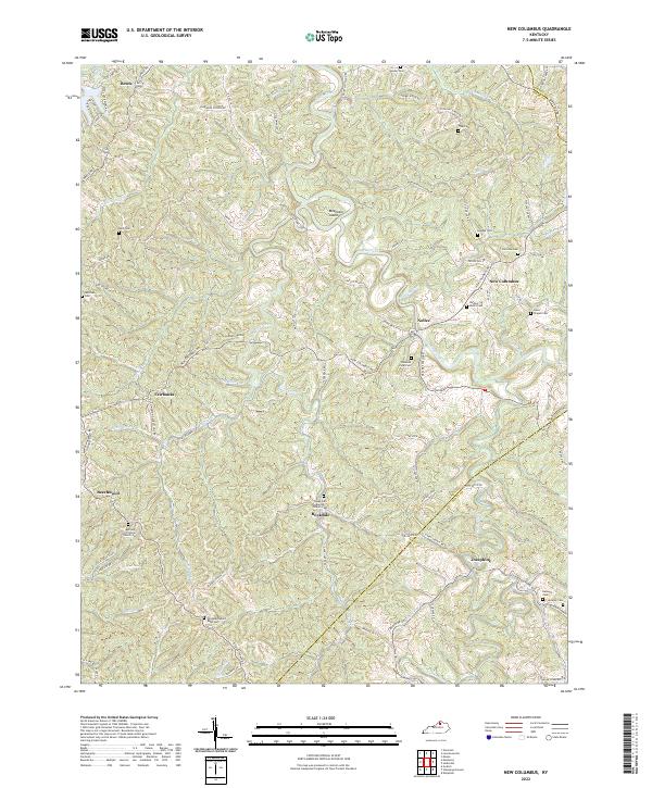 2022 New Columbus2022 Print · USGSOwen County and the rolling hills of north-central Kentucky are shown here in the early twenty-first century, centered on the community of New Columbus. Researchers can locate several rural burial grounds and churches, including Davis Chapel Cem and the Pleasant View Cem.
 - 2022 Map of Owenton, 2022 Print
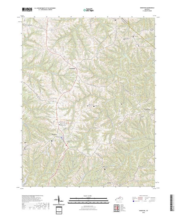 2022 Owenton2022 Print · USGSOwenton and its surrounding ridge-top communities are captured here in the early twenty-first century. Genealogists can locate family burial sites like Franks Cem and Ransdel Cem or trace landmarks such as Elmer Davis Lake and Schroder Airport.
 - 2022 Map of Lawrenceville, 2022 Print
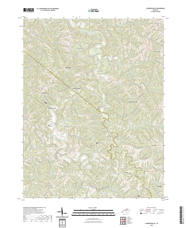 2022 Lawrenceville2022 Print · USGSThe hills of Grant and Owen counties come to life in this contemporary survey of a traditional rural landscape. Genealogists can locate family-named landmarks and burial sites such as Gaugh Cemetery, Mason Cem, and the river crossing at Hensley Ford.
 - 2022 Map of Switzer, 2022 Print
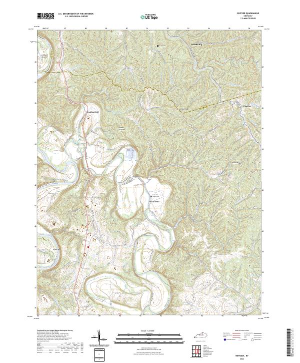 2022 Switzer2022 Print · USGSFranklin and Owen Counties are captured in this recent survey, showing the deep valleys of the Kentucky River corridor. Researchers can trace rural cemeteries and crossroads settlements like Peaks Mill, Swallowfield, and the Peaks Mill Church Cem.
 - 2022 Map of Glencoe, 2022 Print
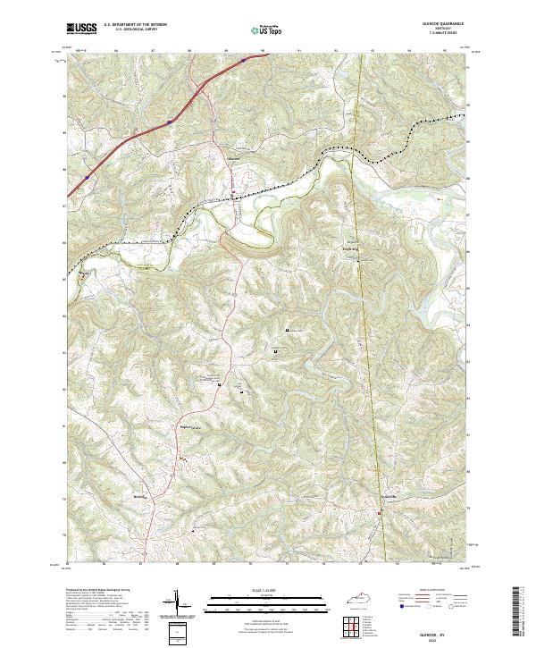 2022 Glencoe2022 Print · USGSThe hills and hollows of Gallatin and Owen counties are meticulously detailed in this recent survey. Local historians can trace family ties through several mapped burial sites like Stewart Cem and Baldwin Cem, or locate landmarks in Poplar Grove and Eagle Hill.
 - 2022 Map of Polsgrove, 2022 Print
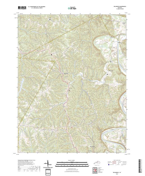 2022 Polsgrove2022 Print · USGSFranklin County and its surrounding borders are captured here in the early 2020s, showcasing a landscape of river bottoms and high ridges. Genealogists can trace family landmarks at Grub Ridge Church Cem, Moore Cem, and the settlement of Polsgrove.
 - 2022 Map of Stamping Ground, 2022 Print
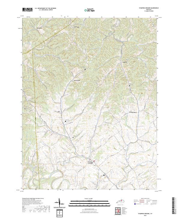 2022 Stamping Ground2022 Print · USGSNorthern Scott County maintains its rural character in the early twenty-first century, centered on the historic crossroads of Stamping Ground. Genealogists can trace family landmarks and burial sites like Bond Cem, Robey Cem, and Lindsay Cem.
 - 2022 Map of Vevay South, 2022 Print
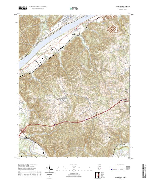 2022 Vevay South2022 Print · USGSThe riverfront communities of Vevay and Ghent sit at a historic crossing of the Ohio River in this recent survey. Genealogists and local researchers can trace numerous rural landmarks, from the Switzerland County Courthouse to the Colored Oddfellows Cem and Whitehead Cem.
 - 2022 Map of Monterey, 2022 Print
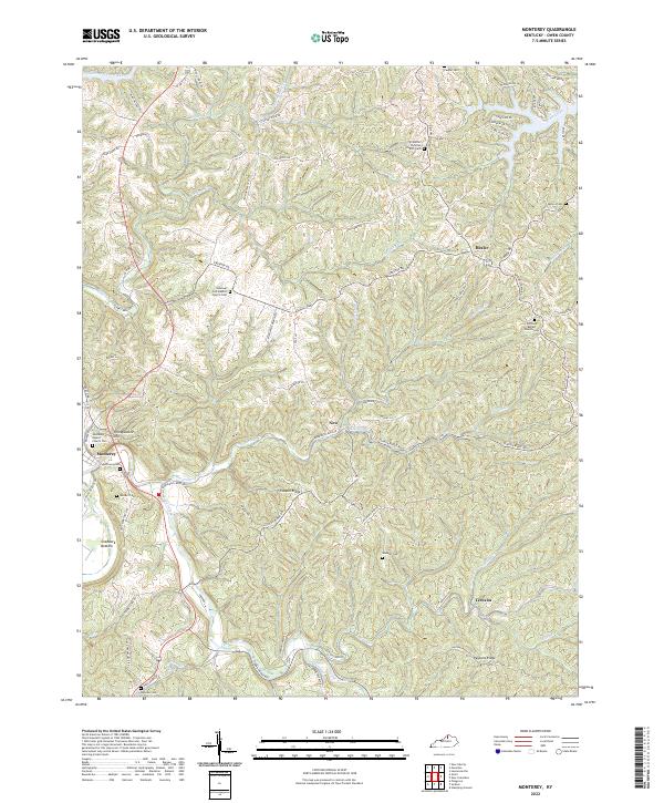 2022 Monterey2022 Print · USGSThe Kentucky River valley in Owen County remains a landscape of deep ridges and rural family nodes. Researchers can trace historic church sites and local burial grounds like Pauper Cem, Monterey Cem, and the El Bethel Christian Church Cem.
 - 2022 Map of Sadieville, 2022 Print
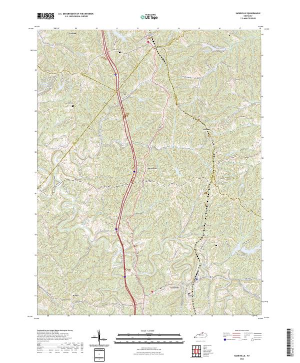 2022 Sadieville2022 Print · USGSThe crossroads of Scott and Grant counties are captured here in the early twenty-first century, centered on the historic rail-and-creek town of Sadieville. Researchers can locate several rural burial sites, including Knights of Pythias Cem and Ecklers Cem, while tracing the waters of Eagle Creek.
 - 2022 Map of Sanders, 2022 Print
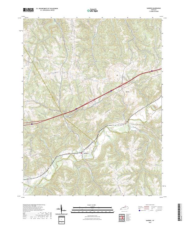 2022 Sanders2022 Print · USGSThe tri-county borderlands of North Central Kentucky come into focus in this contemporary survey. Historians can trace the winding course of Eagle Creek past local settlements like Sanders, Sparta, and Carson, or follow old ridge routes like Hathaway Ridge.
End of results
Showing maps 1-14 of 14
Top cities of Owen County
Frequently asked questions
- What are the different types of historical maps available for Owen County?
- What is the oldest map of Owen County?
- Where can I purchase historical maps of Owen County for my home or office?
- Where can I download high-res historical maps of Owen County?
- Are there historical topographic maps available for Owen County?
- Is there historical aerial imagery available for Owen County?
- Where are historical maps of Owen County sourced from?