Old Maps of Monterey, Kentucky for Academic Research
Study the evolution of Monterey with 17 high-resolution historic maps. Whether you're teaching, researching, or modeling changes in land use, these maps provide essential visual documentation of urban, environmental, and geographic change.
- Analyze long-term change: Track patterns in development, transportation, and natural features.
- Ideal for environmental or urban studies: Support academic projects with primary historical map data.
- Use in the classroom or lab: Educators and researchers rely on these maps to bring historical context to life.
These maps are a powerful tool for teaching, research, and visualizing how Monterey has changed over the decades.
Monterey, KY maps
(17)- 1906 Map of Lockport
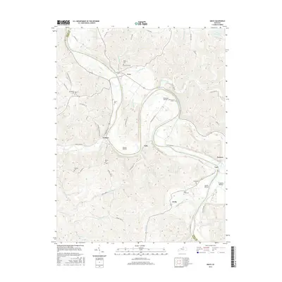
 1906 Lockport1906 Print · USGSOwen and Franklin Counties are surveyed here during the first decade of the century, following the dramatic bends of the Kentucky River. Researchers can trace the river-based economy through Lock & Dam No 1 and old crossings like Manfords Ferry.2 unique versions available
 - 1908 Map of Lockport
 1908 Lockport1908 Print · USGSLife along the Kentucky River in the early twentieth century centered on the water and the rich flats of the river bottoms. Genealogists can trace family footprints through numerous river crossings like Harpers Ferry and rural landmarks such as Tackitts Mill or the Falling Rock School.3 unique versions available
 - 1953 Map of Monterey, 1954 Print
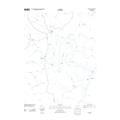
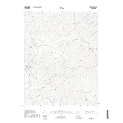
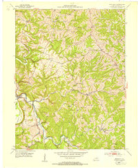 1953 Monterey1954 Print · USGSIn the early 1950s, this Owen County region was a landscape of ridge-top settlements and creek-side congregations. Genealogists and local historians can trace the foundations of Monterey and locate family landmarks like Webster Cem or Greenup Fork Ch.3 unique versions available
 - 1953 Map of Gratz, 1954 Print
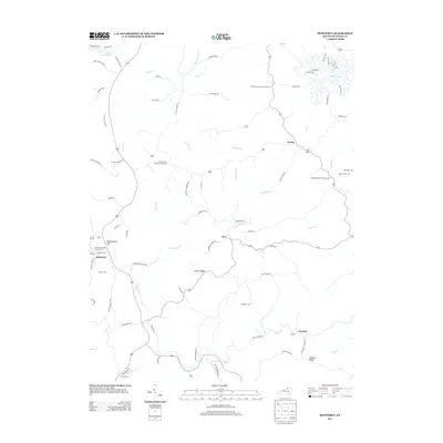
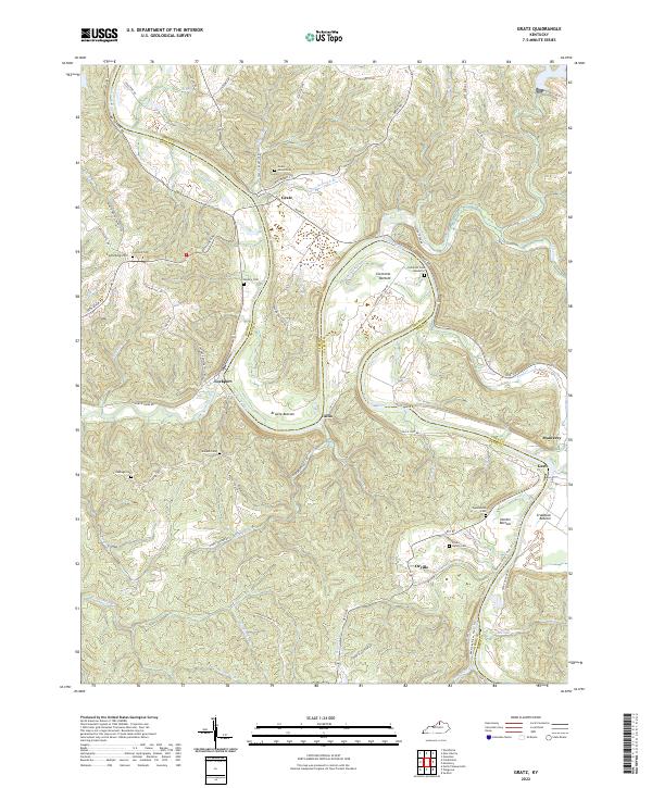
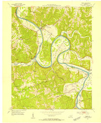 1953 Gratz1954 Print · USGSThe Kentucky River valley at the Henry and Owen county line is captured here in the early fifties, showcasing a river-centric way of life. Genealogists and local historians can locate Lock No 2, the Cemetery Hill Ch, and the town of Gratz as they appeared mid-century.3 unique versions available
 - 1956 Map of Louisville, 1971 Print
 1956 Louisville1971 Print · USGSThe Ohio River valley and the Kentucky Bluegrass are captured here during a period of rapid mid-century growth and industrial activity. Genealogists and historians can trace rail-centered towns and military land use at Fort Knox and the Jefferson Proving Ground.2 unique versions available
 - 1964 Map of Louisville
 1964 Louisville1964 Print · USGSThe Ohio River valley and Kentucky Bluegrass are captured in the mid-1960s, showing a region balanced between industrial growth and its agrarian roots. Genealogists and historians can trace the development of county seats like Shelbyville and Paris, or locate established institutions such as Georgetown College and Bernheim Forest.
 - 1986 Map of Lexington
 1986 Lexington1986 Print · USGSCentral Kentucky’s Bluegrass region is captured in the mid-eighties as urban centers like Lexington and Frankfort expand alongside deep-rooted rural hubs. Researchers can trace historic rail lines like the Southern Railway and find landmarks such as the Lexington Blue Grass Army Depot and Tacketts Mill.
 - 2010 Map of Monterey, 2010 Print
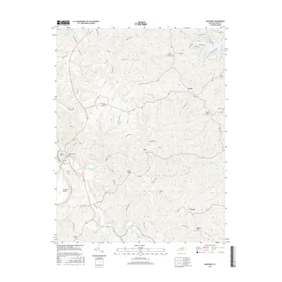
 2010 Monterey2010 Print · USGSCovers Monterey, including Hesler, Ep, and other nearby areas
 - 2010 Map of Gratz, 2010 Print
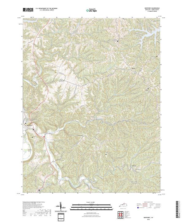
 2010 Gratz2010 Print · USGSCovers Monterey, including Gratz, Fallis, and other nearby areas
 - 2013 Map of Gratz, 2013 Print
 2013 Gratz2013 Print · USGSCovers Monterey, including Gratz, Fallis, and other nearby areas
 - 2013 Map of Monterey, 2013 Print
 2013 Monterey2013 Print · USGSCovers Monterey, including Hesler, Ep, and other nearby areas
 - 2016 Map of Monterey, 2016 Print
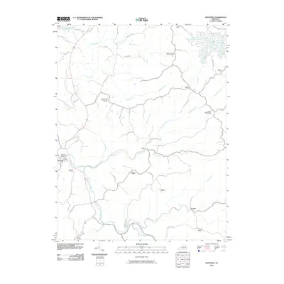
 2016 Monterey2016 Print · USGSCovers Monterey, including Hesler, Ep, and other nearby areas
 - 2016 Map of Gratz, 2016 Print
 2016 Gratz2016 Print · USGSCovers Monterey, including Gratz, Fallis, and other nearby areas
 - 2019 Map of Gratz, 2019 Print
 2019 Gratz2019 Print · USGSCovers Monterey, including Gratz, Fallis, and other nearby areas
 - 2019 Map of Monterey, 2019 Print
 2019 Monterey2019 Print · USGSCovers Monterey, including Hesler, Ep, and other nearby areas
 - 2022 Map of Gratz, 2022 Print
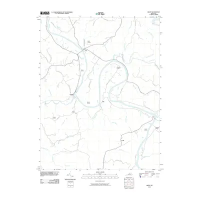
 2022 Gratz2022 Print · USGSThe Kentucky River valley in Owen and Henry Counties remained a landscape of winding water and ridge-top roads into the early 2020s. Genealogists and historians can locate numerous family burial sites like Minish Cem and Wallace Cem near river towns like Lockport.
 - 2022 Map of Monterey, 2022 Print
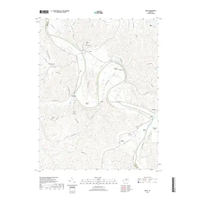
 2022 Monterey2022 Print · USGSThe Kentucky River valley in Owen County remains a landscape of deep ridges and rural family nodes. Researchers can trace historic church sites and local burial grounds like Pauper Cem, Monterey Cem, and the El Bethel Christian Church Cem.
End of results
Showing maps 1-17 of 17
Top cities near Monterey
- Lexington historical maps
- Frankfort historical maps
- Owenton historical maps
- Stamping Ground historical maps
- Worthville historical maps
- Gratz historical maps
Frequently asked questions
- What are the different types of historical maps available for Monterey?
- What is the oldest map of Monterey?
- Where can I purchase historical maps of Monterey for my home or office?
- Where can I download high-res historical maps of Monterey?
- Are there historical topographic maps available for Monterey?
- Is there historical aerial imagery available for Monterey?
- Where are historical maps of Monterey sourced from?