2020s Maps of Perry County, Kentucky
Explore 17 historic maps of Perry County from the 2020s. These maps offer a rare glimpse into what life looked like during the 2020s — showing old roads, neighborhoods, homes, and landmarks that have changed or disappeared over time.
Whether you're researching your family's past, planning a metal detecting trip, or studying how Perry County's landscape evolved across the 2020s, these high-resolution maps are a powerful tool for exploring the history of this region.
- Focus on a specific era: All maps on this page are from the 2020s, giving you a focused view of this time period.
- See what’s changed: Compare century-old streets, trails, and buildings to today's modern landscape using overlays and satellite layers.
- Research with precision: Use these maps for genealogy, historical research, land use analysis, or educational projects.
- View, download, or print: Maps are fully viewable online in high resolution, and can be downloaded or printed for your own records.
Start exploring Perry County's history through authentic maps from the 2020s. This is your window into the past.
Perry County, KY maps
(17)- 2022 Map of Louellen, 2022 Print
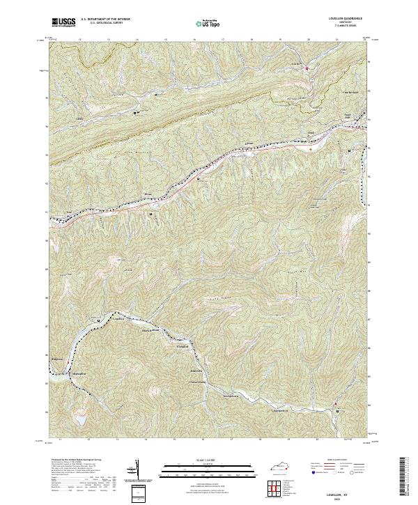 2022 Louellen2022 Print · USGSHarlan County's steep ridges and coal-valley settlements are documented here in the early twenty-first century. Researchers can trace family-named sites and mountain crossings like Robbins Cem, Hurricane Gap, and the community of Louellen.
 - 2022 Map of Tilford, 2022 Print
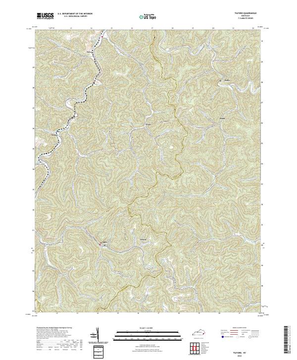 2022 Tilford2022 Print · USGSDeep in the mountains of Perry County, this map shows a region of narrow hollows and high ridges during the 2020s. Genealogists and historians can trace family locations near Slemp, find the Riddle Bradley Cemetery, or follow the winding Leatherwood Creek.
 - 2022 Map of Hyden West, 2022 Print
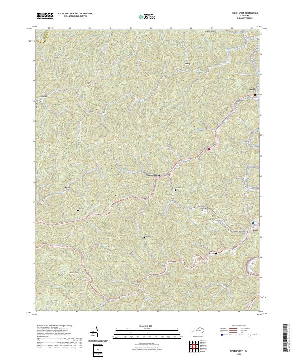 2022 Hyden West2022 Print · USGSLeslie County mountain communities are captured in this modern survey of the Kentucky coalfields. Trace family heritage and local history through numerous family landmarks like Couch Cem, Woods Cem, and the settlement at Thousandsticks.
 - 2022 Map of Hazard South, 2022 Print
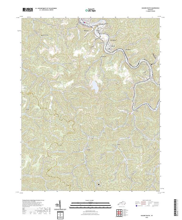 2022 Hazard South2022 Print · USGSPerry County's coal country is on full display in the early 2020s, centered on the river-bend city of Hazard. Genealogists can trace family landmarks like Englewood Cem or locate homesites in Stillhouse Hollow and along the L & N RR corridor near Viper.
 - 2022 Map of Hyden East, 2022 Print
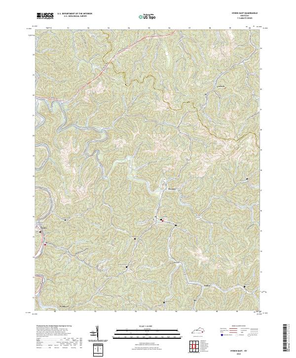 2022 Hyden East2022 Print · USGSLeslie County, Kentucky, in the early 2020s shows a landscape where mountain hollows and winding creeks define the reach of every community. Genealogists can trace family landmarks and burial sites like Hendrix Cem or Hurricane Cem near the banks of Cutshin Creek.
 - 2022 Map of Buckhorn, 2022 Print
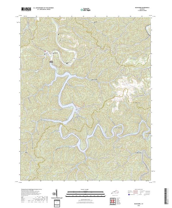 2022 Buckhorn2022 Print · USGSThe Middle Fork of the Kentucky River winds through Perry County in this contemporary study of eastern Kentucky’s ridge-and-hollow terrain. Researchers can identify local burial grounds like Deaton Cem, small communities at Confluence, and landmarks like Courthouse Fort.
 - 2022 Map of Mistletoe, 2022 Print
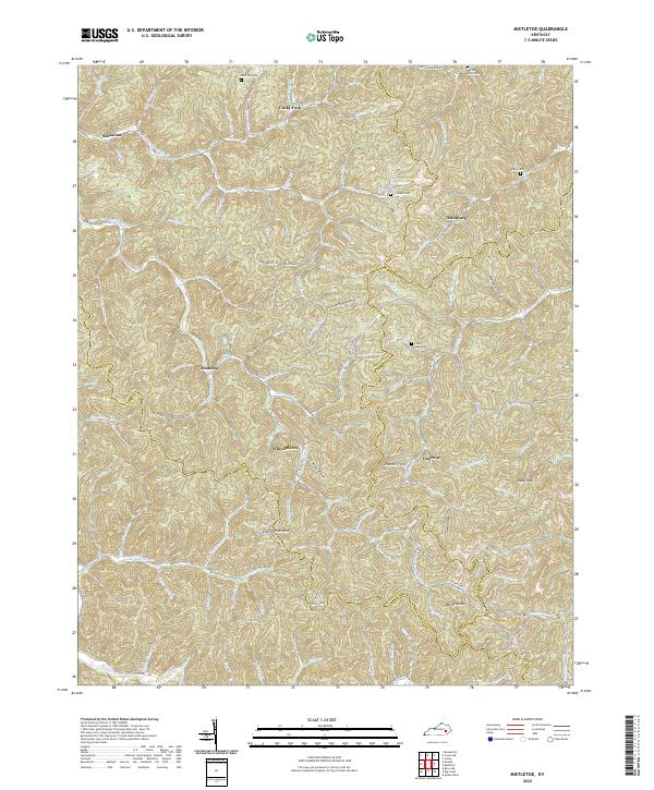 2022 Mistletoe2022 Print · USGSThe eastern Kentucky highlands come into focus here, where the Owsley and Breathitt county lines meet among deeply carved hollows. Genealogists and local researchers can locate numerous family burial sites such as Cortland Cem and Riley Cem, alongside uniquely named settlements like Whoopflarea and Doorway.
 - 2022 Map of Leatherwood, 2022 Print
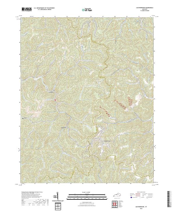 2022 Leatherwood2022 Print · USGSIn the heart of the Kentucky mountains, this 2022 survey captures the enduring settlement patterns of the Leslie and Perry county line. Researchers can trace family roots through sites like Moore Cemetery or follow the winding Cutshin Cr through Leatherwood.
 - 2022 Map of Carrie, 2022 Print
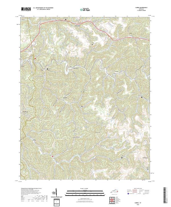 2022 Carrie2022 Print · USGSIn the heart of the Kentucky mountains, this recent survey shows the deep-hollow settlements and high ridge gaps of Knott and Perry counties. Researchers can trace family history through numerous landmarks like the Clear Creek Cem, Fisty, and the Big Branch Church Cem.
 - 2022 Map of Canoe, 2022 Print
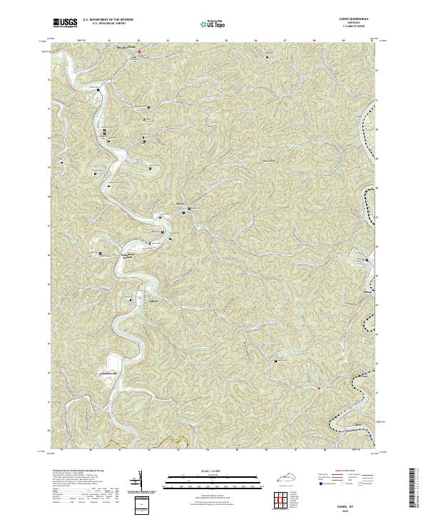 2022 Canoe2022 Print · USGSBreathitt County's river valleys and hollows are captured here during the 2020s, showing the enduring layout of rural Appalachian settlements. Researchers can trace family sites at Figured Beech Cem, visit the namesake Canoe community, or locate the historic river crossing at Crockettsville.
 - 2022 Map of Hazard North, 2022 Print
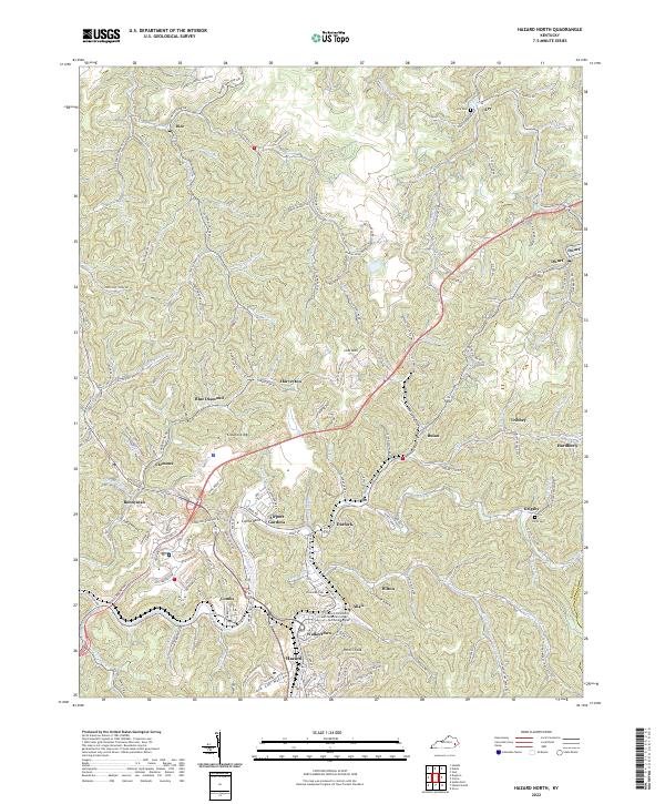 2022 Hazard North2022 Print · USGSThe North Fork Kentucky River valley comes alive in this contemporary study of the coal country around Hazard. Trace local family history and rail routes through Blue Diamond, Hardburly, and the Nobel Cockrell Cemetery.
 - 2022 Map of Krypton, 2022 Print
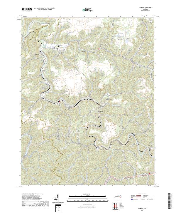 2022 Krypton2022 Print · USGSPerry County in the early 2020s is defined by a dense network of river-valley communities and narrow hollows. Researchers can trace the winding North Fork Kentucky River to find family-named landmarks like McIntosh Mountain, Red Hill Cem, and the unique town of Typo.
 - 2022 Map of Noble, 2022 Print
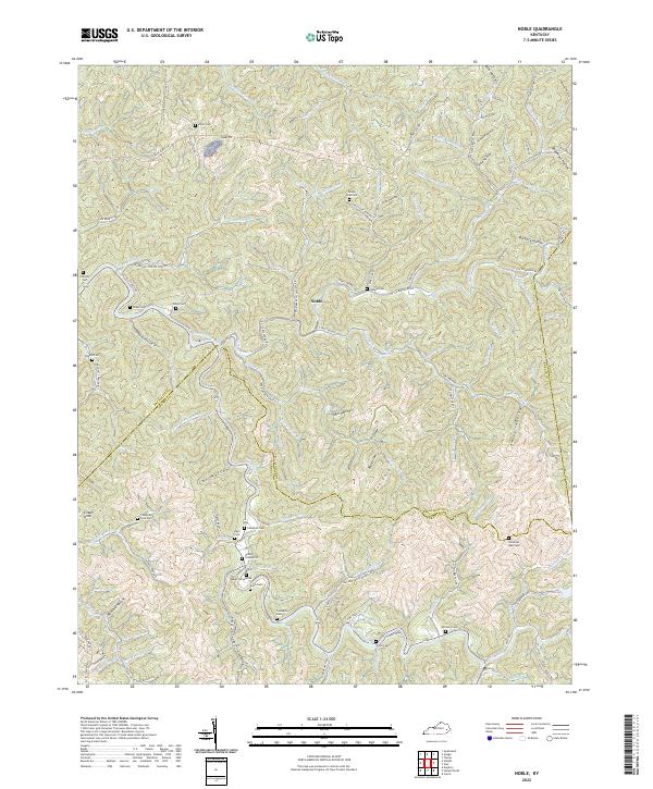 2022 Noble2022 Print · USGSBreathitt County in the early 2020s remains a landscape of deep hollows and family-held ridges centered on the settlement of Noble. Genealogists and local historians can trace legacy burial grounds like Napier Cemeteries and Haddix Cem or follow the path of Troublesome Creek.
 - 2022 Map of Vicco, 2022 Print
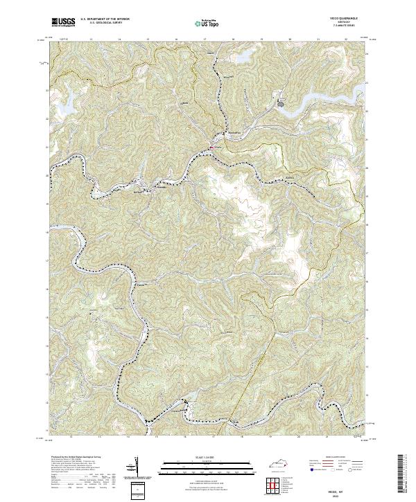 2022 Vicco2022 Print · USGSAppalachian coal country in the early 2020s shows a dense network of valley settlements and family landmarks. Trace local roots at Cornett Hill Cem or explore the river-and-rail geography of Vicco, Cornettsville, and Sassafras.
 - 2022 Map of Big Creek, 2022 Print
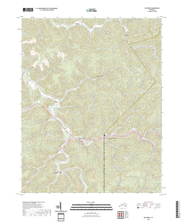 2022 Big Creek2022 Print · USGSClay County at the start of the 2020s is defined by its deep hollows and the enduring settlements of Big Creek and Bear Branch. Genealogists and hikers can trace the Redbird Crest Trl or locate the Roberts Cem near Eriline.
 - 2022 Map of Haddix, 2022 Print
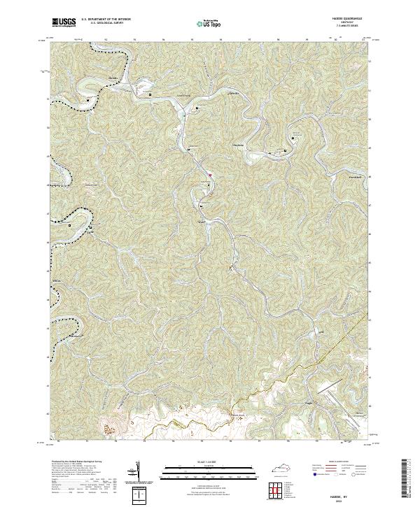 2022 Haddix2022 Print · USGSBreathitt County in the early 2020s remains a landscape of deep hollows and tightly-knit creek communities. Researchers can trace family history through sites like Strong Cem and Teapoint Cemeteries or follow the paths of Troublesome Creek and the North Fork Kentucky River.
 - 2022 Map of Vest, 2022 Print
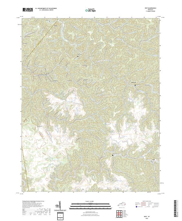 2022 Vest2022 Print · USGSTracing the creek valleys of Knott and Breathitt counties in 2022, this map shows a landscape shaped by water and tradition. Genealogists can locate family landmarks such as Compton Cem and the communities of Decoy and Elmrock along the winding hollows.
End of results
Showing maps 1-17 of 17
Top cities of Perry County
Frequently asked questions
- What are the different types of historical maps available for Perry County?
- What is the oldest map of Perry County?
- Where can I purchase historical maps of Perry County for my home or office?
- Where can I download high-res historical maps of Perry County?
- Are there historical topographic maps available for Perry County?
- Is there historical aerial imagery available for Perry County?
- Where are historical maps of Perry County sourced from?