Old Maps of Perry County, Kentucky for Genealogy
Trace your family roots with 141 historic maps of Perry County. These high-res maps reveal old neighborhoods, homesites, landmarks, and streets — helping you uncover where your ancestors lived and how the area evolved over time.
- Explore historic neighborhoods: Identify where your relatives may have lived in the 1800s or 1900s.
- Compare maps over time: Trace the changes in streets, buildings, and landmarks for multi-generational research.
- Perfect for genealogy & ancestry research: Used by family historians and researchers to map out lineage and migration.
These maps are an incredible resource for exploring your personal connection to Perry County's past.
Perry County, KY maps
(141)- 1887 Map of Jonesville
 1887 Jonesville1887 Print · USGSThe rugged borderlands of Virginia, Kentucky, and Tennessee are captured in the late nineteenth century during a time of isolated valley settlements. Genealogists and historians can trace family locations near Jonesville, Sneedville, and the remote Kyle's Ford along the Powell River.
 - 1891 Map of Manchester
 1891 Manchester1891 Print · USGSEastern Kentucky's mountain settlements and early salt industry come to life in the years following the Reconstruction era. Genealogists and historians can locate early family landmarks such as Moore Store, the Salt Works, and Boush Store.7 unique versions available
 - 1891 Map of Hazard
 1891 Hazard1891 Print · USGSEastern Kentucky's coal country is shown here in the late nineteenth century, focusing on the river-fed valleys of the Cumberland Plateau. Researchers can trace the early layouts of Hazard and Hyden or locate family homesteads near Crockettsville and Dwarf.5 unique versions available
 - 1891 Map of Jonesville
 1891 Jonesville1891 Print · USGSThe tri-state borderlands of Virginia, Kentucky, and Tennessee are captured here in the late nineteenth century. Researchers can trace early river crossings and mountain settlements like Poteet Ford, Shafers P.O., and Mt Pleasant.9 unique versions available
 - 1913 Map of Buckhorn
 1913 Buckhorn1913 Print · USGSThe North and Middle Forks of the Kentucky River dominate this pre-WWI landscape of steep ridges and deep valleys. Genealogists can locate family homesteads near Witherspoon College or trace ancestors along the Lexington and Eastern Ry through Chavies and Haddix.2 unique versions available
 - 1914 Map of Troublesome
 1914 Troublesome1914 Print · USGSEastern Kentucky's mountain hollows and ridge-top boundaries are captured here during the early 20th century. Genealogists and historians can trace numerous rural educational sites like Balls Fork School and Caney School, or locate small settlements such as Buckhorn and Dwarf.3 unique versions available
 - 1916 Map of Cornettsville
 1916 Cornettsville1916 Print · USGSEastern Kentucky's coal and timber country comes alive in this survey of the North Fork Kentucky River valley during the mid-1910s. Genealogists can trace family footprints through numerous rural school sites like Redoak School and vanished river stops such as Dean Sta and Cornettsville.3 unique versions available
 - 1916 Map of Nolansburg
 1916 Nolansburg1916 Print · USGSThe rugged Cumberland Plateau along the Kentucky and Virginia border is captured here during the first World War. Researchers can trace early railroad history and mountain genealogy through labels like Nolansburg, Panorama Station, and the slopes of Black Mountain.
 - 1916 Map of Hyden
 1916 Hyden1916 Print · USGSThe deep hollows of the Kentucky mountains are captured here during the First World War, just as small communities began to coalesce along the waterways. Genealogists can trace family footprints near Hoskinson, Chappell, and landmarks like Levi Lewis Creek.
 - 1919 Map of Nolansburg
 1919 Nolansburg1919 Print · USGSHarlan County and the Virginia borderlands are captured here during the height of early twentieth-century mountain development. Local historians can trace the foundations of the Pine Mountain Settlement School and vanished industrial sites like Leona Mines PO and Bondurant.3 unique versions available
 - 1919 Map of Hyden
 1919 Hyden1919 Print · USGSThe Middle Fork of the Kentucky River winds through Leslie County during the era of early mountain settlement. Genealogists and researchers can trace family landmarks along Hell for Certain Creek or locate old homesteads near Asher and Wooton.2 unique versions available
 - 1953 Map of Buckhorn, 1954 Print
 1953 Buckhorn1954 Print · USGSThe Middle Fork of the Kentucky River winds through Perry and Leslie Counties in the early fifties, connecting isolated mountain communities. Genealogists and historians can locate family landmarks like Witherspoon College, Johnson Church, and several rural schoolhouses including Otter Creek School.
 - 1953 Map of Hyden West, 1954 Print
 1953 Hyden West1954 Print · USGSCentral Leslie County comes into focus in the early fifties, documenting the remote mountain hollows and community hubs of the Kentucky hills. Genealogists can trace family names through landmarks like Thousandsticks, Hals Fork Sch, and the Brethren Ch.
 - 1953 Map of Big Creek, 1954 Print
 1953 Big Creek1954 Print · USGSThe Red Bird River valley in the early fifties shows a landscape of mountain hollows and riverside communities. Genealogists can trace family footprints at Brutus Ch, New Berry Sch, and old settlements like Big Creek or Peabody.2 unique versions available
 - 1953 Map of Mistletoe, 1955 Print
 1953 Mistletoe1955 Print · USGSDeep in the Kentucky hills during the early fifties, this area shows a landscape of hollows and ridges at the height of its rural school system. Genealogists can trace family names through landmarks like Morris Fork Cem, Sandlin Sch, and the community at Sebastian.2 unique versions available
 - 1954 Map of Noble, 1955 Print
 1954 Noble1955 Print · USGSThe Kentucky coalfields of Breathitt and Perry counties are shown here in the mid-fifties, centered on the winding Troublesome Creek. Genealogists can trace family landmarks like Noble Gems and John Noble, or locate the Baptist Childrens Home.4 unique versions available
 - 1954 Map of Krypton, 1955 Print
 1954 Krypton1955 Print · USGSEastern Kentucky's river valleys and rail lines define this mid-century look at the Perry County coalfields. Genealogists and historians can trace numerous small schoolhouses like Red Hill Sch and riverside stops along the Louisville and Nashville Railroad from Chavies to Busy.
 - 1954 Map of Hyden East, 1955 Print
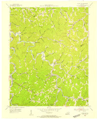 1954 Hyden East1955 Print · USGSLeslie County mountain communities are captured in the mid-1950s, showing the ridge-and-hollow life of the Kentucky Appalachians. Genealogists can trace family roots through numerous mountain schoolhouses like Avawam Sch and Flackey Sch or the riverside settlement at Wendover.
 - 1954 Map of Haddix, 1955 Print
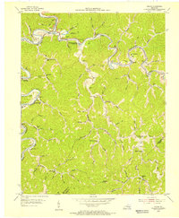 1954 Haddix1955 Print · USGSBreathitt County in the mid-fifties is seen here through its intricate network of river-bottom settlements and remote ridge schools. Researchers can trace family ties through numerous mountain burial grounds and landmarks like Haddix Cem, Whick Sch, and New Bethlehem Ch.
 - 1954 Map of Vest, 1955 Print
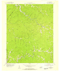 1954 Vest1955 Print · USGSKnott County's narrow valleys and ridge-top boundaries are captured here in the mid-fifties, showing the region's rural character before modern consolidation. Genealogists can locate family-named hollows like John Riley Br and local institutions such as Decoy Sch and Baker Sch.5 unique versions available
 - 1954 Map of Tilford, 1956 Print
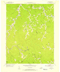 1954 Tilford1956 Print · USGSEastern Kentucky's coal-country hollows are shown in detail during the mid-1950s, as small rail-side communities thrived along the ridges. Genealogists can trace family landmarks and rural institutions like Mt Olivet Ch, Slemp, and Turkey Creek Sch.3 unique versions available
 - 1954 Map of Vicco, 1956 Print
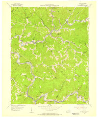 1954 Vicco1956 Print · USGSThe coal and rail corridors of Perry and Knott counties are captured here in the mid-1950s. Researchers can trace family sites at the Open Door Childrens Home or locate early rural schools and churches like Logwood Sch and Little Dove Ch.4 unique versions available
 - 1954 Map of Hazard South, 1956 Print
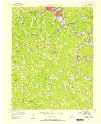 1954 Hazard South1956 Print · USGSThe Kentucky coalfields were in full production in the mid-1950s, with company towns and rail lines lining the riverbanks. Genealogists can locate family landmarks like Sulphur Springs Sch, Logwood Ch, and the many mines near Glomawr.2 unique versions available
 - 1954 Map of Canoe, 1956 Print
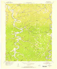 1954 Canoe1956 Print · USGSThe Cumberland Plateau of Breathitt County is captured here in the mid-1950s, showing a landscape defined by the Kentucky River's forks. Genealogists can trace family burial grounds like Hounshell Cem and Spicer Cem or locate vanished post offices at Juan PO and Beech PO.
 - 1954 Map of Carrie, 1956 Print
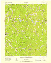 1954 Carrie1956 Print · USGSThe Knott County highlands in the mid-1950s reveal a landscape of deep hollows and dispersed mountain communities. Genealogists can locate numerous rural schools and churches like Ode Everage Sch, Maggie Memorial Ch, and the settlement of Emmalena.4 unique versions available
Showing maps 1-25 of 141
Top cities of Perry County
Frequently asked questions
- What are the different types of historical maps available for Perry County?
- What is the oldest map of Perry County?
- Where can I purchase historical maps of Perry County for my home or office?
- Where can I download high-res historical maps of Perry County?
- Are there historical topographic maps available for Perry County?
- Is there historical aerial imagery available for Perry County?
- Where are historical maps of Perry County sourced from?