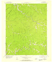
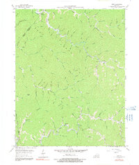
1954 Map of Vest
USGS Topo · Published 1955About this map
Balls Fork and the winding waters of Quicksand Cr carve through the heavily dissected plateau of Knott County in this mid-century portrait. The settlement pattern follows the narrow valley floors, with small communities like Vest and Elmrock established at key drainage convergences. This era shows a landscape defined by its rural infrastructure, where local education was decentralized across several small facilities, including Baker Sch, Dobson Sch, and Puncheon Sch.
Find a feature on this map
77 named features on this map. Tap any name to fly to it.
Don’t see what you’re looking for? This feature index may not catch every label — zoom into the map to look around manually.
Map Details
Editions of this 1954 Vest Map
5 editions found
Other maps of this area

1886 · Prestonsburg
USGS Topo · 1:125,000

1889 · Salyersville
USGS Topo · 1:125,000

1890 · Whitesburg
USGS Topo · 1:125,000

1891 · Hazard
USGS Topo · 1:125,000

1891 · Salyersville
USGS Topo · 1:125,000

1892 · Whitesburg
USGS Topo · 1:125,000

1892 · Prestonsburg
USGS Topo · 1:125,000

1899 · Salyersville
USGS Topo · 1:125,000

1912 · Hindman
USGS Topo · 1:48,000

1914 · Troublesome
USGS Topo · 1:62,500