Old Maps of Robertson County, Kentucky
Explore 47 old maps of Robertson County, spanning from 1915 to today. These high-resolution historic maps reveal how streets, neighborhoods, landmarks, and natural features evolved over time — perfect for genealogy, metal detecting, research, and local history exploration.
What you can do with these maps:
- See how Robertson County changed over time: Compare historical maps to modern-day views to trace roads, homesites, rail lines & more.
- View detailed metadata: Each map includes creators, publishers, year, scale, and archive source.
- Overlay maps with satellite & LiDAR: Visualize the past alongside modern tools to explore terrain & human change.
- Trusted historical sources: Maps sourced from the USGS, Library of Congress, and other archives.
- Access maps your way: View online, download high-res files, or order prints for personal or research use.
Start exploring old maps of Robertson County to uncover forgotten places, hidden landmarks, and the deep history beneath your feet.
Robertson County, KY maps
(47)- 1915 Map of Maysville, 1962 Print
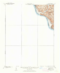 1915 Maysville1962 Print · USGSThe Ohio River valley near the Kentucky border comes to life in this survey from the years before the Great War. Genealogists and local historians can trace rural family-named landmarks like Porter Ridge and remote schoolhouses including Stephenson School and Flaugher School.
 - 1919 Map of Maysville, 1936 Print
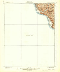 1919 Maysville1936 Print · USGSThe Ohio River bluffs above Ripley were a patchwork of ridge-top farms and rural school districts during the early twentieth century. Researchers can trace the paths of old township roads to find Hawk School, the landing at Aberdeen, and family-named landmarks like Flaugher Ridge.
 - 1952 Map of Cowan, 1953 Print
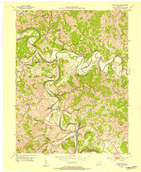
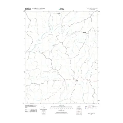
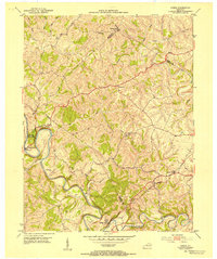 1952 Cowan1953 Print · USGSThe rural landscapes of Fleming and Nicholas counties are captured here in the early fifties, centered on the winding Licking River. Genealogists and historians can locate family landmarks such as Cowan, Blue Licks Spr, and Furman Chapel Ch.3 unique versions available
 - 1952 Map of Sardis, 1953 Print
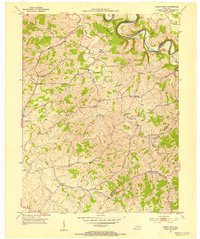
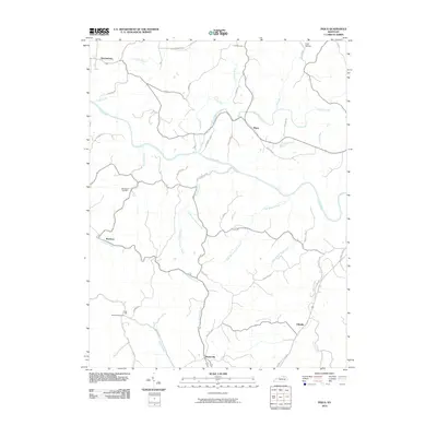
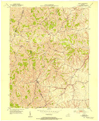 1952 Sardis1953 Print · USGSKentucky's ridge-and-hollow landscape comes into sharp focus in the early fifties at the junction of Mason, Bracken, and Robertson counties. Family historians can trace rural home sites and community landmarks like Salem Ch, Abigail, and the winding North Fork Licking River.2 unique versions available
 - 1952 Map of Mount Olivet, 1954 Print
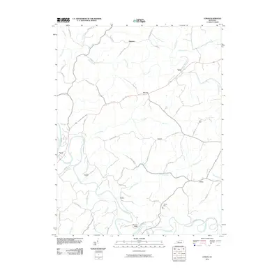
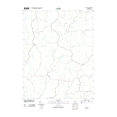
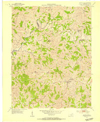 1952 Mount Olivet1954 Print · USGSMount Olivet and the surrounding Robertson County hills are captured here in the early fifties. Researchers can trace the rural landscape's family-named landmarks and community hubs, from Fosters Chapel and McKindree Ch to the small settlement at Santa Fe.
 - 1952 Map of Piqua, 1954 Print
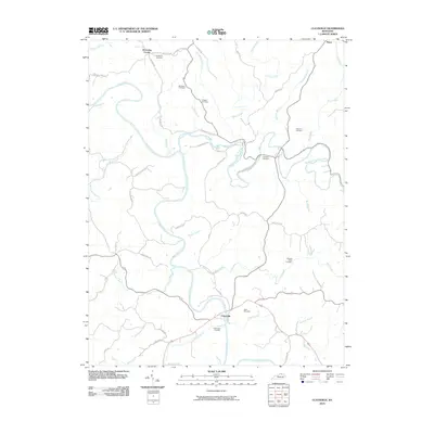
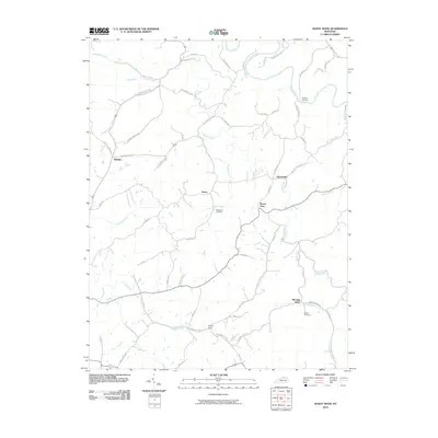
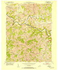 1952 Piqua1954 Print · USGSNicholas and Robertson counties are shown in the early fifties as the Licking River cuts through the northern Kentucky hills. Genealogists can find numerous rural landmarks such as Wagoners Chapel, Needmore Ch, and the small community of Kentontown.
 - 1952 Map of Shady Nook, 1954 Print
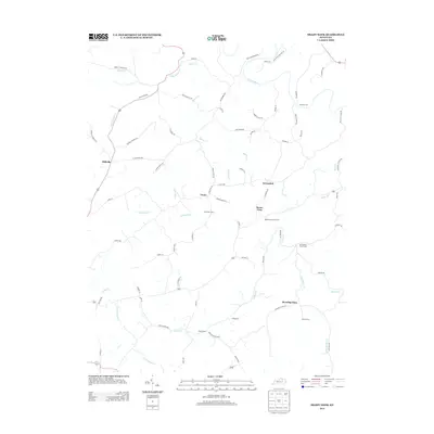
 1952 Shady Nook1954 Print · USGSHarrison County in the early fifties is shown here as a series of tight-knit rural communities connected by the winding Licking River. You can trace old family roots through landmarks like Harding Cem, the Republican Ch, and the crossroads at Shady Nook.2 unique versions available
 - 1952 Map of Claysville, 1954 Print
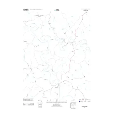
 1952 Claysville1954 Print · USGSNorthern Kentucky's river valleys and ridgeline settlements are meticulously documented in the early fifties. Genealogists and local historians can trace family locations near Browning Corner, Milford, and country churches like Barlow Ch.2 unique versions available
 - 1956 Map of Louisville, 1971 Print
 1956 Louisville1971 Print · USGSThe Ohio River valley and the Kentucky Bluegrass are captured here during a period of rapid mid-century growth and industrial activity. Genealogists and historians can trace rail-centered towns and military land use at Fort Knox and the Jefferson Proving Ground.2 unique versions available
 - 1957 Map of Huntington, 1966 Print
 1957 Huntington1966 Print · USGSThe industrial heart of the Ohio River valley is captured here in the mid-sixties, showing the growth of Huntington and Ashland. Researchers can trace the extensive rail networks of the Chesapeake and Ohio RR and locate sites like the Chief Cornstalk Hunting Ground.3 unique versions available
 - 1960 Map of Huntington
 1960 Huntington1960 Print · USGSThe tri-state river valley thrived in the late fifties as a hub of heavy industry and Appalachian rail transit. Genealogists and historians can trace the connection between river towns like Ashland and Portsmouth or locate family homesteads near Coleman Ridge.
 - 1964 Map of Louisville
 1964 Louisville1964 Print · USGSThe Ohio River valley and Kentucky Bluegrass are captured in the mid-1960s, showing a region balanced between industrial growth and its agrarian roots. Genealogists and historians can trace the development of county seats like Shelbyville and Paris, or locate established institutions such as Georgetown College and Bernheim Forest.
 - 1982 Map of Morehead, 1983 Print
 1982 Morehead1983 Print · USGSThe foothills of northeastern Kentucky come alive in the early eighties, showcasing a landscape defined by timber, limestone caves, and major reservoirs. Local researchers can trace the development of Morehead State University or locate old crossings at Plummers Mill and Salt Lick.
 - 1986 Map of Lexington
 1986 Lexington1986 Print · USGSCentral Kentucky’s Bluegrass region is captured in the mid-eighties as urban centers like Lexington and Frankfort expand alongside deep-rooted rural hubs. Researchers can trace historic rail lines like the Southern Railway and find landmarks such as the Lexington Blue Grass Army Depot and Tacketts Mill.
 - 1986 Map of Maysville
 1986 Maysville1986 Print · USGSThe Ohio River valley in the mid-eighties reveals a landscape of industrial river towns and sprawling public lands spanning the Kentucky and Ohio border. Researchers can trace the rail corridors of the Chesapeake and Ohio Railway or locate landmarks like Confidence Cemetery and the Fleming-Mason Airport.
 - 1986 Map of Falmouth
 1986 Falmouth1986 Print · USGSNorthern Kentucky and the Ohio River valley are shown here in the mid-1980s, highlighting the region's complex river-and-rail geography. Genealogists and researchers can trace the roads connecting Big Bone Lick, Zion Church, and river towns like Falmouth and Augusta.2 unique versions available
 - 1991 Map of Maysville
 1991 Maysville1991 Print · USGSThe Ohio River valley at the turn of the nineties reveals a landscape of river-bend towns and dense forest preserves. Trace local history through landmark sites like Confidence Cemetery, the small-town streets of Ripley, and the river reaches of Manchester Island No 1.
 - 2010 Map of Cowan, 2010 Print
 2010 Cowan2010 Print · USGSCovers Robertson County, including Blue Licks, Fairview, and other nearby areas
 - 2010 Map of Claysville, 2010 Print
 2010 Claysville2010 Print · USGSCovers Robertson County, including Browning Corner, Milford, and other nearby areas
 - 2010 Map of Piqua, 2010 Print
 2010 Piqua2010 Print · USGSCovers Robertson County, including Barterville, Kentontown, and other nearby areas
 - 2010 Map of Mount Olivet, 2010 Print
 2010 Mount Olivet2010 Print · USGSCovers Robertson County, including Mount Olivet, Stonewall, and other nearby areas
 - 2010 Map of Sardis, 2010 Print
 2010 Sardis2010 Print · USGSCovers Robertson County, including Sardis, Abigail, and other nearby areas
 - 2010 Map of Shady Nook, 2010 Print
 2010 Shady Nook2010 Print · USGSCovers Robertson County, including Oddville, Morning Glory, and other nearby areas
 - 2013 Map of Shady Nook, 2013 Print
 2013 Shady Nook2013 Print · USGSCovers Robertson County, including Oddville, Morning Glory, and other nearby areas
 - 2013 Map of Claysville, 2013 Print
 2013 Claysville2013 Print · USGSCovers Robertson County, including Browning Corner, Milford, and other nearby areas
Showing maps 1-25 of 47
Top cities of Robertson County
Frequently asked questions
- What are the different types of historical maps available for Robertson County?
- What is the oldest map of Robertson County?
- Where can I purchase historical maps of Robertson County for my home or office?
- Where can I download high-res historical maps of Robertson County?
- Are there historical topographic maps available for Robertson County?
- Is there historical aerial imagery available for Robertson County?
- Where are historical maps of Robertson County sourced from?