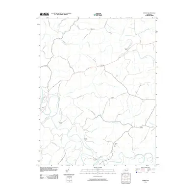
2010 Map of Cowan
USGS Topo · Published 2010About this map
The Licking River carves through the landscape of northern Kentucky, defining the western edge of this 2010 topographic study. Historically significant landmarks such as Blue Licks Spring anchor the riverfront, while the interior is dotted with small rural communities like Cowan, Fairview, and Alhambra. For those tracing local heritage, the map identifies several family and community burial grounds, including Sunnyside Cemetery, Standiford Cemetery, and Herndon Cemetery.
Find a feature on this map
56 named features on this map. Tap any name to fly to it.
Don’t see what you’re looking for? This feature index may not catch every label — zoom into the map to look around manually.
Map Details
Editions of this 2010 Cowan Map
This is the sole edition of this map. No revisions or reprints were ever made.
Other maps of this area

1915 · Maysville
USGS Topo · 1:62,500

1919 · Maysville
USGS Topo · 1:62,500

1952 · Cowan
USGS Topo · 1:24,000

1952 · Sherburne
USGS Topo · 1:24,000

1952 · Elizaville
USGS Topo · 1:24,000

1952 · Sardis
USGS Topo · 1:24,000

1952 · Mount Olivet
USGS Topo · 1:24,000

1952 · Piqua
USGS Topo · 1:24,000
1952 · Mays Lick
USGS Topo · 1:24,000

1953 · Carlisle
USGS Topo · 1:24,000