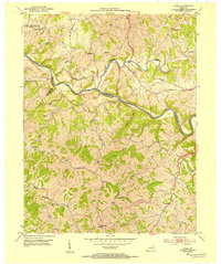
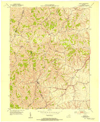
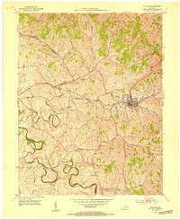
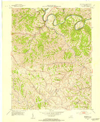
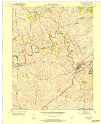
1952 Map of Piqua
USGS Topo · Published 1954About this map
The Licking River and its North Fork carve through the deep ridges of Nicholas and Robertson counties, defining the rural character of this Bluegrass region. Small settlements like Piqua and Kentontown anchor the hillsides, connected by winding roads that follow the high ground between creek drainages. The map reveals a high density of small-scale community landmarks essential for family history research, including Ball Hill Ch, Wagoners Chapel, and the Thomas Sch.
Find a feature on this map
33 named features on this map. Tap any name to fly to it.
Don’t see what you’re looking for? This feature index may not catch every label — zoom into the map to look around manually.
Map Details
Editions of this 1952 Piqua Map
This is the sole edition of this map. No revisions or reprints were ever made.
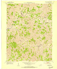
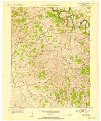
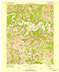
Other maps of this area
1915 · Maysville
USGS Topo · 1:62,500
1919 · Maysville
USGS Topo · 1:62,500
1952 · Cowan
USGS Topo · 1:24,000
1952 · Sardis
USGS Topo · 1:24,000
1952 · Mount Olivet
USGS Topo · 1:24,000
1952 · Shady Nook
USGS Topo · 1:24,000
1952 · Claysville
USGS Topo · 1:24,000
1953 · Carlisle
USGS Topo · 1:24,000
1953 · Moorefield
USGS Topo · 1:24,000
1953 · Millersburg
USGS Topo · 1:24,000