
1953 Map of Moorefield
USGS Topo · Published 1954About this map
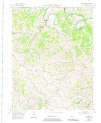
The Licking River winds deeply through the northern portion of this 1953 landscape, carving a meandering path that defines the border between Fleming and Nicholas Counties. Settlement is concentrated along the ridge lines and creek valleys, notably at Moorefield, where a network of local roads converges. The topography is dominated by dissected hills and narrow hollows, with drainage provided by substantial waterways like Fleming Creek and Cassidy Creek.
Find a feature on this map
25 named features on this map. Tap any name to fly to it.
Don’t see what you’re looking for? This feature index may not catch every label — zoom into the map to look around manually.
Map Details
Editions of this 1953 Moorefield Map
2 editions found
Other maps of this area

1952 · Cowan
USGS Topo · 1:24,000

1952 · Owingsville
USGS Topo · 1:24,000

1952 · Sharpsburg
USGS Topo · 1:24,000

1952 · Sherburne
USGS Topo · 1:24,000

1952 · Elizaville
USGS Topo · 1:24,000

1952 · North Middletown
USGS Topo · 1:24,000

1952 · Piqua
USGS Topo · 1:24,000

1953 · Carlisle
USGS Topo · 1:24,000

1956 · Louisville
USGS Topo · 1:250,000

1957 · Huntington
USGS Topo · 1:250,000