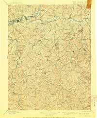
1957 Map of Huntington
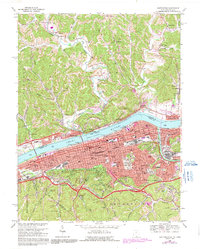
USGS Topo · Published 1966About this map
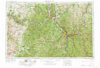
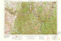
The Ohio River valley serves as the industrial and transport spine for this mid-1960s survey, connecting major regional hubs including Huntington, Ashland, and Portsmouth. This map documents a critical corridor of the tri-state area where the Big Sandy River and Tug Fork define the borders between Ohio, Kentucky, and West Virginia. Heavy rail infrastructure, including the Chesapeake and Ohio RR and Norfolk and Western RR, follows the river's winding course, illustrating the coal and manufacturing economy of the era. Beyond the industrial centers, the landscape is defined by vast public lands such as the Wayne National Forest and Daniel Boone National Forest. To the east, the Chief Cornstalk Hunting Ground stands near the confluence of the Kanawha River at Point Pleasant, while smaller settlements like Maysville and Georgetown dot the western reaches of the survey.
Find a feature on this map
82 named features on this map. Tap any name to fly to it.
Don’t see what you’re looking for? This feature index may not catch every label — zoom into the map to look around manually.
Map Details
Editions of this 1957 Huntington Map
3 editions found
Historical Maps of Huntington Through Time
9 maps found