
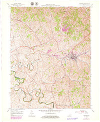
1953 Map of Carlisle
USGS Topo · Published 1954About this map
The Nicholas County seat of Carlisle serves as the central hub of this mid-century landscape, where the Louisville and Nashville railroad cuts through the town's core near the County High Sch. The surrounding terrain is defined by the winding course of Hinkston Creek, which marks the southwestern border between Nicholas and Bourbon Counties. Small rural communities like Oakland Mills and McBrides anchor the agricultural uplands, connected by a network of roads that follow the ridges between deep creek valleys.
Find a feature on this map
29 named features on this map. Tap any name to fly to it.
Don’t see what you’re looking for? This feature index may not catch every label — zoom into the map to look around manually.
Map Details
Editions of this 1953 Carlisle Map
2 editions found
Other maps of this area

1952 · Cowan
USGS Topo · 1:24,000

1952 · Sharpsburg
USGS Topo · 1:24,000

1952 · Paris East
USGS Topo · 1:24,000

1952 · North Middletown
USGS Topo · 1:24,000

1952 · Piqua
USGS Topo · 1:24,000

1952 · Shady Nook
USGS Topo · 1:24,000

1953 · Moorefield
USGS Topo · 1:24,000

1953 · Millersburg
USGS Topo · 1:24,000

1956 · Louisville
USGS Topo · 1:250,000

1957 · Huntington
USGS Topo · 1:250,000