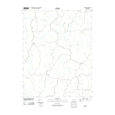
2010 Map of Sardis
USGS Topo · Published 2010About this map
Sardis and the surrounding rural landscape in northeastern Kentucky are defined by a dense network of creek valleys and ridges. This topography is dominated by the North Fork Licking River, which winds through the northwestern corner of the quadrangle, joined by tributaries such as Shannon Creek and Two Lick Creek. The region reflects a classic central Kentucky settlement pattern where small communities like Shannon and Abigail are linked by long-established routes, including Old Sardis Pike and Three Lick Pike.
Find a feature on this map
44 named features on this map. Tap any name to fly to it.
Don’t see what you’re looking for? This feature index may not catch every label — zoom into the map to look around manually.
Map Details
Editions of this 2010 Sardis Map
This is the sole edition of this map. No revisions or reprints were ever made.
Other maps of this area

1915 · Maysville
USGS Topo · 1:62,500

1919 · Maysville
USGS Topo · 1:62,500

1952 · Cowan
USGS Topo · 1:24,000

1952 · Germantown
USGS Topo · 1:24,000

1952 · Elizaville
USGS Topo · 1:24,000

1952 · Maysville West
USGS Topo · 1:24,000

1952 · Sardis
USGS Topo · 1:24,000

1952 · Mount Olivet
USGS Topo · 1:24,000

1952 · Piqua
USGS Topo · 1:24,000
1952 · Mays Lick
USGS Topo · 1:24,000