
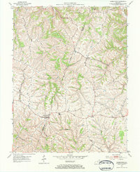
1952 Map of Germantown
USGS Topo · Published 1953About this map
Germantown straddles the county line at the start of the 1950s, serving as a focal point for the rural communities of Bracken and Mason Counties. This agricultural landscape is defined by the sharp dissected plateaus drained by Bracken Creek and Little Bracken Creek to the north, while the southern reaches feed into Two Lick Creek and Pommel Creek. The settlement pattern follows the high ridges, with Minerva and Fernleaf established at key road intersections. A notable center of local activity is visible at the Fairgrounds just east of the main Germantown village. Small rural Cem sites and institutions like Sharon Ch are tucked into the valleys and along the winding ridge-top routes, reflecting a mid-century Kentucky countryside still deeply tied to its local drainage basins and family-owned farmsteads.
Find a feature on this map
16 named features on this map. Tap any name to fly to it.
Don’t see what you’re looking for? This feature index may not catch every label — zoom into the map to look around manually.
Map Details
Editions of this 1952 Germantown Map
2 editions found
Other maps of this area

1915 · Maysville
USGS Topo · 1:62,500

1919 · Maysville
USGS Topo · 1:62,500

1928 · Higginsport
USGS Topo · 1:48,000

1931 · Felicity
USGS Topo · 1:62,500

1931 · Higginsport
USGS Topo · 1:62,500

1952 · Higginsport
USGS Topo · 1:24,000

1952 · Maysville West
USGS Topo · 1:24,000

1952 · Sardis
USGS Topo · 1:24,000

1952 · Mount Olivet
USGS Topo · 1:24,000
1952 · Mays Lick
USGS Topo · 1:24,000