2020s Maps of Rowan County, Kentucky
Explore 12 historic maps of Rowan County from the 2020s. These maps offer a rare glimpse into what life looked like during the 2020s — showing old roads, neighborhoods, homes, and landmarks that have changed or disappeared over time.
Whether you're researching your family's past, planning a metal detecting trip, or studying how Rowan County's landscape evolved across the 2020s, these high-resolution maps are a powerful tool for exploring the history of this region.
- Focus on a specific era: All maps on this page are from the 2020s, giving you a focused view of this time period.
- See what’s changed: Compare century-old streets, trails, and buildings to today's modern landscape using overlays and satellite layers.
- Research with precision: Use these maps for genealogy, historical research, land use analysis, or educational projects.
- View, download, or print: Maps are fully viewable online in high resolution, and can be downloaded or printed for your own records.
Start exploring Rowan County's history through authentic maps from the 2020s. This is your window into the past.
Rowan County, KY maps
(12)- 2022 Map of Stricklett, 2022 Print
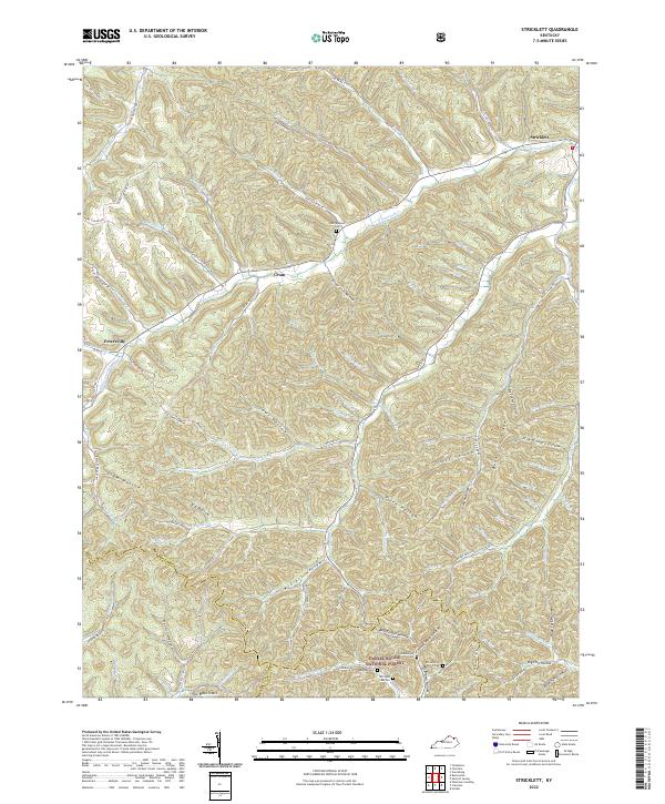 2022 Stricklett2022 Print · USGSThe hill country of northern Kentucky comes to life in this contemporary survey of the Lewis and Fleming county line. Genealogists can trace family names at McEldowney Cem and Buckner Cem, or follow the historic Sheltowee Trace Trl as it winds through the Daniel Boone National Forest.
 - 2022 Map of Morehead, 2022 Print
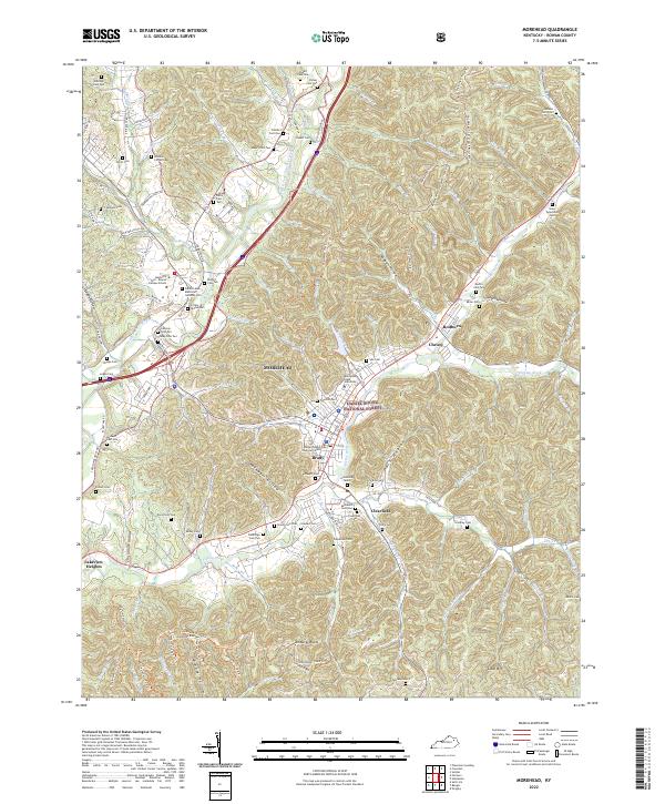 2022 Morehead2022 Print · USGSMorehead and the surrounding Appalachian foothills are captured here as the region grew around its university and forest lands. Genealogists can locate dozens of family burial sites including Pine Hill Cem, Caudill Cem, and Clearfield Cem.
 - 2022 Map of Wrigley, 2022 Print
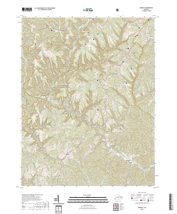 2022 Wrigley2022 Print · USGSMorgan County, Kentucky, maintains its deep-rooted rural character in this recent survey of the Licking River headwaters. Genealogists and local historians can trace family ties through numerous sites like Kidd Family Cem, Blairs Mills, and the community of Wrigley.
 - 2022 Map of Haldeman, 2022 Print
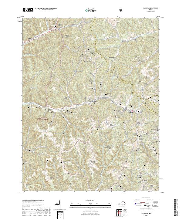 2022 Haldeman2022 Print · USGSRowan County in the early twenty-first century remains a landscape of deep family roots and wooded ridges. Genealogists can trace family burial grounds like Sparks Cemetery One and New Sill Cem near settlements like Brinegar and Elliottville.
 - 2022 Map of Colfax, 2022 Print
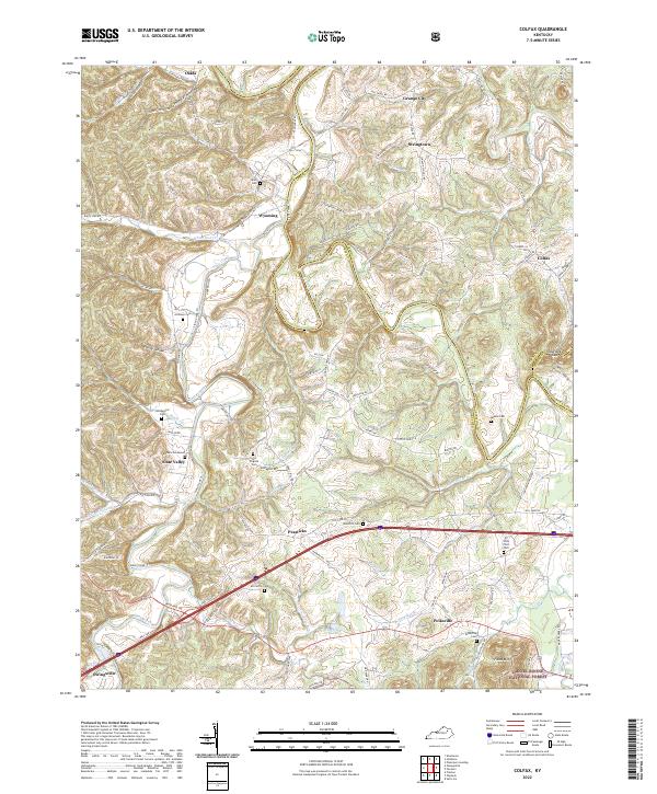 2022 Colfax2022 Print · USGSBath County’s rural character and long-standing family settlements are documented here in the early twenty-first century. Genealogists can trace ancestral ties through landmarks like Barbers Graveyard, Atchison Cem, and the community of Slate Valley.
 - 2022 Map of Plummers Landing, 2022 Print
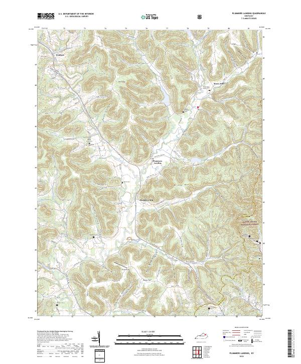 2022 Plummers Landing2022 Print · USGSThe Fleming County hills come alive in this survey of the Plummers Landing area, showing the rural homesteads and mountain ridges of the early 2020s. Genealogists can trace family burial sites like Hurst Cem and Muses Mills Church Cem tucked among the hollows.
 - 2022 Map of Salt Lick, 2022 Print
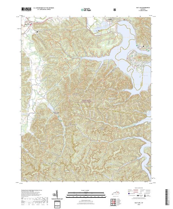 2022 Salt Lick2022 Print · USGSThe foothills of eastern Kentucky are preserved here in the early twenty-first century as the Licking River valley transitions into a forest of ridges and hollows. You can trace family burial grounds at Carey Hill Cem, explore the legacy of Clear Creek Furnace, and follow the long path of the Sheltowee Trace Trl.
 - 2022 Map of Farmers, 2022 Print
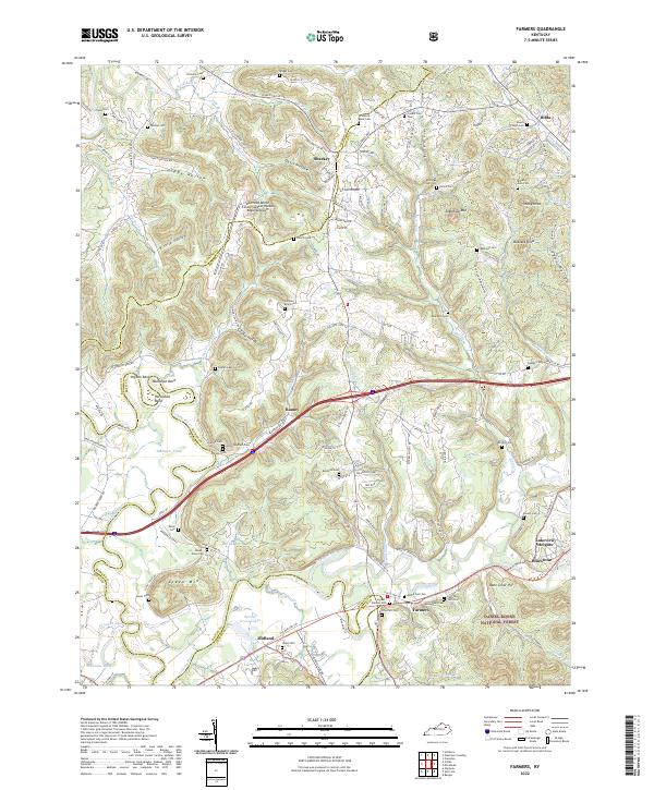 2022 Farmers2022 Print · USGSThe Licking River valley comes into sharp focus during the early twenty-first century, showing the intersection of the Daniel Boone National Forest and local rail corridors. Researchers can trace dozens of family burial sites including the Woodford Black Cem and Ingram-Stevens Cem.
 - 2022 Map of Soldier, 2022 Print
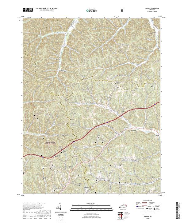 2022 Soldier2022 Print · USGSEastern Kentucky's ridge-and-hollow terrain is captured here in the early twenty-first century, showing the intersection of the CSX rail line and local life. Researchers can trace dozens of family burial sites like Mabry Hill Cem and Stevens Stigall Cem near Haldeman and Soldier.
 - 2022 Map of Ault, 2022 Print
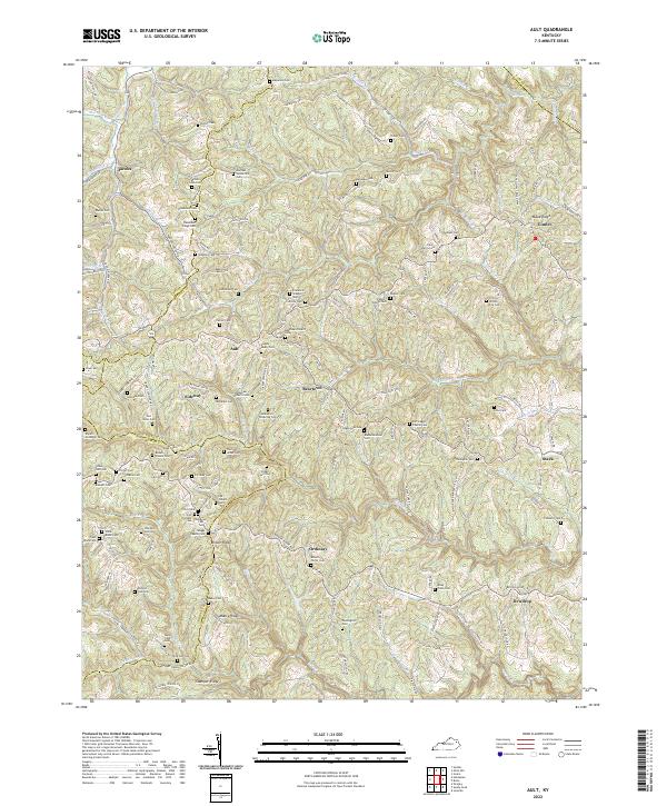 2022 Ault2022 Print · USGSThe northern Cumberland Plateau in Elliott County appears here as a land of high ridges and deep creek hollows in 2022. Genealogists can trace family heritage through scores of named burial sites like Henderson Ridge Cem, Mauk Cem, and Porter Cem.
 - 2022 Map of Cranston, 2022 Print
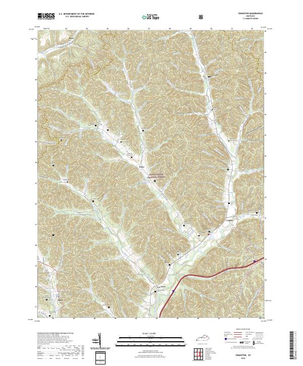 2022 Cranston2022 Print · USGSRowan County's deeply dissected hills and the North Fork Triplett Creek basin are captured here in the early twenty-first century. Genealogists can trace family heritage through numerous hillside burial sites like Cranston Cem, Sardis Cem, and the Anderson Family Cem.
 - 2022 Map of Bangor, 2022 Print
 2022 Bangor2022 Print · USGSThe ridges of eastern Kentucky are captured here in the twenty-first century, showing the intersection of the Daniel Boone National Forest and local hamlets. Trace family roots at Mount Hope Cem or Roll-Alfrey Cem while exploring the hollows around Bangor.
End of results
Showing maps 1-12 of 12
Top cities of Rowan County
Frequently asked questions
- What are the different types of historical maps available for Rowan County?
- What is the oldest map of Rowan County?
- Where can I purchase historical maps of Rowan County for my home or office?
- Where can I download high-res historical maps of Rowan County?
- Are there historical topographic maps available for Rowan County?
- Is there historical aerial imagery available for Rowan County?
- Where are historical maps of Rowan County sourced from?