2020s Maps of Shelby County, Kentucky
Explore 12 historic maps of Shelby County from the 2020s. These maps offer a rare glimpse into what life looked like during the 2020s — showing old roads, neighborhoods, homes, and landmarks that have changed or disappeared over time.
Whether you're researching your family's past, planning a metal detecting trip, or studying how Shelby County's landscape evolved across the 2020s, these high-resolution maps are a powerful tool for exploring the history of this region.
- Focus on a specific era: All maps on this page are from the 2020s, giving you a focused view of this time period.
- See what’s changed: Compare century-old streets, trails, and buildings to today's modern landscape using overlays and satellite layers.
- Research with precision: Use these maps for genealogy, historical research, land use analysis, or educational projects.
- View, download, or print: Maps are fully viewable online in high resolution, and can be downloaded or printed for your own records.
Start exploring Shelby County's history through authentic maps from the 2020s. This is your window into the past.
Shelby County, KY maps
(12)- 2022 Map of Eminence, 2022 Print
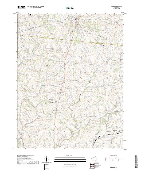 2022 Eminence2022 Print · USGSThe crossroads of Eminence and the surrounding Kentucky farmlands are captured here in the early 2020s. Genealogists can locate family sites like Watkins Cem and Magruder Cem, or trace the headwaters of the Little Kentucky River.
 - 2022 Map of Polsgrove, 2022 Print
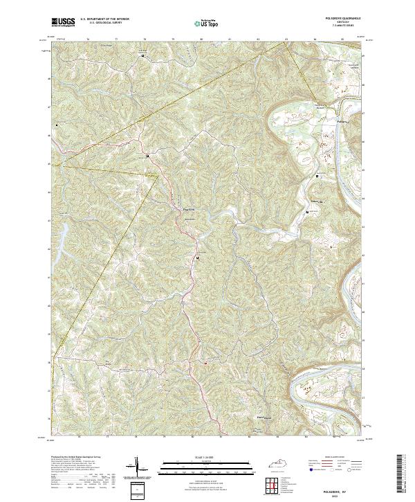 2022 Polsgrove2022 Print · USGSFranklin County and its surrounding borders are captured here in the early 2020s, showcasing a landscape of river bottoms and high ridges. Genealogists can trace family landmarks at Grub Ridge Church Cem, Moore Cem, and the settlement of Polsgrove.
 - 2022 Map of Simpsonville, 2022 Print
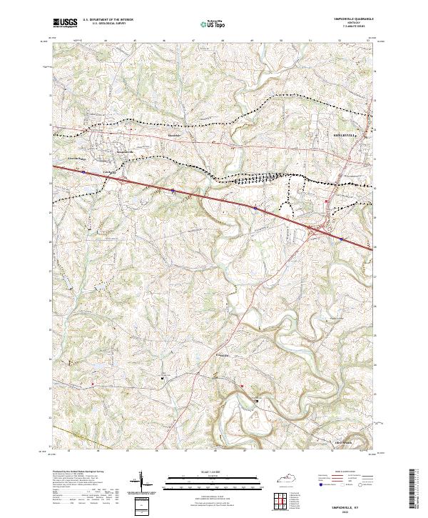 2022 Simpsonville2022 Print · USGSShelby County enters the early 2020s as a landscape where expanding industrial corridors meet historic crossroads and rural family lands. Researchers can trace the development of Simpsonville and Finchville or locate quiet landmarks like Buck Creek Cem and Olive Branch.
 - 2022 Map of Taylorsville, 2022 Print
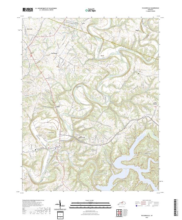 2022 Taylorsville2022 Print · USGSThe Spencer County seat and the expansive Taylorsville Lake dominate this Kentucky landscape in the early 2020s. Genealogists and local researchers can trace the area's rural history through landmarks like Little Mount Cem and the Spencer County Courthouse.
 - 2022 Map of Mount Eden, 2022 Print
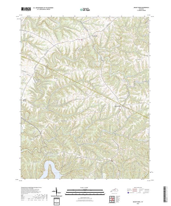 2022 Mount Eden2022 Print · USGSSpencer and Shelby counties in 2022 show a landscape of winding ridges and deep creek valleys where the Kentucky uplands meet the water. Researchers can trace the rural networks connecting Mount Eden, Southville, and the shoreline of Taylorsville Lake near Possum Ridge.
 - 2022 Map of Glensboro, 2022 Print
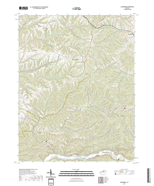 2022 Glensboro2022 Print · USGSCentral Kentucky's rural landscape is captured here in the early twenty-first century, showing the ridges and creek valleys of Anderson and Shelby counties. Trace family history at Glensboro or Anderson City, and locate rural landmarks like Corinth Church and the Petty Cem.
 - 2022 Map of Waddy, 2022 Print
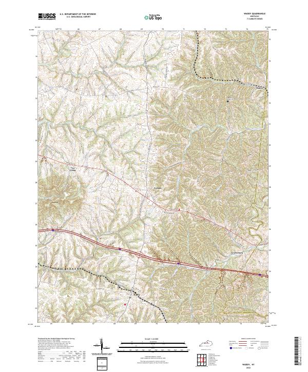 2022 Waddy2022 Print · USGSShelby County's rural landscape is captured here in the early 2020s, showing a network of historic crossroads and farm-to-market routes. Researchers can trace family-named roads and locate community centers like Waddy, Clay Village, and the Beech Ridge Cem.
 - 2022 Map of Fisherville, 2022 Print
 2022 Fisherville2022 Print · USGSEastern Jefferson County at the dawn of the 2020s shows a landscape of suburban growth meeting traditional rural roots. Trace the expansion from Middletown to Fisherville and find family-named landmarks like Long Run Hill and Sheckels Run.
 - 2022 Map of Shelbyville, 2022 Print
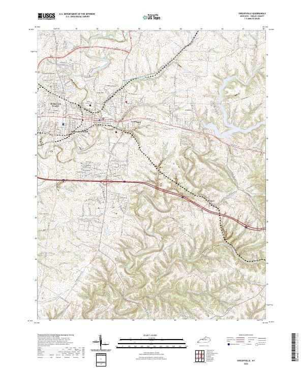 2022 Shelbyville2022 Print · USGSShelbyville and its surrounding Bluegrass countryside are shown here in the early 2020s, revealing a landscape of winding creeks and expanding residential communities. Researchers can locate family landmarks like Saffell Calvary Cem or trace the drainage of Guist Creek and Mulberry Cr.
 - 2022 Map of North Pleasureville, 2022 Print
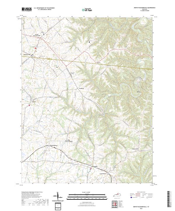 2022 North Pleasureville2022 Print · USGSThe rural borderlands of Henry and Shelby counties come alive in this detailed recent survey of North Central Kentucky. Local researchers can trace family roots at the Dutch Tract Cem or locate old community centers like Old Christianburg, Bagdad, and Defoe.
 - 2022 Map of Crestwood, 2022 Print
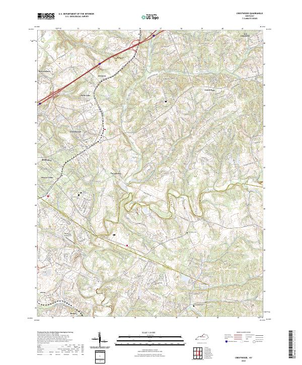 2022 Crestwood2022 Print · USGSCrestwood and Pewee Valley appear at a moment of modern growth where historic crossroads meet suburban expansion. Trace local family history through numerous burial sites like Confederate Cem and Pleasant Hill Cem along the winding Floyds Fork.
 - 2022 Map of Ballardsville, 2022 Print
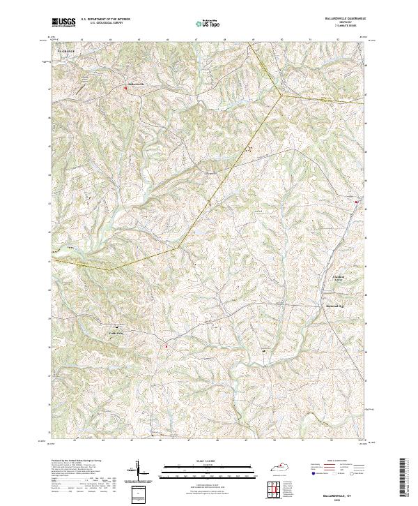 2022 Ballardsville2022 Print · USGSBallardsville and the surrounding Kentucky highlands are captured here in the early twenty-first century, showing a landscape defined by rolling ridges and creek valleys. Researchers can trace rural lineages through local landmarks like Fairview Cem, Todds Point, and the crossroads at Chestnut Grove.
End of results
Showing maps 1-12 of 12
Top cities of Shelby County
Frequently asked questions
- What are the different types of historical maps available for Shelby County?
- What is the oldest map of Shelby County?
- Where can I purchase historical maps of Shelby County for my home or office?
- Where can I download high-res historical maps of Shelby County?
- Are there historical topographic maps available for Shelby County?
- Is there historical aerial imagery available for Shelby County?
- Where are historical maps of Shelby County sourced from?