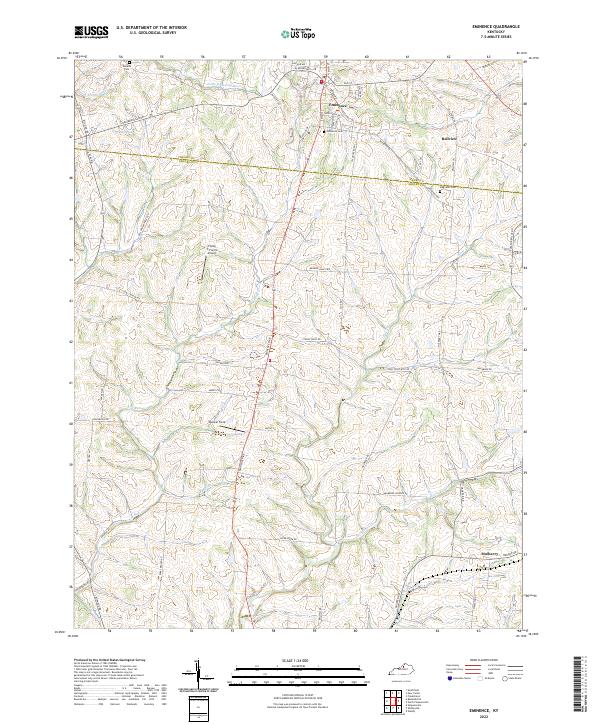
2022 Map of Eminence
USGS Topo · Published 2022About this map
Eminence serves as the central hub of this northern Kentucky landscape, where the street grid of the town core transitions into a network of winding county roads. The terrain is defined by the divides between the Little Kentucky River to the north and the complex drainage systems of Clear Creek and Fox Run to the south. This modern survey captures the persistence of traditional land use patterns, with aviation markers like Flying C Farms Airport and Rooster Field established alongside long-standing family landmarks. For genealogists, the map identifies several local burial grounds including Watkins Cem, Eminence Cem, and Magruder Cem, providing precise locations for ancestral research across the Henry Co Shelby Co line. Smaller settlements such as Bellview and Mulberry remain anchored at key road intersections, illustrating the continued significance of these rural crossroads in the 21st century.
Find a feature on this map
70 named features on this map. Tap any name to fly to it.
Don’t see what you’re looking for? This feature index may not catch every label — zoom into the map to look around manually.
Map Details
Editions of this 2022 Eminence Map
This is the sole edition of this map. No revisions or reprints were ever made.
Other maps of this area

1923 · Waddy
USGS Topo · 1:48,000

1925 · Mount Eden
USGS Topo · 1:48,000

1927 · Mount Eden
USGS Topo · 1:62,500

1928 · New Castle
USGS Topo · 1:48,000

1929 · Taylorsville
USGS Topo · 1:62,500

1932 · New Castle
USGS Topo · 1:62,500

1932 · La Grange
USGS Topo · 1:62,500

1954 · Ballardsville
USGS Topo · 1:24,000
1954 · New Castle
USGS Topo · 1:24,000
1954 · Eminence
USGS Topo · 1:24,000