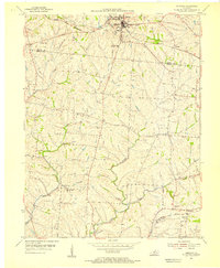
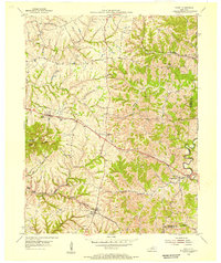
1954 Map of Eminence
USGS Topo · Published 1955About this map
The Louisville and Nashville railroad corridor anchors the northern section of this 1954 survey, defining the industrial and social reach of Eminence. This agricultural region on the border of Henry and Shelby counties is characterized by a dense network of upland drainage, where Fox Run, Burks Branch, and Clear Creek carve through the landscape. The map reveals a mid-century rural infrastructure centered on community nodes like Mulberry, which features its own Mulberry Sch and nearby Mulberry Creek.
Find a feature on this map
19 named features on this map. Tap any name to fly to it.
Don’t see what you’re looking for? This feature index may not catch every label — zoom into the map to look around manually.
Map Details
Editions of this 1954 Eminence Map
3 editions found
Other maps of this area

1923 · Waddy
USGS Topo · 1:48,000

1925 · Mount Eden
USGS Topo · 1:48,000

1927 · Mount Eden
USGS Topo · 1:62,500

1928 · New Castle
USGS Topo · 1:48,000

1929 · Taylorsville
USGS Topo · 1:62,500

1932 · New Castle
USGS Topo · 1:62,500

1932 · La Grange
USGS Topo · 1:62,500

1954 · Ballardsville
USGS Topo · 1:24,000
1954 · New Castle
USGS Topo · 1:24,000
1954 · Waddy
USGS Topo · 1:24,000