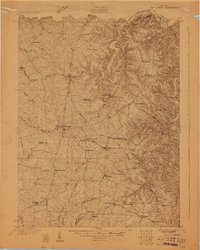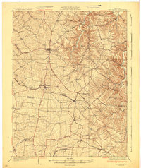
1932 Map of New Castle
USGS Topo · Published 1932About this map
New Castle serves as the focal point of this Bluegrass region survey, situated at the junction of State Highway No 22 and several secondary routes. The landscape transitions from the concentrated settlement at Eminence to the winding course of the Kentucky River, which carves a deep valley along the eastern boundary, featuring the prominent Beaver Dam Bend. The 1920s infrastructure is clearly defined by the Louisville and Nashville Railroad, which connects the communities of Pleasureville, Cropper, and Bagdad.
Find a feature on this map
78 named features on this map. Tap any name to fly to it.
Don’t see what you’re looking for? This feature index may not catch every label — zoom into the map to look around manually.
Map Details
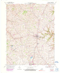
Editions of this 1932 New Castle Map
This is the sole edition of this map. No revisions or reprints were ever made.
Historical Maps of Eminence Through Time
8 maps found