1900s (20th Century) Maps of Spencer County, Kentucky
Explore 36 historic maps of Spencer County from the 1900s (20th Century). These maps offer a rare glimpse into what life looked like during the 1900s — showing old roads, neighborhoods, homes, and landmarks that have changed or disappeared over time.
Whether you're researching your family's past, planning a metal detecting trip, or studying how Spencer County's landscape evolved across the 1900s, these high-resolution maps are a powerful tool for exploring the history of this region.
- Focus on a specific era: All maps on this page are from the 1900s, giving you a focused view of this time period.
- See what’s changed: Compare century-old streets, trails, and buildings to today's modern landscape using overlays and satellite layers.
- Research with precision: Use these maps for genealogy, historical research, land use analysis, or educational projects.
- View, download, or print: Maps are fully viewable online in high resolution, and can be downloaded or printed for your own records.
Start exploring Spencer County's history through authentic maps from the 1900s. This is your window into the past.
Spencer County, KY maps
(36)- 1907 Map of Louisville
 1907 Louisville1907 Print · USGSLouisville and the rolling hills of Jefferson and Bullitt counties are captured here in the early 1900s. Researchers can trace ancestral connections through sites like Cave Hill Cemetery, Pleasant Grove Schoolhouse, and the river crossing at Bells Mill Ford.3 unique versions available
 - 1923 Map of Waddy
 1923 Waddy1923 Print · USGSShelby County and Anderson County are captured here in the early 1920s, showing a rural landscape organized around the Midland Trail and regional rail lines. Genealogists can trace family connections to numerous landmarks like Buffalo Lick Church, Jeptha Knob, and small settlements including Waddy and Glensboro.
 - 1925 Map of Mount Eden
 1925 Mount Eden1925 Print · USGSThe rolling hills between Shelbyville and the Salt River are captured here in the mid-twenties, showing a landscape tied to the rails and old turnpikes. Researchers can find dozens of rural landmarks, from Jeptha Knob to family-named sites like Martin School and Browns Store.
 - 1927 Map of Mount Eden
 1927 Mount Eden1927 Print · USGSShelby County and its neighbors at the height of the 1920s reveal a landscape of ridge-top schools and bustling rail towns. Genealogists and local historians can trace family locations near landmarks like Jeptha Knob, the Buffalo Lick Church, or the community of Mount Eden.
 - 1929 Map of Taylorsville
 1929 Taylorsville1929 Print · USGSSpencer and Shelby counties are shown here in the late twenties, where the Salt River meets a network of early rail and pike roads. Genealogists can trace family lands near Shiloh Church, Beechwood School, and the settlement of Simpsonville.2 unique versions available
 - 1949 Map of Samuels, 1953 Print
 1949 Samuels1953 Print · USGSBullitt and Nelson counties are captured here in the late 1940s as the rail-and-river economy shaped rural Kentucky life. Genealogists and historians can trace the foundations of local communities at St Gregory Sem, the Woodsdale Sch, and the quiet rail stops of Deatsville and Samuels.
 - 1949 Map of Shepherdsville, 1959 Print
 1949 Shepherdsville1959 Print · USGSBullitt and Nelson counties are shown here in the late 1940s, a landscape shaped by the Salt River and the expanding Bernheim Forest. Researchers can trace rural life through old schools like Woodsdale Sch and the rail-side activity at Bardstown Junction.
 - 1951 Map of Fisherville
 1951 Fisherville1951 Print · USGSEastern Jefferson County and the neighboring borderlands of Shelby and Spencer counties are captured here in the early fifties. Genealogists and local historians can trace the foundations of Fisherville, the grounds of the Lincoln Institute, and rural landmarks like Bethlehem Ch.
 - 1951 Map of Waterford
 1951 Waterford1951 Print · USGSSpencer and Bullitt counties are mapped here in the early fifties, showing the rural landscape along the meandering Salt River. Genealogists can trace family connections through local landmarks like Carrithers Chapel, Whitfield, and the Locust Grove Sch.
 - 1951 Map of Mount Washington
 1951 Mount Washington1951 Print · USGSThe crossroads of Bullitt and Jefferson counties come into focus in the early fifties, centered on the growing community of Mount Washington. Researchers can trace rural life along the Salt River through landmarks like Bethel Church, Lovvorn School, and numerous family plots like the Gentry Cemetery.
 - 1951 Map of Louisville, 1959 Print
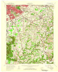 1951 Louisville1959 Print · USGSGreater Louisville and Bullitt County are seen here in a period of rapid suburban growth following the war. Researchers can trace family history through dozens of landmarks like Evergreen Cemetery, Camp Taylor, and the rural schools of Okolona.
 - 1952 Map of Chaplin, 1953 Print
 1952 Chaplin1953 Print · USGSNorth of the Chaplin River in the early 1950s, this area shows a rural Kentucky landscape shaped by winding waterways and county borders. Genealogists can trace family footprints at Highview Cemetery, Independent School, and the river crossing at Gordon Ford.2 unique versions available
 - 1953 Map of Bloomfield, 1954 Print
 1953 Bloomfield1954 Print · USGSThe Nelson and Spencer County borderlands in the early fifties reveal a landscape of rural communities and family farmsteads. Genealogists can trace property roots near Mt Zion Ch, Maple Grove Cem, and the old Wakefield Sch.2 unique versions available
 - 1953 Map of Fairfield, 1955 Print
 1953 Fairfield1955 Print · USGSNelson County's rural landscape at the start of the 1950s shows a community of small crossroads and family-run farms before widespread modernization. Genealogists and local researchers can trace the locations of Highgrove Sch, St Michaels Cem, and even a mid-century Drive-in Theatre.2 unique versions available
 - 1954 Map of Glensboro, 1955 Print
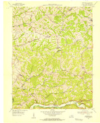 1954 Glensboro1955 Print · USGSThe Salt River valley and the ridges of Anderson County are captured here in the mid-fifties. Genealogists can locate family landmarks like Petty Cem, Marlowe Sch, and several rural churches including Pleasant Hill Ch.
 - 1954 Map of Taylorsville, 1955 Print
 1954 Taylorsville1955 Print · USGSSpencer County and the Salt River valley come into focus during the early fifties, showing the area's rural transition and river-bend geography. Genealogists and local historians can trace family roots through Little Mount Cem and find old centers like Rivals or Normandy.
 - 1954 Map of Mount Eden, 1955 Print
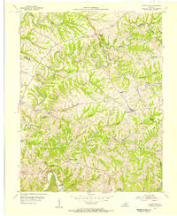 1954 Mount Eden1955 Print · USGSSpencer and Shelby counties are captured in the mid-fifties, showing a rural landscape defined by ridge-top farming and winding river valleys. Genealogists can locate family homesteads near Mount Eden, Salem Ch, and the Upper Brier Ridge Ch.4 unique versions available
 - 1954 Map of Simpsonville, 1956 Print
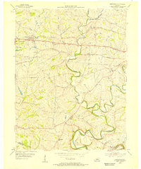 1954 Simpsonville1956 Print · USGSShelby County agriculture and transit dominate this mid-century portrait of the Kentucky countryside. Researchers can trace family roots at Buck Creek Sch or find old rail stops at Veechdale and along the Louisville and Nashville line.
 - 1956 Map of Louisville, 1971 Print
 1956 Louisville1971 Print · USGSThe Ohio River valley and the Kentucky Bluegrass are captured here during a period of rapid mid-century growth and industrial activity. Genealogists and historians can trace rail-centered towns and military land use at Fort Knox and the Jefferson Proving Ground.2 unique versions available
 - 1957 Map of Winchester, 1968 Print
 1957 Winchester1968 Print · USGSCentral Kentucky's landscape in the mid-twentieth century features the sprawling Fort Knox and the early parkway system. Genealogists and historians can trace rail lines like the Southern Railway and find landmarks from Bernheim Forest to Pilot Knob.3 unique versions available
 - 1959 Map of Mount Washington, 1960 Print
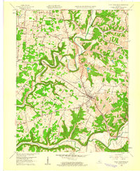 1959 Mount Washington1960 Print · USGSMount Washington and the Bullitt County countryside appear here in the late fifties, just as the rural road network began to modernize. Researchers can trace ancestral locations near St Francis Cem, Fairmount, and the banks of the Salt River.2 unique versions available
 - 1960 Map of Simpsonville
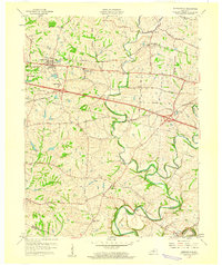 1960 Simpsonville1960 Print · USGSShelby County farmland was defined by its creeks and competing rail lines during the mid-twentieth century. Researchers can trace the development of Simpsonville and Lincoln Ridge or locate family landmarks like Shiloh Ch and Buck Creek Sch.3 unique versions available
 - 1960 Map of Winchester
 1960 Winchester1960 Print · USGSCentral Kentucky's diverse landscape is shown here at mid-century, from the bluegrass plains to the rugged Pottsville Escarpment. Genealogists and historians can trace the rail-and-river network connecting towns like Bardstown and Stanford alongside landmarks like Lake Cumberland.
 - 1960 Map of Taylorsville
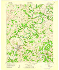 1960 Taylorsville1960 Print · USGSSpencer County at the start of the 1960s shows a landscape of winding river valleys and tight-knit rural hamlets. Researchers can trace family history through local sites like Little Mount Cem or explore the river-side settings of Taylorsville, Normandy, and Rivals.3 unique versions available
 - 1960 Map of Waterford, 1961 Print
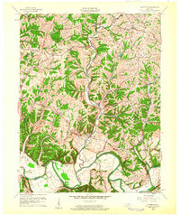 1960 Waterford1961 Print · USGSCentral Kentucky's rural river valleys and county boundaries are captured here in the early 1960s. Genealogists and local historians can locate Waterford, Whitfield, and the Carrithers Chapel among the winding paths of the Salt River.
Showing maps 1-25 of 36
Top cities of Spencer County
Frequently asked questions
- What are the different types of historical maps available for Spencer County?
- What is the oldest map of Spencer County?
- Where can I purchase historical maps of Spencer County for my home or office?
- Where can I download high-res historical maps of Spencer County?
- Are there historical topographic maps available for Spencer County?
- Is there historical aerial imagery available for Spencer County?
- Where are historical maps of Spencer County sourced from?