Old Maps of Shawnee Estates, Bowling Green for Academic Research
Study the evolution of Shawnee Estates with 14 high-resolution historic maps. Whether you're teaching, researching, or modeling changes in land use, these maps provide essential visual documentation of urban, environmental, and geographic change.
- Analyze long-term change: Track patterns in development, transportation, and natural features.
- Ideal for environmental or urban studies: Support academic projects with primary historical map data.
- Use in the classroom or lab: Educators and researchers rely on these maps to bring historical context to life.
These maps are a powerful tool for teaching, research, and visualizing how Shawnee Estates has changed over the decades.
Shawnee Estates, Bowling Green maps
(14)- 1921 Map of Bowling Green, 1955 Print
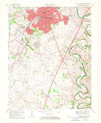
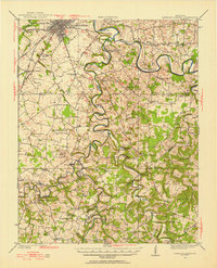 1921 Bowling Green1955 Print · USGSBowling Green and its surrounding counties are shown here just after the Great War, when the Louisville and Nashville railroad fueled regional growth. Genealogists can trace hundreds of family landmarks, from Mussey Mill to schools like Cave Mill School and the remote Antioch Chapel.
 - 1923 Map of Bowling Green
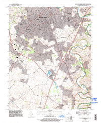
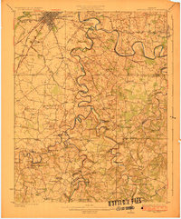 1923 Bowling Green1923 Print · USGSThe Bowling Green area in the early 1920s was a landscape defined by the winding Barren River and the busy Louisville and Nashville Railroad. Researchers can trace ancestral roots through dozens of rural sites like Cassadays Store, Massey Mill, and the Lost River.4 unique versions available
 - 1954 Map of Bowling Green South, 1956 Print
 1954 Bowling Green South1956 Print · USGSMid-century Bowling Green is shown during a period of post-war expansion near the Western State College campus. Genealogists and local historians can trace family locations through Memphis Junction, Rich Pond, and numerous local burial sites like Fairview Cem.
 - 1956 Map of Nashville, 1971 Print
 1956 Nashville1971 Print · USGSThe Tennessee-Kentucky borderlands come into focus in the mid-1960s as major reservoir projects transformed the Cumberland and Tennessee river valleys. Researchers can trace the rail networks of the Louisville and Nashville and visit sites like Fort Campbell and Fort Donelson National Military Park.2 unique versions available
 - 1959 Map of Nashville
 1959 Nashville1959 Print · USGSMiddle Tennessee and Southern Kentucky come into focus during the late fifties, showing the region's transition into a modern transportation and military hub. Researchers can trace the sprawling Fort Campbell Military Reservation or locate historic rail stops along the Tennessee Central Ry and Illinois Central RR.
 - 1959 Map of Bowling Green South, 1960 Print
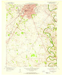
 1959 Bowling Green South1960 Print · USGSBowling Green expands southward in the late fifties as a hub of education and transit. Researchers can trace the mid-century footprint of Western State College, find small communities like Memphis Junction, and locate family burial sites such as Trinity Cem.
 - 1968 Map of Bowling Green South, 1970 Print
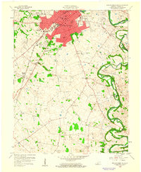
 1968 Bowling Green South1970 Print · USGSBowling Green was expanding rapidly in the late 1960s, as new suburbs reached toward the Tennessee border. Genealogists and historians can trace family plots and rural congregations at Mount Moriah Cem, Potter Grave, and Little Zion Ch.2 unique versions available
 - 1985 Map of Bowling Green
 1985 Bowling Green1985 Print · USGSThe rolling borderlands of Kentucky and Tennessee are captured here in the mid-eighties, showing a landscape shaped by the Barren River and deep-rooted rail networks. Genealogists and researchers can trace local landmarks like Prices Mill, Highland Academy, and Green Lawn Cem.3 unique versions available
 - 1993 Map of Bowling Green South, 1996 Print
 1993 Bowling Green South1996 Print · USGSWarren County in the early 1990s shows the suburban expansion of Bowling Green alongside its deep agricultural and industrial roots. Genealogists can trace family landmarks near Plano and Memphis Junction, or locate burials at Trinity Cem and St Joseph Cem.
 - 2010 Map of Bowling Green South, 2010 Print
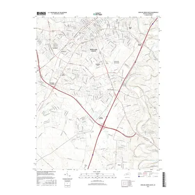
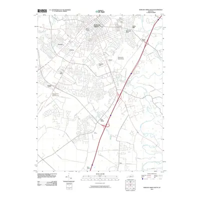 2010 Bowling Green South2010 Print · USGSCovers Shawnee Estates, including Bowling Green, Plano, and other nearby areas
 - 2013 Map of Bowling Green South, 2013 Print
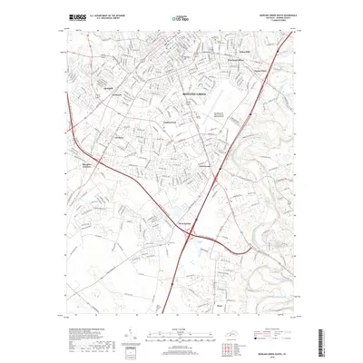
 2013 Bowling Green South2013 Print · USGSCovers Shawnee Estates, including Bowling Green, Plano, and other nearby areas
 - 2016 Map of Bowling Green South, 2016 Print
 2016 Bowling Green South2016 Print · USGSCovers Shawnee Estates, including Bowling Green, Plano, and other nearby areas
 - 2019 Map of Bowling Green South, 2019 Print
 2019 Bowling Green South2019 Print · USGSCovers Shawnee Estates, including Bowling Green, Plano, and other nearby areas
 - 2022 Map of Bowling Green South, 2022 Print
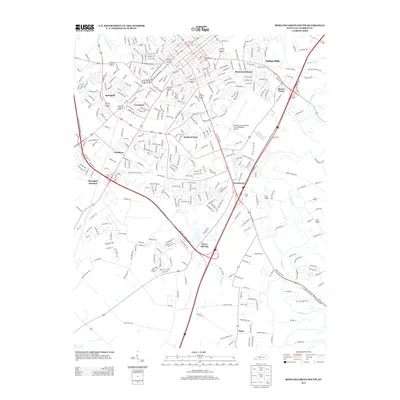
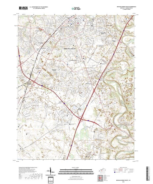 2022 Bowling Green South2022 Print · USGSSouthern Warren County in the early 2020s shows the expansion of BOWLING GREEN alongside its deeper heritage. Genealogists can trace family sites at Saint Joseph Historic Catholic Cem, Ennis Cem, and the old rail junction at Memphis Junction.
End of results
Showing maps 1-14 of 14
Top cities near Shawnee Estates
- Bowling Green historical maps
- Franklin historical maps
- Scottsville historical maps
- Plum Springs historical maps
- Woodburn historical maps
- Oakland historical maps
Frequently asked questions
- What are the different types of historical maps available for Shawnee Estates?
- What is the oldest map of Shawnee Estates?
- Where can I purchase historical maps of Shawnee Estates for my home or office?
- Where can I download high-res historical maps of Shawnee Estates?
- Are there historical topographic maps available for Shawnee Estates?
- Is there historical aerial imagery available for Shawnee Estates?
- Where are historical maps of Shawnee Estates sourced from?