1970s Maps of Wolfe County, Kentucky
Explore 2 historic maps of Wolfe County from the 1970s. These maps offer a rare glimpse into what life looked like during the 1970s — showing old roads, neighborhoods, homes, and landmarks that have changed or disappeared over time.
Whether you're researching your family's past, planning a metal detecting trip, or studying how Wolfe County's landscape evolved across the 1970s, these high-resolution maps are a powerful tool for exploring the history of this region.
- Focus on a specific era: All maps on this page are from the 1970s, giving you a focused view of this time period.
- See what’s changed: Compare century-old streets, trails, and buildings to today's modern landscape using overlays and satellite layers.
- Research with precision: Use these maps for genealogy, historical research, land use analysis, or educational projects.
- View, download, or print: Maps are fully viewable online in high resolution, and can be downloaded or printed for your own records.
Start exploring Wolfe County's history through authentic maps from the 1970s. This is your window into the past.
Wolfe County, KY maps
(2)- 1971 Map of Landsaw, 1973 Print
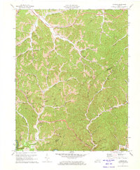 1971 Landsaw1973 Print · USGSThe hill country of Wolfe and Breathitt Counties comes into focus in the early 1970s as industrial gas and oil wells dot the hollows. Genealogists can locate family landmarks like Shackelford Cem and Sewell Cem or historic community hubs such as Malaga Sch.
 - 1972 Map of Campton, 1973 Print
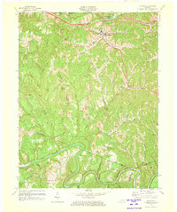 1972 Campton1973 Print · USGSWolfe County in the early seventies is a landscape of high ridges and deep river bends along the Kentucky River. Genealogists and local historians can locate rural landmarks like Rear Pen Mansion, New Antioch Ch, and the small community of Vortex.
End of results
Showing maps 1-2 of 2
Top cities of Wolfe County
Frequently asked questions
- What are the different types of historical maps available for Wolfe County?
- What is the oldest map of Wolfe County?
- Where can I purchase historical maps of Wolfe County for my home or office?
- Where can I download high-res historical maps of Wolfe County?
- Are there historical topographic maps available for Wolfe County?
- Is there historical aerial imagery available for Wolfe County?
- Where are historical maps of Wolfe County sourced from?