Old Maps of Wolfe County, Kentucky for Metal Detecting
Plan your next treasure hunt with 78 historic maps of Wolfe County. Find old homesites, ghost towns, trails, and gathering spots that may be lost to time — perfect for identifying promising metal detecting locations.
- Locate forgotten sites: Uncover places like long-lost settlements, abandoned rail lines, or gathering spots.
- Plan better hunts: Use map overlays combined with LiDAR or satellite views to narrow in on historically rich areas.
- Made for detectorists: Thousands of hobbyists use these maps to discover relics, coins, and hidden history.
Use these historic maps to boost your research and find new opportunities beneath the surface of Wolfe County.
Wolfe County, KY maps
(78)- 1889 Map of Salyersville, 1949 Print
 1889 Salyersville1949 Print · USGSEastern Kentucky at the close of the nineteenth century reveals a complex landscape of river-valley settlements and highland hollows. Genealogists can trace early homesteads and communities like Salyersville, Hazel Green, and Jackson along the winding Licking River and Quicksand Creek.
 - 1891 Map of Salyersville
 1891 Salyersville1891 Print · USGSEastern Kentucky's rugged plateau is captured in the late nineteenth century as small river towns and remote hollows defined the region. Genealogists can trace family roots through mountain settlements like Salyersville, Hazel Green, and Maytown along the Licking River.2 unique versions available
 - 1892 Map of Beattyville
 1892 Beattyville1892 Print · USGSThe Kentucky River and its headwaters define this late nineteenth-century survey of the rugged Cumberland Plateau. Researchers can trace the early industrial sites of Estill Furnace and Fitchburg Furnace alongside the path of the Kentucky Union Railroad.6 unique versions available
 - 1899 Map of Salyersville
 1899 Salyersville1899 Print · USGSEastern Kentucky's mountain communities were well-established along the winding river forks at the turn of the century. Genealogists and local historians can trace family-named landmarks and old settlements like Hazel Green, Ezel, and West Liberty along the Licking River.4 unique versions available
 - 1951 Map of Cannel City, 1952 Print
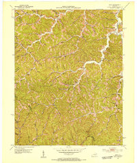
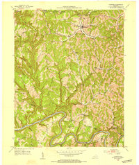
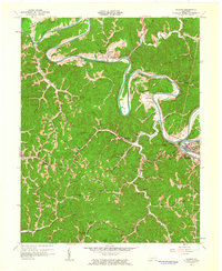
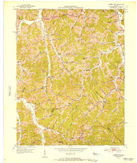 1951 Cannel City1952 Print · USGSThe Morgan and Wolfe County borderlands come to life in the early fifties, showing a landscape defined by narrow hollows and ridge-top knobs. Genealogists can locate family landmarks like Wells Cem or trace the old post offices at Buskirk (P O) and Insko (PO).
 - 1951 Map of Landsaw, 1953 Print
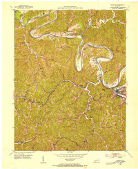
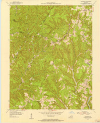
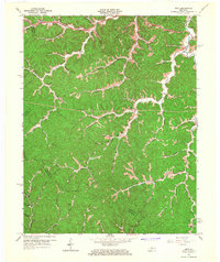
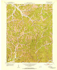 1951 Landsaw1953 Print · USGSWolfe and Breathitt Counties are shown here in the early fifties, where hollow-dwelling communities were connected by a intricate web of mountain schools and churches. Genealogists can trace family landmarks like Bethany Orphanage, the Hollon Cem, and the village of Hollonville.
 - 1951 Map of Hazel Green, 1953 Print
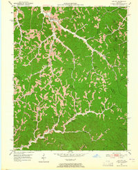
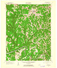
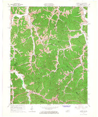
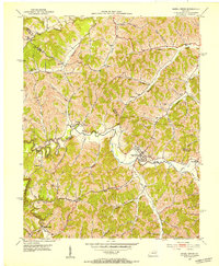 1951 Hazel Green1953 Print · USGSHazel Green and the surrounding hollows of Wolfe and Morgan counties are shown here in the early fifties. Local historians can trace the foundations of these communities through landmarks like the Hazel Green Academy, the Flat Rock Ch, and the Sandfield Sch.
 - 1951 Map of Pomeroyton, 1953 Print
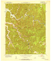
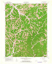
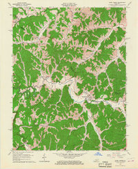
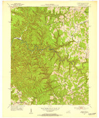 1951 Pomeroyton1953 Print · USGSThe winding Red River corridor defines this 1950s look at Wolfe County, Kentucky. Genealogists and local historians can locate early homesteads and trace rural life around the settlements of Pomeroyton and Valeria.2 unique versions available
 - 1951 Map of Seitz, 1953 Print
 1951 Seitz1953 Print · USGSMagoffin County at mid-century reveals a landscape of isolated hollows and creek-side communities before major modernization. Genealogists can trace family landmarks and schools like Puncheon Cem, Wagers Sch, and the settlements at Seitz and Netty.
 - 1951 Map of Jackson, 1953 Print
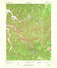
 1951 Jackson1953 Print · USGSBreathitt County in the early fifties shows a rugged landscape of river bends and mountain hollows centered on the town of Jackson. Genealogists can trace family names at the Higgins Cem and Spicer Cem, or locate rural landmarks like the Chenowee Tunnel and Wolverine.
 - 1951 Map of Lee City, 1965 Print
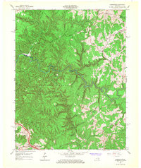
 1951 Lee City1965 Print · USGSWolfe County in the early fifties is captured here as a landscape of tight-knit hollows and ridge-line communities. Genealogists and local historians can trace family locations through numerous landmarks like Wheel Rim (Elam Cem), Magoffin Institute, and Lee City.
 - 1952 Map of Slade, 1954 Print
 1952 Slade1954 Print · USGSThe Red River Gorge region in the early fifties shows a landscape defined by deep hollows and the early development of Natural Bridge State Park. Researchers can trace the path of the Abandoned RR Tunnel and locate old rural schools like Tin Town Sch and Walnut Grove Sch.
 - 1952 Map of Campton, 1954 Print
 1952 Campton1954 Print · USGSMid-century Wolfe County is centered on the town of Campton and the high ridges above the North Fork Kentucky River. Researchers can trace rural life through numerous neighborhood schools like Big Andy Sch and missions including Bear Pen Mission.
 - 1953 Map of Zachariah, 1956 Print
 1953 Zachariah1956 Print · USGSThe hills of Eastern Kentucky appear in the early fifties as a landscape of remote ridges and tight-knit hollows. Genealogists can trace family roots through Townsend Cem and Thacker Cem or locate old schoolhouses like Mt Paran Sch.2 unique versions available
 - 1957 Map of Jenkins, 1974 Print
 1957 Jenkins1974 Print · USGSThe Cumberland Plateau in the mid-twentieth century reveals a complex landscape of winding river valleys and deep-seated industry. Genealogists and historians can trace the development of Hazard, Jenkins, and Pikeville alongside extensive Numerous Oil and Gas Fields and the routes of the Chesapeake & Ohio Railway.
 - 1960 Map of Jenkins
 1960 Jenkins1960 Print · USGSEastern Kentucky and the West Virginia borderlands are captured at a mid-century peak of the coal and rail era. Trace the industrial corridors of the Chesapeake and Ohio RR through mountain hubs like Hazard and Jenkins.
 - 1961 Map of Campton, 1963 Print
 1961 Campton1963 Print · USGSWolfe County settlement and the meandering NORTH FORK KENTUCKY RIVER take center stage in the early sixties. Genealogists can trace family landmarks like Quillins Chapel Sch, Booth Ridge, and Bethesda Mission across this dissected landscape.
 - 1961 Map of Landsaw, 1963 Print
 1961 Landsaw1963 Print · USGSThe borderlands of Wolfe and Breathitt counties are captured here in the early sixties as modern infrastructure met traditional valley life. Genealogists can trace family roots through numerous sites like the Bethany Childrens Home, Centers-Rose Cem, and Hollonville.
 - 1961 Map of Jackson, 1963 Print
 1961 Jackson1963 Print · USGSBreathitt County's serpentine river valleys and coal-country hollows are captured here in the early sixties. Researchers can trace family roots through numerous remote burial sites like Blanche Haddix Cem and local landmarks like Lawson Sch.3 unique versions available
 - 1965 Map of Seitz, 1967 Print
 1965 Seitz1967 Print · USGSThe hill country of eastern Kentucky in the mid-sixties is shown here just as new parkways began to cut through the isolated hollows of Magoffin County. Genealogists and researchers can locate family landmarks such as the Cutuno Burton Cem, Wagers Sch, and the community of Seitz.2 unique versions available
 - 1965 Map of Cannel City, 1967 Print
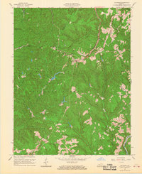
 1965 Cannel City1967 Print · USGSThe Cumberland Plateau of Morgan and Wolfe Counties is shown here in the mid-sixties as the PARKWAY began to modernize the region. Genealogists can trace family names and small hubs like Cannel City, Salem (Buskirk PO), and Mize along with numerous hilltop oil wells.3 unique versions available
 - 1965 Map of Hazel Green, 1967 Print
 1965 Hazel Green1967 Print · USGSThe Red River Valley in the mid-1960s reveals a rural landscape defined by narrow hollows and ridge-line communities along the Morgan and Wolfe County line. Researchers can locate specific family-named landmarks and institutions like the Hazel Green Academy, Flat Rock Ch, and early Oil Wells.3 unique versions available
 - 1966 Map of Pomeroyton, 1968 Print
 1966 Pomeroyton1968 Print · USGSThe Red River Gorge area comes to life in the mid-sixties, highlighting the rugged settlement patterns of Wolfe and Menifee Counties. Trace local landmarks like the Dessie Scott Childrens Home, Calaboose Sch, and geological wonders from Sky Bridge to Tower Rock.4 unique versions available
 - 1966 Map of Slade, 1968 Print
 1966 Slade1968 Print · USGSThe Red River Gorge region comes alive in the mid-1960s as new highways began to meet traditional mountain settlements. Genealogists and hikers can trace old homesites near Nada, locate the Middle Fork Ch, or follow the path of the Mountain Central Railroad.2 unique versions available
 - 1966 Map of Zachariah, 1968 Print
 1966 Zachariah1968 Print · USGSKentucky's mountain frontier comes into focus during the mid-sixties, where the borders of Lee, Wolfe, Estill, and Powell counties converge. Researchers can trace rural genealogy and land use through landmarks like Townsend Cem, Fixer, and the local Oil Field.2 unique versions available
Showing maps 1-25 of 78
Top cities of Wolfe County
Frequently asked questions
- What are the different types of historical maps available for Wolfe County?
- What is the oldest map of Wolfe County?
- Where can I purchase historical maps of Wolfe County for my home or office?
- Where can I download high-res historical maps of Wolfe County?
- Are there historical topographic maps available for Wolfe County?
- Is there historical aerial imagery available for Wolfe County?
- Where are historical maps of Wolfe County sourced from?